H
Seller's Agent in 2025
Heather Milner-Ellison
Milner & Harrelson, Inc
(706) 888-1575
50 in this area
115 Total Sales
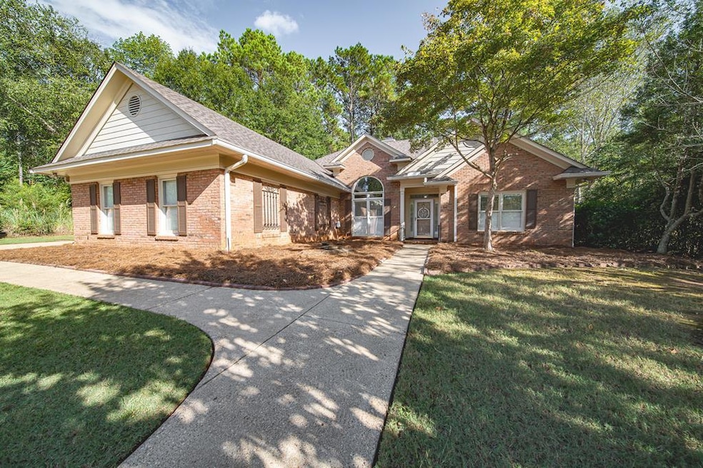


**All-brick home in the sought-after Maple Ridge Golf Community** Quietly positioned on a cul-de-sac, this home offers a split floor plan with hardwood floors, granite kitchen countertops, plantation shutters and a separate dining room. The bright sunroom opens to a private, fenced backyard with a pergola that's perfect for outdoor entertaining. The master suite is set apart for privacy, while secondary bedrooms share a convenient hall bath. A heated and cooled workshop or small office off the garage provides flexible space for projects, storage, or remote work. Additional features include a sprinkler system and an architectural shingled roof that's only one year old!
Last Agent to Sell the Property
Milner & Harrelson, Inc Brokerage Phone: 7068881575 License #214616 Listed on: 10/08/2025
| Date | Type | Sale Price | Title Company |
|---|---|---|---|
| Special Warranty Deed | $349,900 | None Listed On Document | |
| Warranty Deed | $218,900 | -- |
| Date | Status | Loan Amount | Loan Type |
|---|---|---|---|
| Open | $249,900 | New Conventional | |
| Previous Owner | $214,934 | FHA |
| Date | Event | Price | List to Sale | Price per Sq Ft |
|---|---|---|---|---|
| 11/06/2025 11/06/25 | Sold | $349,900 | 0.0% | $169 / Sq Ft |
| 10/09/2025 10/09/25 | Pending | -- | -- | -- |
| 10/08/2025 10/08/25 | For Sale | $349,900 | -- | $169 / Sq Ft |
| Year | Tax Paid | Tax Assessment Tax Assessment Total Assessment is a certain percentage of the fair market value that is determined by local assessors to be the total taxable value of land and additions on the property. | Land | Improvement |
|---|---|---|---|---|
| 2025 | $2,862 | $103,616 | $26,484 | $77,132 |
| 2024 | $2,861 | $103,616 | $26,484 | $77,132 |
| 2023 | $2,185 | $103,616 | $26,484 | $77,132 |
| 2022 | $2,984 | $89,484 | $26,484 | $63,000 |
| 2021 | $2,977 | $86,296 | $26,484 | $59,812 |
| 2020 | $2,978 | $86,296 | $26,484 | $59,812 |
| 2019 | $2,989 | $86,296 | $26,484 | $59,812 |
| 2018 | $2,989 | $86,296 | $26,484 | $59,812 |
| 2017 | $3,000 | $86,296 | $26,484 | $59,812 |
| 2016 | $3,244 | $78,652 | $16,263 | $62,389 |
| 2015 | $1,080 | $78,652 | $16,263 | $62,389 |
| 2014 | $1,082 | $78,652 | $16,263 | $62,389 |
| 2013 | -- | $78,652 | $16,263 | $62,389 |
H
Seller's Agent in 2025
Heather Milner-Ellison
Milner & Harrelson, Inc
(706) 888-1575
50 in this area
115 Total Sales

Buyer's Agent in 2025
Lisa Raines
Keller Williams Realty River Cities
(706) 888-8778
109 in this area
294 Total Sales
Source: Columbus Board of REALTORS® (GA)
MLS Number: 223817
APN: 080-005-041
Disclaimer: Certain information contained herein is derived from information provided by parties other than Homes.com. All information provided is deemed reliable, but is not guaranteed to be accurate and should be independently verified.
![]() IDX information is provided exclusively for personal, non-commercial use, and may not be used for any purpose other than to identify prospective properties consumers may be interested in purchasing. Information is deemed reliable but not guaranteed.
IDX information is provided exclusively for personal, non-commercial use, and may not be used for any purpose other than to identify prospective properties consumers may be interested in purchasing. Information is deemed reliable but not guaranteed.