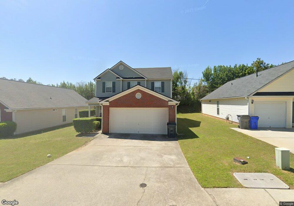
4607 Rolling Brook Ct Union City, GA 30291
Estimated Value: $220,426 - $247,000
3
Beds
2
Baths
1,378
Sq Ft
$167/Sq Ft
Est. Value
About This Home
This home is located at 4607 Rolling Brook Ct, Union City, GA 30291 and is currently estimated at $230,607, approximately $167 per square foot. 4607 Rolling Brook Ct is a home located in Fulton County with nearby schools including C. H. Gullatt Elementary School, Camp Creek Middle School, and Creekside High School.
Ownership History
Date
Name
Owned For
Owner Type
Purchase Details
Closed on
Oct 31, 2002
Sold by
G T Architecture Contractors Co
Bought by
Compton Theresha
Current Estimated Value
Home Financials for this Owner
Home Financials are based on the most recent Mortgage that was taken out on this home.
Original Mortgage
$110,026
Outstanding Balance
$45,848
Interest Rate
5.95%
Mortgage Type
FHA
Estimated Equity
$184,759
Create a Home Valuation Report for This Property
The Home Valuation Report is an in-depth analysis detailing your home's value as well as a comparison with similar homes in the area
Home Values in the Area
Average Home Value in this Area
Purchase History
| Date | Buyer | Sale Price | Title Company |
|---|---|---|---|
| Compton Theresha | $111,700 | -- |
Source: Public Records
Mortgage History
| Date | Status | Borrower | Loan Amount |
|---|---|---|---|
| Open | Compton Theresha | $110,026 |
Source: Public Records
Tax History
| Year | Tax Paid | Tax Assessment Tax Assessment Total Assessment is a certain percentage of the fair market value that is determined by local assessors to be the total taxable value of land and additions on the property. | Land | Improvement |
|---|---|---|---|---|
| 2025 | $1,021 | $86,320 | $18,920 | $67,400 |
| 2023 | $1,695 | $60,040 | $13,720 | $46,320 |
| 2022 | $841 | $60,040 | $13,720 | $46,320 |
| 2021 | $759 | $49,040 | $6,000 | $43,040 |
| 2020 | $760 | $48,240 | $9,440 | $38,800 |
| 2019 | $1,264 | $40,960 | $5,480 | $35,480 |
| 2018 | $786 | $39,960 | $7,040 | $32,920 |
| 2017 | $589 | $32,120 | $7,040 | $25,080 |
| 2016 | $587 | $32,120 | $7,040 | $25,080 |
| 2015 | $1,093 | $32,120 | $7,040 | $25,080 |
| 2014 | $331 | $19,520 | $4,360 | $15,160 |
Source: Public Records
Map
Nearby Homes
- 4611 Rolling Brook Ct
- 289 Switcher Ct
- 282 Switcher Ct
- 286 Switcher Ct
- 285 Switcher Ct
- 284 Switcher Ct
- 290 Switcher Ct
- 424 Camrose Ave
- 185 Stanchion Dr
- 187 Stanchion Dr
- 3589 Brookstone Way
- 294 Switcher Ct
- 296 Switcher Ct
- 298 Switcher Ct
- 300 Switcher Ct
- 302 Switcher Ct
- 5733 Rockaway Dr
- 460 Parkway Rd
- 530 Parkway Rd
- 1265 Maple Valley Ct
- 4609 Rolling Brook Ct Unit 110
- 4609 Rolling Brook Ct
- 4605 Rolling Brook Ct
- 4603 Rolling Brook Ct
- 4613 Rolling Brook Ct
- 4601 Rolling Brook Ct
- 5700 Rockaway Dr
- 5332 Jonesboro Rd Unit 39404612
- 4615 Rolling Brook Ct
- 5340 Fairburn Jonesboro Rd Unit 3-4
- 5340 Fairburn Jonesboro Rd
- 212 Switcher Ct Unit 80
- 212 Switcher Ct
- 3505 Brookstone Way
- 5701 Rockaway Dr
- 210 Switcher Ct Unit 81
- 210 Switcher Ct
- 5702 Rockaway Dr
- 204 Switcher Ct Unit 84
- 204 Switcher Ct
Your Personal Tour Guide
Ask me questions while you tour the home.