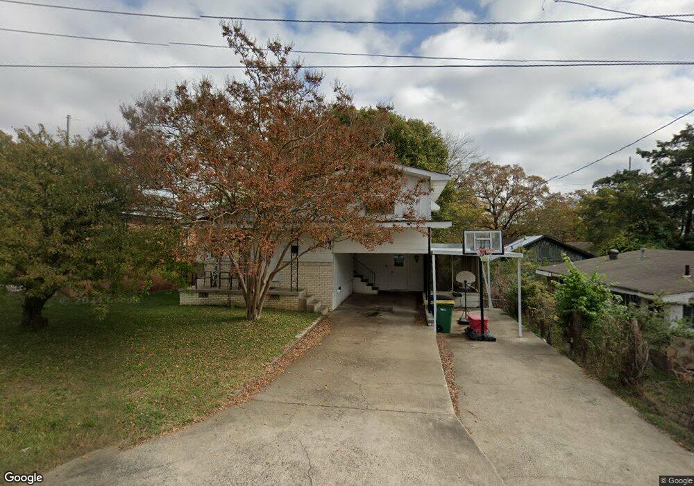
4608 Frank St North Little Rock, AR 72118
Levy NeighborhoodEstimated Value: $80,578 - $107,000
--
Bed
1
Bath
872
Sq Ft
$107/Sq Ft
Est. Value
About This Home
This home is located at 4608 Frank St, North Little Rock, AR 72118 and is currently estimated at $93,645, approximately $107 per square foot. 4608 Frank St is a home located in Pulaski County with nearby schools including Amboy Elementary School, North Little Rock Middle School 6th Grade Campus, and North Little Rock High School.
Ownership History
Date
Name
Owned For
Owner Type
Purchase Details
Closed on
Jun 29, 2001
Sold by
West Jim and West Wanda
Bought by
George James M and George Lori R
Current Estimated Value
Home Financials for this Owner
Home Financials are based on the most recent Mortgage that was taken out on this home.
Original Mortgage
$31,700
Interest Rate
7.07%
Mortgage Type
Purchase Money Mortgage
Purchase Details
Closed on
Apr 26, 2000
Sold by
Fox Virginia
Bought by
West Jim and West Wanda
Create a Home Valuation Report for This Property
The Home Valuation Report is an in-depth analysis detailing your home's value as well as a comparison with similar homes in the area
Home Values in the Area
Average Home Value in this Area
Purchase History
| Date | Buyer | Sale Price | Title Company |
|---|---|---|---|
| George James M | $32,000 | Stewart Title | |
| West Jim | $40,000 | -- |
Source: Public Records
Mortgage History
| Date | Status | Borrower | Loan Amount |
|---|---|---|---|
| Closed | George James M | $31,700 |
Source: Public Records
Tax History Compared to Growth
Tax History
| Year | Tax Paid | Tax Assessment Tax Assessment Total Assessment is a certain percentage of the fair market value that is determined by local assessors to be the total taxable value of land and additions on the property. | Land | Improvement |
|---|---|---|---|---|
| 2025 | $875 | $13,105 | $700 | $12,405 |
| 2024 | $875 | $13,105 | $700 | $12,405 |
| 2023 | $875 | $13,105 | $700 | $12,405 |
| 2022 | $823 | $13,105 | $700 | $12,405 |
| 2021 | $748 | $11,200 | $1,000 | $10,200 |
| 2020 | $748 | $11,200 | $1,000 | $10,200 |
| 2019 | $748 | $11,200 | $1,000 | $10,200 |
| 2018 | $732 | $11,200 | $1,000 | $10,200 |
| 2017 | $671 | $11,200 | $1,000 | $10,200 |
| 2016 | $611 | $9,140 | $1,600 | $7,540 |
| 2015 | $611 | $9,140 | $1,600 | $7,540 |
| 2014 | $611 | $9,140 | $1,600 | $7,540 |
Source: Public Records
Map
Nearby Homes
- 4400 Augusta St
- 1214 W 48th St
- 1300 Parkway Dr
- 1200 W 49th St
- 1900 Broken Arrow Dr
- 1201 W 49th St
- 1927 Arrowhead Rd
- 4618 Pike Ave
- 1104 Parkway Dr
- 1103 W 51st St
- 909 W 42nd St
- 1006 W 41st St
- 909 W 50th St
- 4006 Virginia Dr
- 1400 W 55th St
- 3907 Susan Cir
- 615 W 46th St
- 2500 North Dr
- 3615 Pike Ave
- 5502 Francis St
- 1519 W 46th St
- 4620 Frank St
- 4619 Division St
- 4615 Frank St
- 1501 W 46th St
- 4611 Frank St
- 4524 Frank St
- 4619 Frank St
- 4601 Frank St
- 4623 Frank St
- 4519 Division St
- 4523 Frank St
- 4614 Division St
- 4516 Frank St
- 4612 Division St
- 0 Frank St Unit 16005597
- 1424 W 47th St
- 4515 Frank St
- 4515 Division St
- 1422 W 47th St