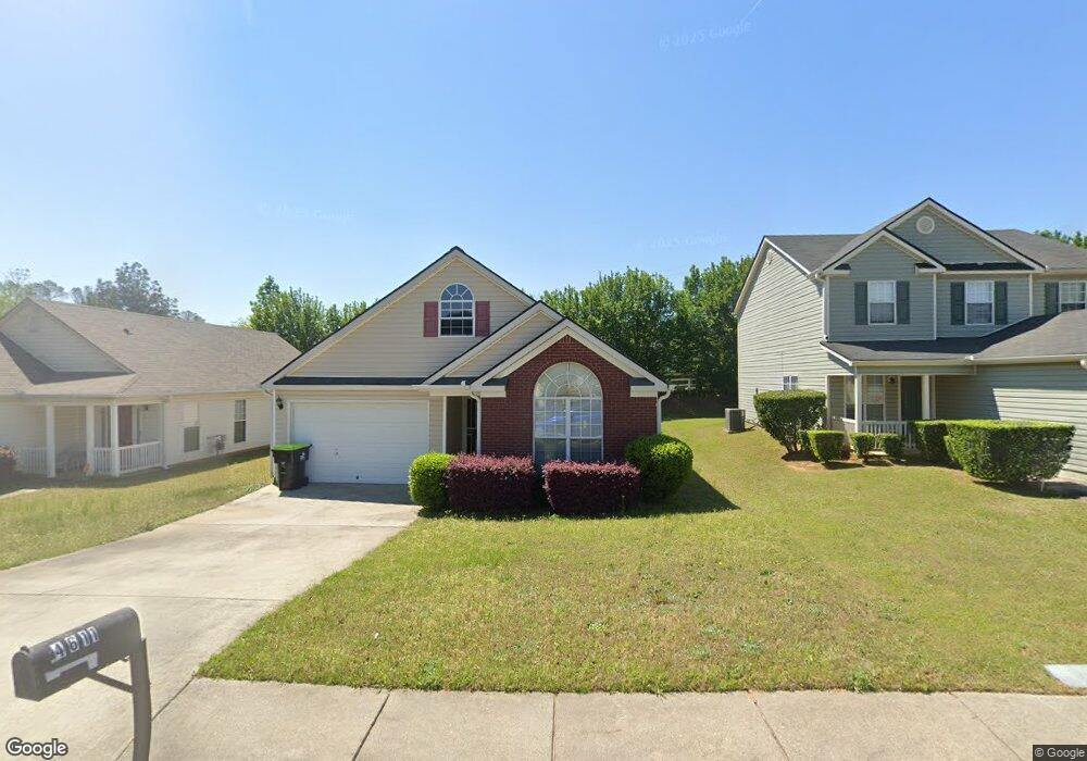
4609 Rolling Brook Ct Unit 110 Union City, GA 30291
Estimated Value: $247,000 - $271,000
3
Beds
2
Baths
1,940
Sq Ft
$133/Sq Ft
Est. Value
About This Home
This home is located at 4609 Rolling Brook Ct Unit 110, Union City, GA 30291 and is currently estimated at $257,556, approximately $132 per square foot. 4609 Rolling Brook Ct Unit 110 is a home located in Fulton County with nearby schools including C. H. Gullatt Elementary School, Camp Creek Middle School, and Creekside High School.
Ownership History
Date
Name
Owned For
Owner Type
Purchase Details
Closed on
Jan 8, 2018
Sold by
Atlanta Neighborhood Devel
Bought by
Walker Emanuel Rashad
Current Estimated Value
Purchase Details
Closed on
Sep 12, 2017
Sold by
Williams Teresa O
Bought by
Atlanta Neighborhood Developme
Purchase Details
Closed on
May 5, 2003
Sold by
Gt Architecture Contractors Corp
Bought by
Williams Teresa and Williams Gregory
Home Financials for this Owner
Home Financials are based on the most recent Mortgage that was taken out on this home.
Original Mortgage
$132,000
Interest Rate
5.76%
Mortgage Type
New Conventional
Create a Home Valuation Report for This Property
The Home Valuation Report is an in-depth analysis detailing your home's value as well as a comparison with similar homes in the area
Home Values in the Area
Average Home Value in this Area
Purchase History
| Date | Buyer | Sale Price | Title Company |
|---|---|---|---|
| Walker Emanuel Rashad | $130,000 | -- | |
| Atlanta Neighborhood Developme | $85,500 | -- | |
| Williams Teresa | $132,000 | -- |
Source: Public Records
Mortgage History
| Date | Status | Borrower | Loan Amount |
|---|---|---|---|
| Previous Owner | Williams Teresa | $132,000 |
Source: Public Records
Tax History Compared to Growth
Tax History
| Year | Tax Paid | Tax Assessment Tax Assessment Total Assessment is a certain percentage of the fair market value that is determined by local assessors to be the total taxable value of land and additions on the property. | Land | Improvement |
|---|---|---|---|---|
| 2025 | $1,241 | $104,480 | $18,920 | $85,560 |
| 2023 | $2,047 | $72,520 | $13,720 | $58,800 |
| 2022 | $915 | $72,520 | $13,720 | $58,800 |
| 2021 | $901 | $60,600 | $6,000 | $54,600 |
| 2020 | $904 | $58,680 | $9,440 | $49,240 |
| 2019 | $1,607 | $50,520 | $5,480 | $45,040 |
| 2018 | $1,379 | $48,840 | $7,040 | $41,800 |
| 2017 | $786 | $38,880 | $7,040 | $31,840 |
| 2016 | $784 | $38,880 | $7,040 | $31,840 |
| 2015 | $1,397 | $38,880 | $7,040 | $31,840 |
| 2014 | $408 | $23,600 | $4,360 | $19,240 |
Source: Public Records
Map
Nearby Homes
- 203 Switcher Ct
- 289 Switcher Ct
- 288 Switcher Ct
- 280 Switcher Ct
- 291 Switcher Ct
- 282 Switcher Ct
- 286 Switcher Ct
- 285 Switcher Ct
- 292 Switcher Ct
- 284 Switcher Ct
- 290 Switcher Ct
- 3589 Brookstone Way
- 183 Stanchion Dr
- 423 Camrose Ave
- 424 Camrose Ave
- 3599 Brookstone Way
- 185 Stanchion Dr
- 179 Stanchion Dr
- 187 Stanchion Dr
- 5733 Rockaway Dr
- 4609 Rolling Brook Ct
- 4611 Rolling Brook Ct
- 4607 Rolling Brook Ct
- 4613 Rolling Brook Ct
- 4605 Rolling Brook Ct
- 4615 Rolling Brook Ct
- 4603 Rolling Brook Ct
- 5700 Rockaway Dr
- 5701 Rockaway Dr
- 4617 Rolling Brook Ct
- 212 Switcher Ct Unit 80
- 212 Switcher Ct
- 4601 Rolling Brook Ct
- 5703 Rockaway Dr
- 5702 Rockaway Dr
- 5340 Fairburn Jonesboro Rd Unit 3-4
- 5340 Fairburn Jonesboro Rd
- 3505 Brookstone Way
- 4619 Rolling Brook Ct
- 204 Switcher Ct Unit 84