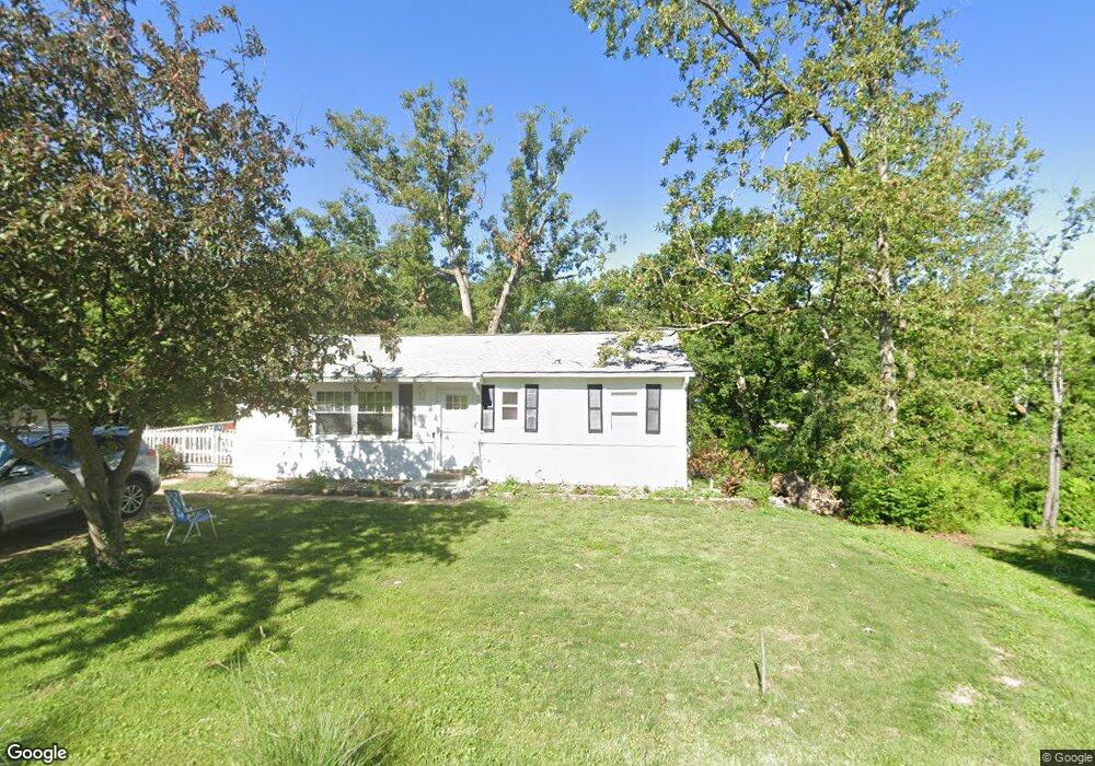
461 Brookside Ln Hillsboro, MO 63050
Estimated Value: $160,143 - $190,000
Studio
--
Bath
912
Sq Ft
$191/Sq Ft
Est. Value
About This Home
This home is located at 461 Brookside Ln, Hillsboro, MO 63050 and is currently estimated at $174,036, approximately $190 per square foot. 461 Brookside Ln is a home with nearby schools including Hillsboro Elementary School, Hillsboro Primary School, and Hillsboro Middle Elementary School.
Ownership History
Date
Name
Owned For
Owner Type
Purchase Details
Closed on
Oct 21, 2024
Sold by
Robert M Williams M and Robert Elsie M
Bought by
White Kenneth D and White Kathleen A
Current Estimated Value
Home Financials for this Owner
Home Financials are based on the most recent Mortgage that was taken out on this home.
Original Mortgage
$45,000
Outstanding Balance
$44,513
Interest Rate
6.2%
Mortgage Type
New Conventional
Estimated Equity
$129,523
Purchase Details
Closed on
Jul 23, 2004
Sold by
Williams Robert M and Williams Elsie M
Bought by
Williams Robert M and Williams Elsie M
Create a Home Valuation Report for This Property
The Home Valuation Report is an in-depth analysis detailing your home's value as well as a comparison with similar homes in the area
Home Values in the Area
Average Home Value in this Area
Purchase History
| Date | Buyer | Sale Price | Title Company |
|---|---|---|---|
| White Kenneth D | -- | None Listed On Document | |
| Williams Robert M | -- | -- |
Source: Public Records
Mortgage History
| Date | Status | Borrower | Loan Amount |
|---|---|---|---|
| Open | White Kenneth D | $45,000 |
Source: Public Records
Tax History
| Year | Tax Paid | Tax Assessment Tax Assessment Total Assessment is a certain percentage of the fair market value that is determined by local assessors to be the total taxable value of land and additions on the property. | Land | Improvement |
|---|---|---|---|---|
| 2025 | $722 | $12,700 | $1,500 | $11,200 |
| 2024 | $722 | $11,700 | $1,500 | $10,200 |
| 2023 | $722 | $11,700 | $1,500 | $10,200 |
| 2022 | $725 | $11,700 | $1,500 | $10,200 |
| 2021 | $777 | $11,700 | $1,500 | $10,200 |
| 2020 | $704 | $10,300 | $1,200 | $9,100 |
| 2019 | $704 | $10,300 | $1,200 | $9,100 |
| 2018 | $707 | $10,300 | $1,200 | $9,100 |
| 2016 | $702 | $9,700 | $1,500 | $8,200 |
Source: Public Records
Map
Nearby Homes
- 612 Ray Henry Way
- 714 Camelot Estates Dr
- 9 Ridgewood Dr
- 0 Lot 62 01 Acres Unit 23042037
- 10865 Business 21
- 5640 Hawks Landing Dr
- 10430 Business 21
- 5641 Hawks Landing Dr
- 4671 Cedar Dr
- 6005 Elm
- 4654 Cedar Dr
- 4625 Cedar Dr
- 6360 State Road B
- 726 Blake Dr
- Lot 11 Hawk Ridge Estates
- 0 Hawk Ridge Estates Augusta Model Unit MIS25075139
- 733 Blake Dr
- 0 Hawk Ridge Estates Walnut Model Unit MIS25075019
- 0
- 0 Hawk Ridge Estates Augusta II Model Unit MIS25075006
- 449 Brookside Ln
- 467 Brookside Ln
- 460 Brookside Ln
- 443 Brookside Ln
- 449 Maple Ln
- 438 Brookside Ln
- 443 Maple Ln
- 15 Jo Vette Lot Terrace
- 15Lot Jo Vette Terrace
- 437 Maple Ln
- 437 Brookside Ln
- 546 Elm St
- 610 Elm St
- 0Lot 5 Brookside Dr
- 431 Maple Ln
- 553 Elm St
- 720 Jo Vette Terrace Dr
- 426 Brookside Ln
- 454 Maple Ln
- 611 Elm St
Your Personal Tour Guide
Ask me questions while you tour the home.