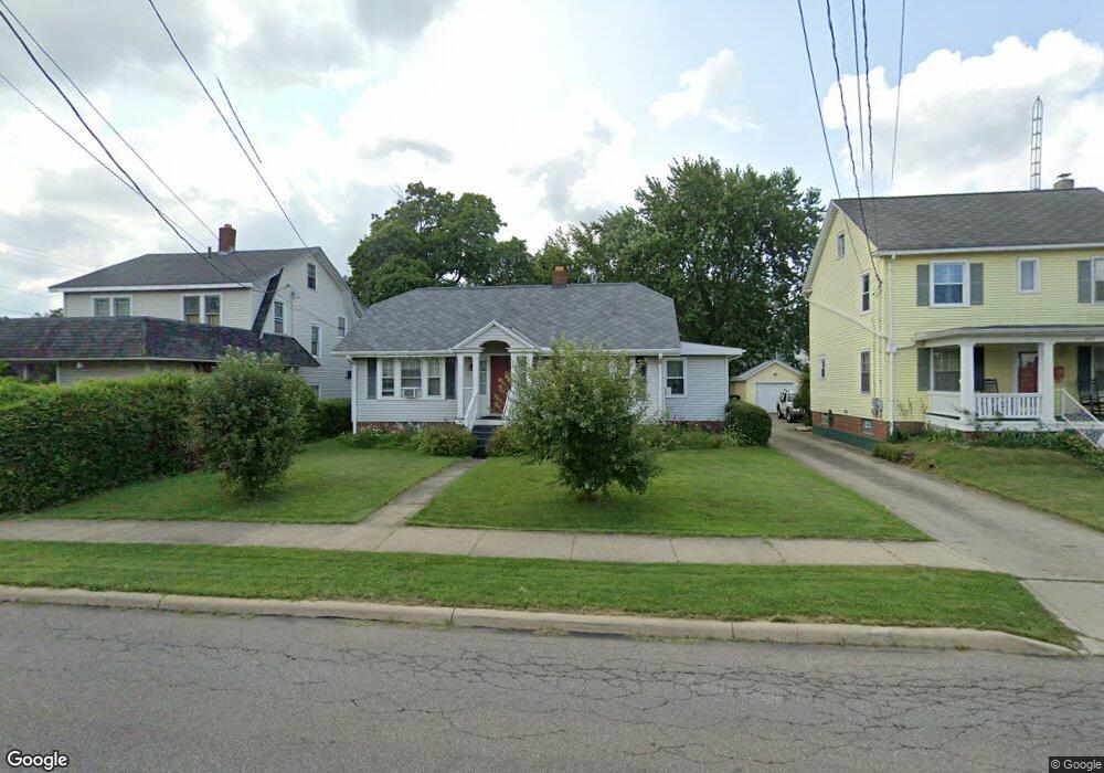
461 Glessner Ave Mansfield, OH 44903
Estimated Value: $102,000 - $124,762
3
Beds
2
Baths
1,700
Sq Ft
$67/Sq Ft
Est. Value
About This Home
This home is located at 461 Glessner Ave, Mansfield, OH 44903 and is currently estimated at $113,941, approximately $67 per square foot. 461 Glessner Ave is a home located in Richland County with nearby schools including St. Peter's Elementary/Montessori School, Discovery School, and St. Peter's Junior High / High School.
Ownership History
Date
Name
Owned For
Owner Type
Purchase Details
Closed on
May 16, 2003
Sold by
Striker Roberta M
Bought by
Sharp William J and Sharp Maria Francisca F
Current Estimated Value
Home Financials for this Owner
Home Financials are based on the most recent Mortgage that was taken out on this home.
Original Mortgage
$61,200
Outstanding Balance
$26,754
Interest Rate
5.87%
Mortgage Type
Commercial
Estimated Equity
$87,187
Purchase Details
Closed on
Apr 5, 2002
Sold by
Hull James
Bought by
Striker Roberta M
Home Financials for this Owner
Home Financials are based on the most recent Mortgage that was taken out on this home.
Original Mortgage
$35,000
Interest Rate
6.87%
Mortgage Type
Commercial
Create a Home Valuation Report for This Property
The Home Valuation Report is an in-depth analysis detailing your home's value as well as a comparison with similar homes in the area
Home Values in the Area
Average Home Value in this Area
Purchase History
| Date | Buyer | Sale Price | Title Company |
|---|---|---|---|
| Sharp William J | $68,000 | Southern Title | |
| Striker Roberta M | $52,500 | -- |
Source: Public Records
Mortgage History
| Date | Status | Borrower | Loan Amount |
|---|---|---|---|
| Open | Sharp William J | $61,200 | |
| Closed | Striker Roberta M | $35,000 |
Source: Public Records
Tax History
| Year | Tax Paid | Tax Assessment Tax Assessment Total Assessment is a certain percentage of the fair market value that is determined by local assessors to be the total taxable value of land and additions on the property. | Land | Improvement |
|---|---|---|---|---|
| 2024 | $891 | $29,750 | $4,410 | $25,340 |
| 2023 | $1,424 | $29,750 | $4,410 | $25,340 |
| 2022 | $858 | $15,020 | $5,200 | $9,820 |
| 2021 | $864 | $15,020 | $5,200 | $9,820 |
| 2020 | $884 | $15,020 | $5,200 | $9,820 |
| 2019 | $979 | $15,020 | $5,200 | $9,820 |
| 2018 | $967 | $15,020 | $5,200 | $9,820 |
| 2017 | $941 | $15,020 | $5,200 | $9,820 |
| 2016 | $927 | $14,350 | $5,200 | $9,150 |
| 2015 | $885 | $14,350 | $5,200 | $9,150 |
| 2014 | $873 | $14,350 | $5,200 | $9,150 |
| 2012 | $331 | $14,200 | $5,200 | $9,000 |
Source: Public Records
Map
Nearby Homes
- 455 Marion Ave
- 158 Vennum Ave
- 189 Westwood Ave
- 126 Dawson Ave
- 133 Stewart Ave S
- 183 Carpenter Rd
- 116 Stewart Ave S
- 108 Stewart Ave S
- 71 Dawson Ave
- 31 Bartley Ave
- 51 Lind Ave
- 30 Douglas Ave
- 135 Wood St
- 616 Cline Ave
- 24 Stewart Ave S
- 679 Coleman Rd
- 686 Barnard Ave
- 31 Parkwood Blvd
- 131 Sturges Ave
- 310 Townview Cir N
- 469 Glessner Ave
- 471 Glessner Ave
- 466 Davey Ave
- 462 Davey Ave
- 473 Glessner Ave
- 470 Davey Ave
- 472 Davey Ave
- 478 Davey Ave
- 480 Glessner Ave
- 458 Davey Ave
- 489 Glessner Ave
- 445 Glessner Ave
- 482 Davey Ave
- 213 Bartley Ave
- 491 Glessner Ave
- 188 Bartley Ave
- 486 Davey Ave
- 232 Bartley Ave
- 441 Glessner Ave
- 448 Glessner Ave
Your Personal Tour Guide
Ask me questions while you tour the home.