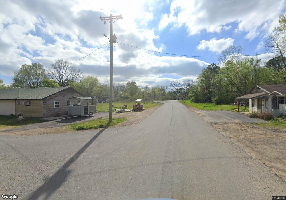
Estimated Value: $367,000 - $551,000
--
Bed
2
Baths
2,234
Sq Ft
$212/Sq Ft
Est. Value
About This Home
This home is located at 461 Highway 332 W, Ozan, AR 71855 and is currently estimated at $473,700, approximately $212 per square foot. 461 Highway 332 W is a home located in Hempstead County with nearby schools including Nashville Elementary School, Nashville Primary School, and Nashville Junior High School.
Ownership History
Date
Name
Owned For
Owner Type
Purchase Details
Closed on
Jun 25, 2024
Sold by
Ray Hansford Allan and Ray Glenda
Bought by
Ray Hansford Allan
Current Estimated Value
Home Financials for this Owner
Home Financials are based on the most recent Mortgage that was taken out on this home.
Original Mortgage
$155,000
Outstanding Balance
$10,761
Interest Rate
7.02%
Mortgage Type
New Conventional
Estimated Equity
$462,939
Purchase Details
Closed on
Nov 18, 2010
Bought by
Ray Hansford A and Ray Tandie C
Purchase Details
Closed on
Jul 1, 2005
Bought by
Ray Paul Wayne and Ray Andrea
Purchase Details
Closed on
Jun 23, 2005
Bought by
Ray Paul Wayne and Ray Andrea
Purchase Details
Closed on
Apr 20, 2004
Bought by
Ray Hansford Allan
Purchase Details
Closed on
Apr 5, 1999
Bought by
Ray Allan and Ray Glenda
Create a Home Valuation Report for This Property
The Home Valuation Report is an in-depth analysis detailing your home's value as well as a comparison with similar homes in the area
Home Values in the Area
Average Home Value in this Area
Purchase History
| Date | Buyer | Sale Price | Title Company |
|---|---|---|---|
| Ray Hansford Allan | -- | None Listed On Document | |
| Ray Hansford Allan | -- | None Listed On Document | |
| Ray Hansford A | $583,300 | -- | |
| Ray Paul Wayne | -- | -- | |
| Ray Paul Wayne | -- | -- | |
| Ray Hansford Allan | -- | -- | |
| Ray Allan | $224,000 | -- |
Source: Public Records
Mortgage History
| Date | Status | Borrower | Loan Amount |
|---|---|---|---|
| Open | Ray Hansford Allan | $155,000 | |
| Closed | Ray Hansford Allan | $155,000 | |
| Open | Ray Hansford Allan | $450,000 | |
| Closed | Ray Hansford Allan | $450,000 |
Source: Public Records
Tax History Compared to Growth
Tax History
| Year | Tax Paid | Tax Assessment Tax Assessment Total Assessment is a certain percentage of the fair market value that is determined by local assessors to be the total taxable value of land and additions on the property. | Land | Improvement |
|---|---|---|---|---|
| 2024 | $2,122 | $64,340 | $2,430 | $61,910 |
| 2023 | $2,503 | $64,340 | $2,430 | $61,910 |
| 2022 | $2,506 | $64,340 | $2,430 | $61,910 |
| 2021 | $2,506 | $64,340 | $2,430 | $61,910 |
| 2020 | $2,314 | $59,390 | $2,540 | $56,850 |
| 2019 | $2,314 | $59,390 | $2,540 | $56,850 |
| 2018 | $2,260 | $59,390 | $2,540 | $56,850 |
| 2017 | $2,227 | $59,380 | $2,540 | $56,840 |
| 2016 | $2,230 | $59,380 | $2,540 | $56,840 |
| 2015 | $2,338 | $62,520 | $3,850 | $58,670 |
| 2014 | $2,413 | $62,520 | $3,850 | $58,670 |
Source: Public Records
Map
Nearby Homes
- 398 Barton Bethel Rd
- 0 Ozan C Unit 24032575
- 0 Ozan A Unit 24032571
- 161 Funderburg Rd
- 143 Hempstead 333
- TBD Hempstead 48 Rd
- 503 Trenton Blvd
- 801 E Runnels St
- 209 Clermont St
- TBD Hempstead 14 Rd
- 320 S Lewis St
- 121 W Lee St
- 114 W Runnels St
- 158 Sand Hill Rd
- 120 N Holcomb St
- 141 N Church St
- TBD Castleberry St
- 521 S Ansley St
- 121 W Hale St
- 211 S Ansley St
- 384 Hempstead 44
- 353 Highway 332 W
- 390 Hempstead 44
- 356 Hempstead 44
- 478 Hempstead 44
- 518 Highway 332 W
- 498 Hempstead 44
- 318 Hempstead 44
- 495 Hempstead 44
- 331 Highway 332 W
- 291 Highway 332 W
- 332 Hempstead 44
- 314 Highway 332 W
- 155 Hempstead 319
- 294 Highway 332 W
- 474 Highway 332 W
- 474 Highway 332 W
- 255 Highway 332 W
- 182 Hempstead 319
- 591 Highway 332 W
