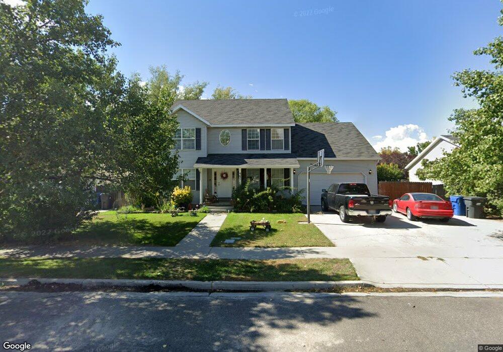
461 N 570 W American Fork, UT 84003
Estimated Value: $361,000 - $387,000
3
Beds
2
Baths
1,313
Sq Ft
$286/Sq Ft
Est. Value
About This Home
This home is located at 461 N 570 W, American Fork, UT 84003 and is currently estimated at $375,123, approximately $285 per square foot. 461 N 570 W is a home located in Utah County with nearby schools including Shelley Elementary School, American Fork Junior High School, and American Fork High School.
Ownership History
Date
Name
Owned For
Owner Type
Purchase Details
Closed on
Apr 28, 2020
Sold by
Meyers Jenna
Bought by
Borges Ana C
Current Estimated Value
Home Financials for this Owner
Home Financials are based on the most recent Mortgage that was taken out on this home.
Original Mortgage
$232,750
Outstanding Balance
$207,396
Interest Rate
3.6%
Mortgage Type
New Conventional
Estimated Equity
$167,727
Purchase Details
Closed on
Jul 31, 2017
Sold by
Beck Jonathan and Beck Ashley
Bought by
Meyers Jenna
Home Financials for this Owner
Home Financials are based on the most recent Mortgage that was taken out on this home.
Original Mortgage
$174,775
Interest Rate
3.75%
Mortgage Type
FHA
Purchase Details
Closed on
Mar 16, 2007
Sold by
Mckinney Brandon D and Mckinney Traci L
Bought by
Beck Jonathan and Beck Ashley
Purchase Details
Closed on
Mar 16, 2004
Sold by
Archibald Jason and Archibald Susan
Bought by
Mckinney Brandon D and Mckinney Traci L
Home Financials for this Owner
Home Financials are based on the most recent Mortgage that was taken out on this home.
Original Mortgage
$119,130
Interest Rate
5.69%
Purchase Details
Closed on
Aug 28, 2000
Sold by
Robb Lance B and Robb Amber L
Bought by
Archibald Jason and Archibald Susan
Home Financials for this Owner
Home Financials are based on the most recent Mortgage that was taken out on this home.
Original Mortgage
$110,675
Interest Rate
8.2%
Purchase Details
Closed on
Nov 12, 1998
Sold by
Anderson Jared L and Anderson Jodi L
Bought by
Robb Lance B and Robb Amber L
Home Financials for this Owner
Home Financials are based on the most recent Mortgage that was taken out on this home.
Original Mortgage
$114,112
Interest Rate
6.54%
Purchase Details
Closed on
Oct 24, 1996
Sold by
Heaps Joseph J and Heaps Shirley
Bought by
Anderson Jared L and Anderson Jodi L
Home Financials for this Owner
Home Financials are based on the most recent Mortgage that was taken out on this home.
Original Mortgage
$104,836
Interest Rate
8.3%
Create a Home Valuation Report for This Property
The Home Valuation Report is an in-depth analysis detailing your home's value as well as a comparison with similar homes in the area
Home Values in the Area
Average Home Value in this Area
Purchase History
| Date | Buyer | Sale Price | Title Company |
|---|---|---|---|
| Borges Ana C | -- | Vanguard Title Ins Agcy Llc | |
| Meyers Jenna | -- | Vanguard Title Ins Agcy Llc | |
| Beck Jonathan | -- | Union Title | |
| Mckinney Brandon D | -- | Inwest Title Services Inc | |
| Archibald Jason | -- | Timp Title Insurance Agency | |
| Robb Lance B | -- | Timp Title Insurance Agency | |
| Anderson Jared L | -- | First American Title |
Source: Public Records
Mortgage History
| Date | Status | Borrower | Loan Amount |
|---|---|---|---|
| Open | Borges Ana C | $232,750 | |
| Previous Owner | Meyers Jenna | $174,775 | |
| Previous Owner | Mckinney Brandon D | $119,130 | |
| Previous Owner | Archibald Jason | $110,675 | |
| Previous Owner | Robb Lance B | $114,112 | |
| Previous Owner | Anderson Jared L | $104,836 |
Source: Public Records
Tax History Compared to Growth
Tax History
| Year | Tax Paid | Tax Assessment Tax Assessment Total Assessment is a certain percentage of the fair market value that is determined by local assessors to be the total taxable value of land and additions on the property. | Land | Improvement |
|---|---|---|---|---|
| 2025 | $1,704 | $181,775 | $48,600 | $281,900 |
| 2024 | $1,704 | $189,310 | $0 | $0 |
| 2023 | $1,468 | $172,975 | $0 | $0 |
| 2022 | $1,643 | $191,015 | $0 | $0 |
| 2021 | $1,347 | $244,500 | $36,700 | $207,800 |
| 2020 | $1,275 | $224,600 | $33,700 | $190,900 |
| 2019 | $1,038 | $189,100 | $28,400 | $160,700 |
| 2018 | $930 | $162,000 | $24,300 | $137,700 |
| 2017 | $849 | $79,805 | $0 | $0 |
| 2016 | $863 | $75,350 | $0 | $0 |
| 2015 | $909 | $75,350 | $0 | $0 |
| 2014 | $807 | $66,000 | $0 | $0 |
Source: Public Records
Map
Nearby Homes
- 356 N 480 W
- 641 N 420 W
- 777 W State Rd
- 540 N 300 W
- 399 W Pacific Dr
- 370 W Pacific Dr Unit 1
- 962 N 780 St W Unit 508
- 974 N 780 St W Unit 509
- 916 N 780 St W Unit 501
- 602 W 860 N
- 822 W 800 St N Unit LOT319
- 120 N 350 W Unit 127
- 120 N 350 W Unit 133
- 120 N 350 W Unit 130
- 822 N 860 W Unit 317
- 914 N 400 W Unit A
- 365 N 100 W
- 217 W Main St
- 621 N 100 W
- 782 N 200 W