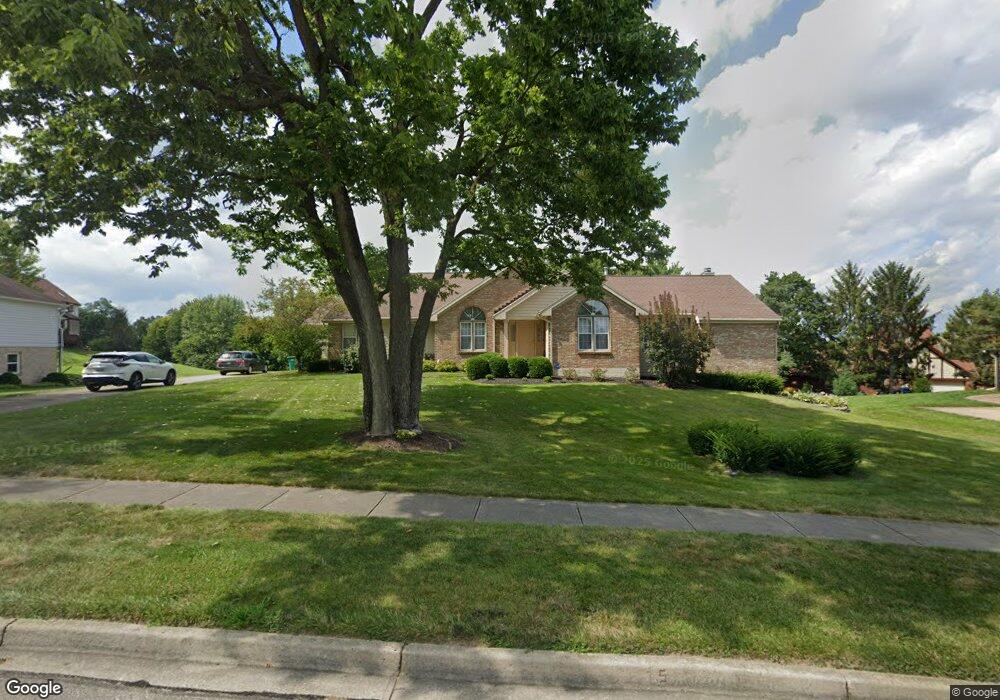
461 Ramsgate Dr Beavercreek, OH 45430
Estimated Value: $461,000 - $589,000
3
Beds
4
Baths
2,678
Sq Ft
$199/Sq Ft
Est. Value
About This Home
This home is located at 461 Ramsgate Dr, Beavercreek, OH 45430 and is currently estimated at $533,752, approximately $199 per square foot. 461 Ramsgate Dr is a home located in Greene County with nearby schools including Fairbrook Elementary School, Herman K Ankeney Middle School, and Beavercreek High School.
Ownership History
Date
Name
Owned For
Owner Type
Purchase Details
Closed on
Oct 4, 1996
Sold by
Deffeyes Robert J
Bought by
Huttsell Lawrence J and Huttsell R
Current Estimated Value
Home Financials for this Owner
Home Financials are based on the most recent Mortgage that was taken out on this home.
Original Mortgage
$197,000
Outstanding Balance
$8,530
Interest Rate
6.5%
Mortgage Type
New Conventional
Estimated Equity
$525,222
Create a Home Valuation Report for This Property
The Home Valuation Report is an in-depth analysis detailing your home's value as well as a comparison with similar homes in the area
Home Values in the Area
Average Home Value in this Area
Purchase History
We collect this data history from publicly available records. To have your information removed, we recommend requesting removal directly through your county’s website.
| Date | Buyer | Sale Price | Title Company |
|---|---|---|---|
| Huttsell Lawrence J | $246,900 | -- |
Source: Public Records
Mortgage History
We collect this data history from publicly available records. To have your information removed, we recommend requesting removal directly through your county’s website.
| Date | Status | Borrower | Loan Amount |
|---|---|---|---|
| Open | Huttsell Lawrence J | $197,000 |
Source: Public Records
Tax History
| Year | Tax Paid | Tax Assessment Tax Assessment Total Assessment is a certain percentage of the fair market value that is determined by local assessors to be the total taxable value of land and additions on the property. | Land | Improvement |
|---|---|---|---|---|
| 2025 | $9,380 | $152,440 | $28,070 | $124,370 |
| 2024 | $9,380 | $152,440 | $28,070 | $124,370 |
| 2023 | $9,313 | $152,440 | $28,070 | $124,370 |
| 2022 | $8,795 | $127,670 | $21,590 | $106,080 |
| 2021 | $8,616 | $127,670 | $21,590 | $106,080 |
| 2020 | $8,681 | $127,670 | $21,590 | $106,080 |
| 2019 | $8,868 | $119,470 | $18,290 | $101,180 |
| 2018 | $7,829 | $119,470 | $18,290 | $101,180 |
| 2017 | $8,057 | $119,470 | $18,290 | $101,180 |
| 2016 | $8,057 | $119,340 | $18,290 | $101,050 |
| 2015 | $8,009 | $119,340 | $18,290 | $101,050 |
| 2014 | $7,888 | $119,340 | $18,290 | $101,050 |
Source: Public Records
Map
Nearby Homes
- 4139 Abbeygate Dr
- 4015 Margate Dr
- 4199 White Hawk Ct
- 438 Grange Hall Rd
- 204 Saundra Ct
- 3955 Oakview Dr
- 500 Woodcove Way
- 4096 Willow Run Dr
- 4355 Cottage Park Dr
- 4300 Straight Arrow Rd Unit 4300
- 4324 Straight Arrow Rd Unit 4324
- 605 Cape Cod Ct
- 4338 Straight Arrow Rd Unit 4338
- 3959 Turnberry Way Unit 2
- 3978 Indian Ripple Rd
- 637 Angler Ct
- 647 Angler Ct
- 3938 Cold Stream Way
- 3913 E Summit Ridge Dr Unit 2
- 2726 Tihart Way
- 455 Ramsgate Dr
- 465 Ramsgate Dr
- 4045 N Emerald Ct
- 454 Ramsgate Dr
- 458 Terri Ct
- 469 Ramsgate Dr
- 445 Ramsgate Dr
- 389 Bronston Trail
- 460 Ramsgate Dr
- 4044 N Emerald Ct
- 446 Ramsgate Dr
- 459 Terri Ct
- 4023 S Emerald Ct
- 390 Bronston Trail
- 4038 N Emerald Ct
- 438 Ramsgate Dr
- 369 Bronston Trail
- 455 Terri Ct
- 4030 N Emerald Ct
- 439 Ramsgate Dr
Your Personal Tour Guide
Ask me questions while you tour the home.