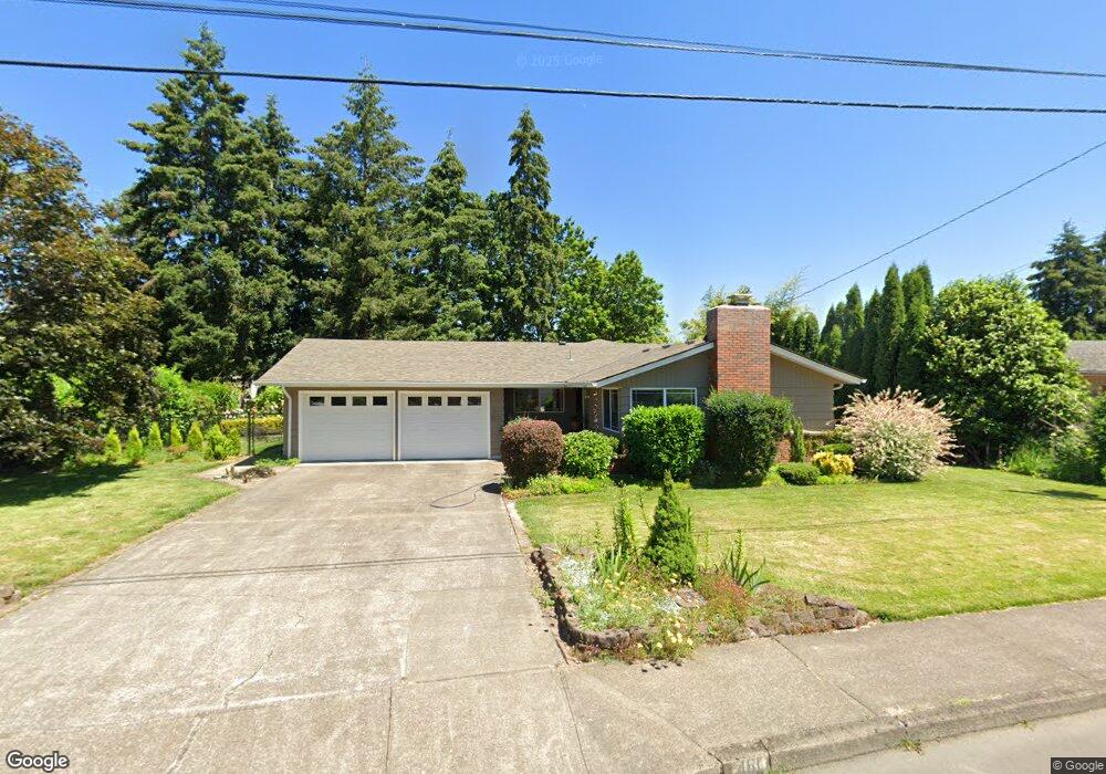
461 Sacre Ln N Monmouth, OR 97361
Estimated Value: $429,000 - $460,000
3
Beds
2
Baths
1,730
Sq Ft
$259/Sq Ft
Est. Value
About This Home
This home is located at 461 Sacre Ln N, Monmouth, OR 97361 and is currently estimated at $448,792, approximately $259 per square foot. 461 Sacre Ln N is a home located in Polk County with nearby schools including Monmouth Elementary School, Talmadge Middle School, and Central High School.
Ownership History
Date
Name
Owned For
Owner Type
Purchase Details
Closed on
Dec 18, 2012
Sold by
Milligan Donald C
Bought by
Long Debra L
Current Estimated Value
Home Financials for this Owner
Home Financials are based on the most recent Mortgage that was taken out on this home.
Original Mortgage
$151,300
Outstanding Balance
$104,826
Interest Rate
3.37%
Mortgage Type
New Conventional
Estimated Equity
$343,966
Create a Home Valuation Report for This Property
The Home Valuation Report is an in-depth analysis detailing your home's value as well as a comparison with similar homes in the area
Home Values in the Area
Average Home Value in this Area
Purchase History
| Date | Buyer | Sale Price | Title Company |
|---|---|---|---|
| Long Debra L | $178,000 | Amerititle |
Source: Public Records
Mortgage History
| Date | Status | Borrower | Loan Amount |
|---|---|---|---|
| Open | Long Debra L | $151,300 |
Source: Public Records
Tax History Compared to Growth
Tax History
| Year | Tax Paid | Tax Assessment Tax Assessment Total Assessment is a certain percentage of the fair market value that is determined by local assessors to be the total taxable value of land and additions on the property. | Land | Improvement |
|---|---|---|---|---|
| 2025 | $3,585 | $216,130 | $60,310 | $155,820 |
| 2024 | $3,585 | $209,840 | $58,550 | $151,290 |
| 2023 | $3,733 | $203,730 | $56,850 | $146,880 |
| 2022 | $3,361 | $197,800 | $55,200 | $142,600 |
| 2021 | $3,323 | $192,040 | $53,590 | $138,450 |
| 2020 | $3,191 | $186,450 | $52,030 | $134,420 |
| 2019 | $3,098 | $181,020 | $50,520 | $130,500 |
| 2018 | $2,992 | $175,750 | $49,050 | $126,700 |
| 2017 | $2,975 | $170,640 | $47,620 | $123,020 |
| 2016 | $3,038 | $165,670 | $46,240 | $119,430 |
| 2015 | $2,905 | $160,850 | $44,890 | $115,960 |
| 2014 | $2,840 | $156,170 | $43,590 | $112,580 |
Source: Public Records
Map
Nearby Homes
- 555 High St N
- 1082 Alberta Ave E
- 858 Main St E
- 0 Catron St N
- 751 Catron St N
- 1329 Price Ln E
- 191 Catron St S
- 348 Main St E
- 309 Atwater St S
- 101 Edwards Rd S Unit 10-B Rd S
- 235 Edwards (#104) Rd S Unit 104
- 151 Edwards (#46) Rd S Unit 46
- 151 S Edwards (151) Rd
- 355 Jacobson Ct S
- 271 Clay St E
- 141 S 17th St Unit 61 St
- 141 S 17th St Unit 70 St
- 277 Edwards Rd S
- 277 Edwards Rd S Unit 133
- 141 17th (#7) St S Unit 7
- 493 Sacre Ln N
- 429 Sacre Ln N
- 458 Sacre Ln N
- 525 Sacre Ln N
- 426 Sacre Ln N
- 490 Sacre Ln N
- 393 Sacre Ln N
- 555 Sacre Ln N
- 441 Craven St N
- 471 Craven St N
- 415 Craven St N
- 843 Church St E
- 501 Craven St N
- 552 Sacre Ln N
- 908 Alberta Ave E
- 373 Sacre Ln N
- 898 Alberta Ave E
- 938 Alberta Ave E
- 531 Craven St N
- 587 Sacre Ln N