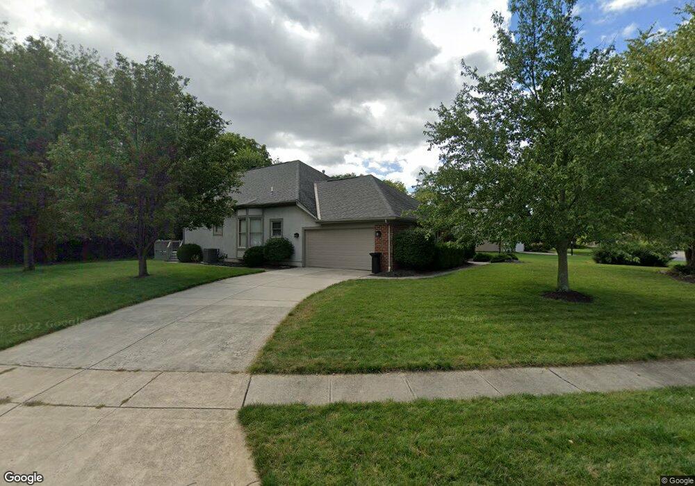
461 Welwyn Dr Powell, OH 43065
Liberty Township NeighborhoodEstimated Value: $536,002 - $666,000
3
Beds
2
Baths
2,420
Sq Ft
$246/Sq Ft
Est. Value
About This Home
This home is located at 461 Welwyn Dr, Powell, OH 43065 and is currently estimated at $596,001, approximately $246 per square foot. 461 Welwyn Dr is a home located in Delaware County with nearby schools including Tyler Run Elementary School, Olentangy Liberty Middle School, and Olentangy Liberty High School.
Ownership History
Date
Name
Owned For
Owner Type
Purchase Details
Closed on
Jul 21, 1997
Sold by
Radiewicz Thomas E
Bought by
Zellmer Richard B and Zellmer Vickie T
Current Estimated Value
Home Financials for this Owner
Home Financials are based on the most recent Mortgage that was taken out on this home.
Original Mortgage
$200,000
Outstanding Balance
$29,783
Interest Rate
7.94%
Mortgage Type
New Conventional
Estimated Equity
$566,218
Purchase Details
Closed on
Sep 16, 1994
Sold by
M/I Schottenstein Homes
Bought by
Radkiewicz Thomas E and Radkiewicz Carol M
Home Financials for this Owner
Home Financials are based on the most recent Mortgage that was taken out on this home.
Original Mortgage
$220,000
Interest Rate
6.87%
Mortgage Type
New Conventional
Create a Home Valuation Report for This Property
The Home Valuation Report is an in-depth analysis detailing your home's value as well as a comparison with similar homes in the area
Home Values in the Area
Average Home Value in this Area
Purchase History
| Date | Buyer | Sale Price | Title Company |
|---|---|---|---|
| Zellmer Richard B | $250,000 | -- | |
| Radkiewicz Thomas E | $244,693 | -- |
Source: Public Records
Mortgage History
| Date | Status | Borrower | Loan Amount |
|---|---|---|---|
| Open | Zellmer Richard B | $200,000 | |
| Previous Owner | Radkiewicz Thomas E | $220,000 |
Source: Public Records
Tax History Compared to Growth
Tax History
| Year | Tax Paid | Tax Assessment Tax Assessment Total Assessment is a certain percentage of the fair market value that is determined by local assessors to be the total taxable value of land and additions on the property. | Land | Improvement |
|---|---|---|---|---|
| 2024 | $7,367 | $150,400 | $38,400 | $112,000 |
| 2023 | $7,429 | $150,400 | $38,400 | $112,000 |
| 2022 | $6,964 | $113,720 | $25,730 | $87,990 |
| 2021 | $7,084 | $113,720 | $25,730 | $87,990 |
| 2020 | $7,109 | $113,720 | $25,730 | $87,990 |
| 2019 | $6,105 | $102,240 | $25,730 | $76,510 |
| 2018 | $6,175 | $102,240 | $25,730 | $76,510 |
| 2017 | $6,218 | $99,230 | $21,390 | $77,840 |
| 2016 | $6,413 | $99,230 | $21,390 | $77,840 |
| 2015 | $5,835 | $99,230 | $21,390 | $77,840 |
| 2014 | $5,913 | $99,230 | $21,390 | $77,840 |
| 2013 | $5,967 | $97,970 | $21,390 | $76,580 |
Source: Public Records
Map
Nearby Homes
- 55 Timber Oak Ct
- 1937 Liberty St
- 2020 Liberty St
- 2961 Lexington Dr
- 91 Tiller Dr
- 120 S Liberty St
- 274 Stamford Dr
- 261 Andover Dr
- 630 Woods Hollow Ln
- 660 Woods Hollow Ln
- 92 Barrington Place
- 6615 Scioto St
- 6583 Scioto St
- 6601 Scioto St
- 6555 Scioto St
- 8803 Yates Point Ct
- 8796 Yates Point Ct
- 575 Woods Hollow Ln
- 87 Murphys Oval Unit N87
- 170 Barrington Place
- 0 Welwyn Dr Unit Tract 1 215007466
- 0 Welwyn Dr Unit Tract 3 215031784
- 0 Welwyn Dr Unit Lot 4 216042488
- 0 Welwyn Dr
- 191 Briarbend Ct
- 460 Welwyn Dr
- 452 Briarbend Blvd
- 173 Briarbend Ct
- 466 Welwyn Dr
- 441 Briarbend Blvd
- 180 Briarbend Ct
- 446 Briarbend Blvd
- 481 Welwyn Dr
- 251 Bluff Ridge Ct
- 157 Briarbend Ct
- 261 Bluff Ridge Ct
- 241 Bluff Ridge Ct
- 421 Briarbend Blvd
- 160 Briarbend Ct
- 175 Whitegate Ct