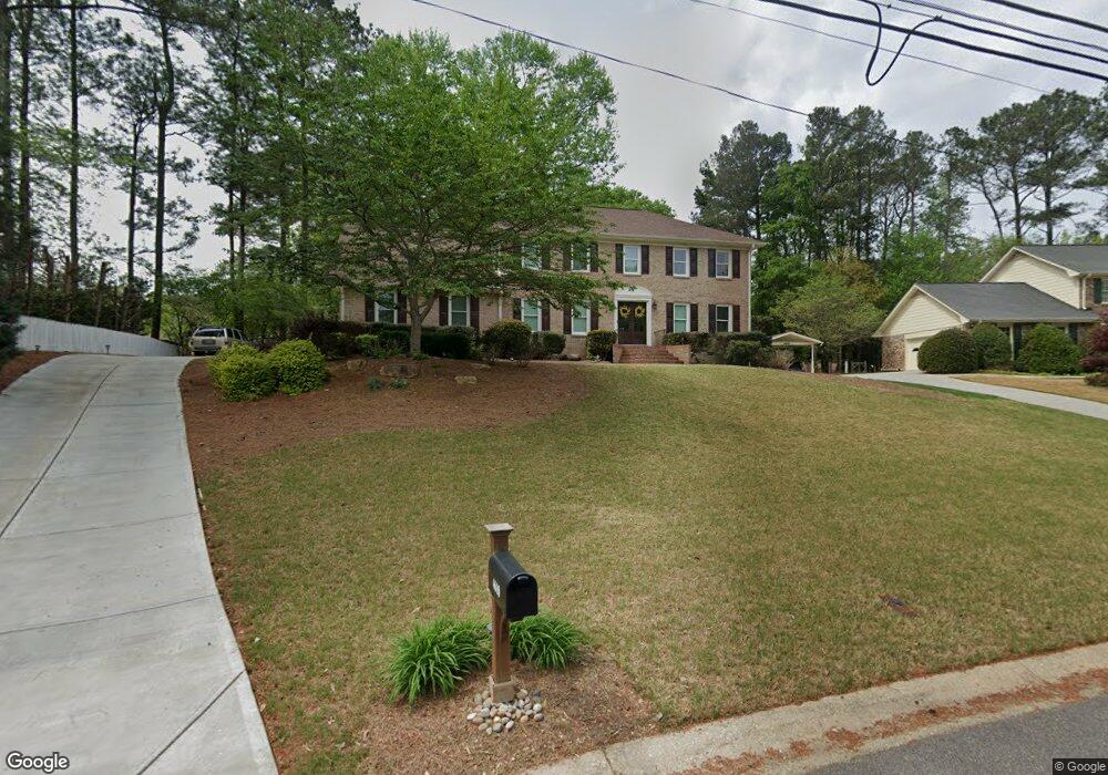
4610 Dellrose Dr Unit 4 Atlanta, GA 30338
Estimated Value: $575,618 - $843,000
4
Beds
3
Baths
2,537
Sq Ft
$277/Sq Ft
Est. Value
About This Home
This home is located at 4610 Dellrose Dr Unit 4, Atlanta, GA 30338 and is currently estimated at $701,905, approximately $276 per square foot. 4610 Dellrose Dr Unit 4 is a home located in DeKalb County with nearby schools including Kingsley Elementary School, Peachtree Middle School, and Dunwoody High School.
Ownership History
Date
Name
Owned For
Owner Type
Purchase Details
Closed on
Nov 29, 2010
Sold by
Boerman Kenneth A and Boerman Paula J
Bought by
Bielan Ann C and Castrucci George
Current Estimated Value
Home Financials for this Owner
Home Financials are based on the most recent Mortgage that was taken out on this home.
Original Mortgage
$260,000
Outstanding Balance
$172,677
Interest Rate
4.4%
Mortgage Type
New Conventional
Estimated Equity
$529,228
Purchase Details
Closed on
Dec 5, 2005
Sold by
Harries Edward M and Harries Suzanne T
Bought by
Boerman Kennth A and Boerman Paula J
Home Financials for this Owner
Home Financials are based on the most recent Mortgage that was taken out on this home.
Original Mortgage
$183,000
Interest Rate
6.29%
Mortgage Type
New Conventional
Create a Home Valuation Report for This Property
The Home Valuation Report is an in-depth analysis detailing your home's value as well as a comparison with similar homes in the area
Home Values in the Area
Average Home Value in this Area
Purchase History
| Date | Buyer | Sale Price | Title Company |
|---|---|---|---|
| Bielan Ann C | $325,000 | -- | |
| Boerman Kennth A | $46,000 | -- |
Source: Public Records
Mortgage History
| Date | Status | Borrower | Loan Amount |
|---|---|---|---|
| Open | Bielan Ann C | $260,000 | |
| Previous Owner | Boerman Kennth A | $183,000 |
Source: Public Records
Tax History Compared to Growth
Tax History
| Year | Tax Paid | Tax Assessment Tax Assessment Total Assessment is a certain percentage of the fair market value that is determined by local assessors to be the total taxable value of land and additions on the property. | Land | Improvement |
|---|---|---|---|---|
| 2025 | $5,095 | $193,360 | $54,000 | $139,360 |
| 2024 | $5,018 | $186,440 | $54,000 | $132,440 |
| 2023 | $5,018 | $188,480 | $54,000 | $134,480 |
| 2022 | $4,867 | $179,720 | $54,000 | $125,720 |
| 2021 | $4,135 | $150,520 | $54,000 | $96,520 |
| 2020 | $3,903 | $136,720 | $54,000 | $82,720 |
| 2019 | $4,121 | $148,960 | $54,000 | $94,960 |
| 2018 | $3,798 | $141,440 | $66,280 | $75,160 |
| 2017 | $3,924 | $120,000 | $66,280 | $53,720 |
| 2016 | $3,790 | $119,240 | $66,280 | $52,960 |
| 2014 | $3,377 | $104,480 | $66,280 | $38,200 |
Source: Public Records
Map
Nearby Homes
- 4641 Brunning Ct
- 5352 Waterford Dr
- 5284 Brookelake Dr
- 2381 Briarleigh Way
- 2293 Littlebrooke Trace
- 355 Aldenshire Place
- 5264 Brooke Ridge Dr
- 5310 Brooke Ridge Dr Unit 5310
- 7695 Brigham Dr
- 5318 Brooke Farm Dr
- 2587 Windwood Ct
- 5145 Davantry Dr
- 2820 Harwick Dr
- 5513 N Peachtree Rd
- 7640 Ryefield Dr
- 7611 Regency Cir
- 5004 Delverton Ct Unit 8
- 4618 Dellrose Dr
- 5215 Waterford Dr
- 5229 Waterford Dr
- 5237 Waterford Dr
- 4615 Dellrose Dr
- 4626 Dellrose Dr Unit 4
- 5247 Waterford Dr
- 4603 Dellrose Dr
- 4611 Brunning Ct
- 4625 Dellrose Dr
- 4627 Brunning Ct
- 4634 4634 Dellrose Dr
- 4634 Dellrose Dr
- 5191 Waterford Dr
- 4601 Brunning Ct Unit 2
- 5214 Waterford Dr
- 4635 Dellrose Dr Unit 4
- 5236 Waterford Dr Unit 4
- 5228 Waterford Dr
- 0 Brunning Ct Unit 7370913