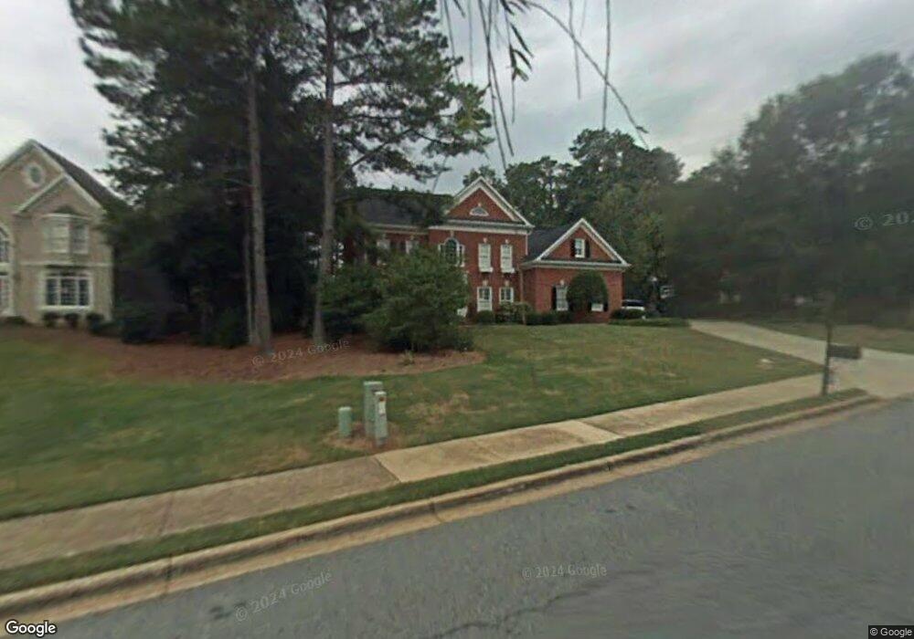
4610 River Bottom Dr Unit 7 Norcross, GA 30092
Estimated Value: $995,000 - $1,383,000
4
Beds
5
Baths
3,803
Sq Ft
$304/Sq Ft
Est. Value
About This Home
This home is located at 4610 River Bottom Dr Unit 7, Norcross, GA 30092 and is currently estimated at $1,156,083, approximately $303 per square foot. 4610 River Bottom Dr Unit 7 is a home located in Gwinnett County with nearby schools including Simpson Elementary School, Pinckneyville Middle School, and Norcross High School.
Ownership History
Date
Name
Owned For
Owner Type
Purchase Details
Closed on
Apr 18, 2005
Sold by
Wesley Kathleen J
Bought by
Doran Thomas T and Doran Kelley
Current Estimated Value
Home Financials for this Owner
Home Financials are based on the most recent Mortgage that was taken out on this home.
Original Mortgage
$255,000
Outstanding Balance
$129,953
Interest Rate
5.79%
Mortgage Type
New Conventional
Estimated Equity
$1,026,130
Create a Home Valuation Report for This Property
The Home Valuation Report is an in-depth analysis detailing your home's value as well as a comparison with similar homes in the area
Home Values in the Area
Average Home Value in this Area
Purchase History
| Date | Buyer | Sale Price | Title Company |
|---|---|---|---|
| Doran Thomas T | $665,000 | -- |
Source: Public Records
Mortgage History
| Date | Status | Borrower | Loan Amount |
|---|---|---|---|
| Open | Doran Thomas T | $255,000 | |
| Closed | Doran Thomas T | $250,000 |
Source: Public Records
Tax History Compared to Growth
Tax History
| Year | Tax Paid | Tax Assessment Tax Assessment Total Assessment is a certain percentage of the fair market value that is determined by local assessors to be the total taxable value of land and additions on the property. | Land | Improvement |
|---|---|---|---|---|
| 2025 | -- | $443,840 | $61,960 | $381,880 |
| 2024 | $11,344 | $420,240 | $71,200 | $349,040 |
| 2023 | $11,344 | $349,800 | $64,000 | $285,800 |
| 2022 | $9,039 | $307,160 | $52,000 | $255,160 |
| 2021 | $8,764 | $284,600 | $49,840 | $234,760 |
| 2020 | $8,830 | $284,600 | $49,840 | $234,760 |
| 2019 | $8,135 | $263,440 | $44,000 | $219,440 |
| 2018 | $7,614 | $237,960 | $36,000 | $201,960 |
| 2016 | $7,268 | $224,640 | $36,000 | $188,640 |
| 2015 | $7,346 | $224,640 | $36,000 | $188,640 |
| 2014 | $7,248 | $224,640 | $36,000 | $188,640 |
Source: Public Records
Map
Nearby Homes
- 4575 Dairy Way
- 0 Hawk Run Unit 7571401
- 0 Hawk Run
- 4410 River Trail Dr Unit 383
- 4405 River Trail Dr
- 225 Brassy Ct
- 6040 Neely Farm Dr Unit 3
- 4291 River Bottom Dr
- 0 Niblick Dr Unit 7655286
- 102 Hawkstone Way
- 5970 Rachel Ridge Unit 2
- 420 Sandwedge Ln
- 917 Wentworth Ct
- 606 Cypress Pointe St
- 5961 Ranger Ct
- 1003 Sandy Lane Dr
- 712 Cypress Pointe St
- 703 Cypress Pointe St Unit 123
- 4620 River Bottom Dr Unit 7
- 4600 River Bottom Dr
- 6245 Harrow Trace
- 6255 Harrow Trace
- 4630 River Bottom Dr
- 4611 River Bottom Dr
- 4621 River Bottom Dr
- 4601 River Bottom Dr Unit 7
- 6265 Harrow Trace
- 4580 River Bottom Dr
- 4585 Dairy Way
- 4591 River Bottom Dr
- 4631 River Bottom Dr
- 4584 Dairy Way
- 4581 River Bottom Dr
- 6275 Harrow Trace
- 4575 Dairy Way Unit 14
- 4570 River Bottom Dr Unit 7
- 4589 Holstein Hill Dr
- 4571 River Bottom Dr Unit 7