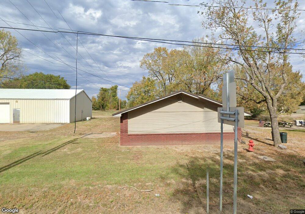
4611 E State Highway 288 Scranton, AR 72863
Estimated Value: $77,676 - $264,000
Studio
1
Bath
480
Sq Ft
$308/Sq Ft
Est. Value
About This Home
This home is located at 4611 E State Highway 288, Scranton, AR 72863 and is currently estimated at $147,919, approximately $308 per square foot. 4611 E State Highway 288 is a home located in Logan County with nearby schools including Scranton Elementary School and Scranton High School.
Ownership History
Date
Name
Owned For
Owner Type
Purchase Details
Closed on
Mar 7, 2012
Bought by
Jones Carrie
Current Estimated Value
Purchase Details
Closed on
Jun 3, 1996
Bought by
Koch
Purchase Details
Closed on
Jan 1, 1994
Bought by
Lynch
Purchase Details
Closed on
Jan 1, 1993
Bought by
Gaisbauer
Purchase Details
Closed on
May 1, 1984
Bought by
Tritt
Create a Home Valuation Report for This Property
The Home Valuation Report is an in-depth analysis detailing your home's value as well as a comparison with similar homes in the area
Purchase History
| Date | Buyer | Sale Price | Title Company |
|---|---|---|---|
| Jones Carrie | -- | -- | |
| Koch | -- | -- | |
| Lynch | -- | -- | |
| Gaisbauer | -- | -- | |
| Tritt | $2,500 | -- |
Source: Public Records
Tax History
| Year | Tax Paid | Tax Assessment Tax Assessment Total Assessment is a certain percentage of the fair market value that is determined by local assessors to be the total taxable value of land and additions on the property. | Land | Improvement |
|---|---|---|---|---|
| 2025 | $575 | $17,476 | $1,600 | $15,876 |
| 2024 | $522 | $11,380 | $1,600 | $9,780 |
| 2023 | $522 | $11,380 | $1,600 | $9,780 |
| 2022 | $522 | $11,380 | $1,600 | $9,780 |
| 2021 | $522 | $11,380 | $1,600 | $9,780 |
| 2020 | $522 | $11,380 | $1,600 | $9,780 |
| 2019 | $522 | $10,690 | $1,600 | $9,090 |
| 2018 | $491 | $10,690 | $1,600 | $9,090 |
| 2017 | $491 | $10,690 | $1,600 | $9,090 |
| 2016 | $491 | $10,690 | $1,600 | $9,090 |
| 2015 | -- | $9,230 | $1,600 | $7,630 |
| 2014 | -- | $9,230 | $1,600 | $7,630 |
| 2013 | -- | $9,230 | $1,600 | $7,630 |
Source: Public Records
Map
Nearby Homes
- 000 Fritsche Rd
- 501 Main St
- 208 11th St
- 1102 Olive St
- 457 Rodeo Arena Rd
- 2220 Dublin Rd
- 0000 Dublin Rd
- 000 Dublin Rd
- 619 Ellsworth Rd
- 356 River Port Rd
- 527 Thompson Bay Rd
- 458 W Dublin Bay Rd
- 10127 E State Highway 22
- 1347 Patterson Bluff Rd
- 548 Boyd Dr
- 465 Boyd Dr
- 301 County Road 2322
- 106 Lakeside Dr
- 4562 Cottontown Rd
- 705 Cr-2291
- 4561 E State Highway 288
- 17779 N State Highway 109
- 17755 N State Highway 109
- 4586 E State Highway 288
- 4527 E State Highway 22
- 17795 N State Highway 109
- 17818 N State Highway 109
- 17873 N State Highway 109
- 17701 N State Highway 109
- 4495 E State Highway 288
- 58 Parks Rd
- 4484 E State Highway 288
- 4449 E State Highway 288
- 122 W Parish Dr
- 4436 E State Highway 288
- 97 Saint Meinrad Loop
- 18039 N State Highway 109
- 293 S Walker Rd
- 38 Stoney Point Rd
- 56 St Meinrad Loop
Your Personal Tour Guide
Ask me questions while you tour the home.