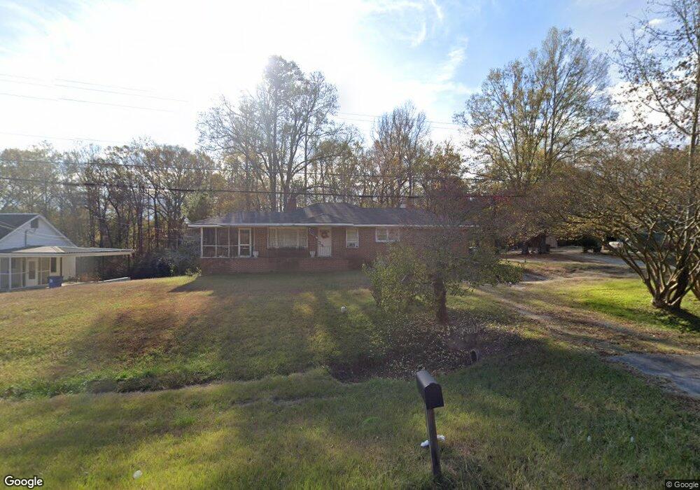
4611 Lamb Ave Union Point, GA 30669
Estimated Value: $139,000 - $214,000
3
Beds
1
Bath
1,073
Sq Ft
$162/Sq Ft
Est. Value
About This Home
This home is located at 4611 Lamb Ave, Union Point, GA 30669 and is currently estimated at $174,066, approximately $162 per square foot. 4611 Lamb Ave is a home located in Greene County with nearby schools including Greene County High School.
Ownership History
Date
Name
Owned For
Owner Type
Purchase Details
Closed on
Jan 23, 1991
Sold by
Estate Of Sara M West
Bought by
Charles Teresa W
Current Estimated Value
Purchase Details
Closed on
Jan 22, 1991
Sold by
West Millard T
Bought by
Estate Of Sara M West
Purchase Details
Closed on
Jan 1, 1986
Sold by
West Sara M
Bought by
West Millard T
Purchase Details
Closed on
Jan 1, 1985
Sold by
West James E and West Sarah E
Bought by
West Sara M
Purchase Details
Closed on
Jan 1, 1982
Sold by
West James E and West Sarah E
Bought by
West James E and West Sarah E
Purchase Details
Closed on
Jan 1, 1979
Sold by
Margaret Thurman B and Margaret Cutright
Bought by
West James E and West Sarah E
Purchase Details
Closed on
Jan 1, 1958
Bought by
Cawthon S A
Create a Home Valuation Report for This Property
The Home Valuation Report is an in-depth analysis detailing your home's value as well as a comparison with similar homes in the area
Purchase History
| Date | Buyer | Sale Price | Title Company |
|---|---|---|---|
| Charles Teresa W | -- | -- | |
| Estate Of Sara M West | -- | -- | |
| West Millard T | -- | -- | |
| West Sara M | -- | -- | |
| West James E | -- | -- | |
| West James E | -- | -- | |
| Margaret Thurman B | -- | -- | |
| Cawthon S A | -- | -- |
Source: Public Records
Tax History
| Year | Tax Paid | Tax Assessment Tax Assessment Total Assessment is a certain percentage of the fair market value that is determined by local assessors to be the total taxable value of land and additions on the property. | Land | Improvement |
|---|---|---|---|---|
| 2025 | $641 | $47,880 | $4,720 | $43,160 |
| 2024 | $595 | $44,560 | $4,720 | $39,840 |
| 2023 | $245 | $43,320 | $4,720 | $38,600 |
| 2022 | $232 | $39,720 | $4,720 | $35,000 |
| 2021 | $227 | $35,720 | $4,720 | $31,000 |
| 2020 | $187 | $15,520 | $2,400 | $13,120 |
| 2019 | $187 | $15,520 | $2,400 | $13,120 |
| 2018 | $310 | $15,520 | $2,400 | $13,120 |
| 2017 | $403 | $15,553 | $2,430 | $13,123 |
| 2016 | $423 | $16,296 | $2,430 | $13,866 |
| 2015 | $392 | $16,296 | $2,430 | $13,866 |
| 2014 | $399 | $16,273 | $2,430 | $13,843 |
Source: Public Records
Map
Nearby Homes
- 0 S Rhodes St Unit 10618488
- 1160 Moody St
- 1241 Old Siloam Rd
- 202 Veazey St
- 215 Hunter St
- 1041 Hillcrest Dr
- 607 Bryan Ave
- 324 N Rhodes St
- 405 Crawfordville Rd
- 000 Washington Hwy
- 0 Woodland Ct Unit 10543600
- 1581 Highway 77 S Hwy
- 1581 Highway 77 S
- 5401 Union Point Hwy
- 1860 Washington Hwy
- 1201 Buffalo Lick Rd
- 0 Buffalo Lick Rd Unit 10551234
- 0 Buffalo Lick Rd Unit 10551325
- 1251 Adams Rd
- 0 Old Union Point Rd Unit 1 10557753
- 4621 Lamb Ave
- 4591 Lamb Ave
- 4631 Lamb Ave
- 4581 Lamb Ave
- 1061 Industrial Blvd
- 0 Georgia 77
- 210 S Rhodes St
- 212 S Rhodes St
- 214 S Rhodes St
- 208 S Rhodes St
- 1040 Highway 77 N
- 218 S Rhodes St
- 202 S Rhodes St
- 4681 Lamb Ave
- 204 S Rhodes St
- 220 S Rhodes St
- 4561 Lamb Ave
- 211 S Rhodes St
- 1060 Industrial Blvd
- 0 S Rhodes St Unit CM1004415
Your Personal Tour Guide
Ask me questions while you tour the home.