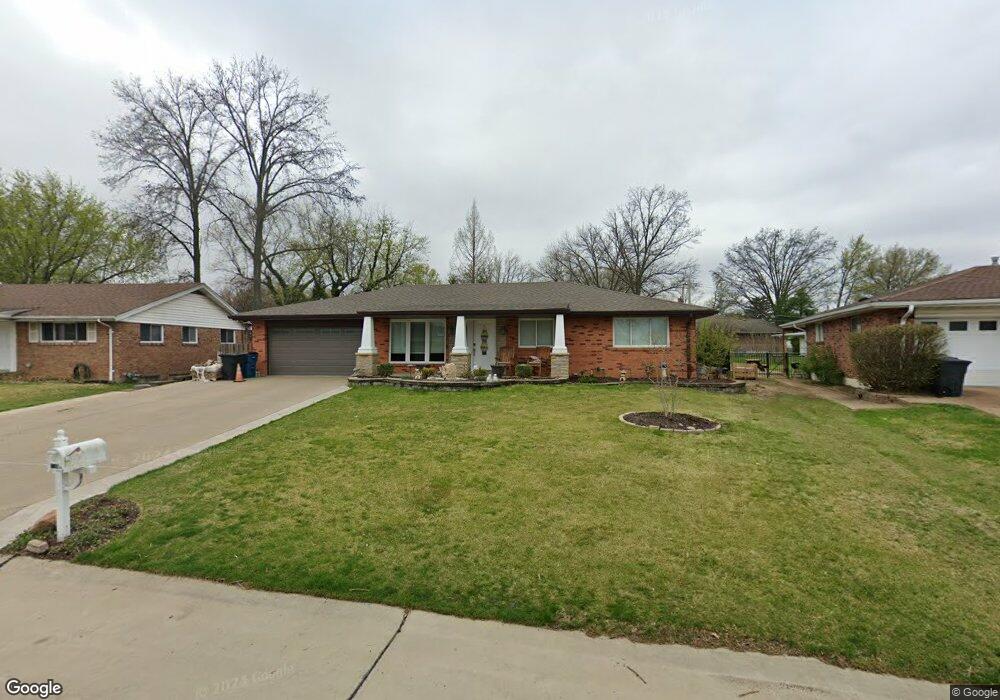
4611 Telestar Dr Saint Louis, MO 63128
Estimated Value: $304,000 - $476,000
3
Beds
2
Baths
2,097
Sq Ft
$182/Sq Ft
Est. Value
About This Home
This home is located at 4611 Telestar Dr, Saint Louis, MO 63128 and is currently estimated at $381,928, approximately $182 per square foot. 4611 Telestar Dr is a home located in St. Louis County with nearby schools including Trautwein Elementary School, Washington Middle School, and Mehlville High School.
Ownership History
Date
Name
Owned For
Owner Type
Purchase Details
Closed on
Nov 16, 2004
Sold by
Westre Investments Llc
Bought by
Blackford Donald and Blackford Tammy
Current Estimated Value
Home Financials for this Owner
Home Financials are based on the most recent Mortgage that was taken out on this home.
Original Mortgage
$177,880
Outstanding Balance
$87,563
Interest Rate
5.68%
Mortgage Type
Purchase Money Mortgage
Estimated Equity
$294,365
Purchase Details
Closed on
Aug 12, 2004
Sold by
Clevlen Ronald and Laws Pamela Clevlen
Bought by
Westre Investments Llc
Home Financials for this Owner
Home Financials are based on the most recent Mortgage that was taken out on this home.
Original Mortgage
$120,000
Interest Rate
6.02%
Mortgage Type
Purchase Money Mortgage
Create a Home Valuation Report for This Property
The Home Valuation Report is an in-depth analysis detailing your home's value as well as a comparison with similar homes in the area
Home Values in the Area
Average Home Value in this Area
Purchase History
| Date | Buyer | Sale Price | Title Company |
|---|---|---|---|
| Blackford Donald | $177,880 | -- | |
| Westre Investments Llc | $165,000 | Capital Title |
Source: Public Records
Mortgage History
| Date | Status | Borrower | Loan Amount |
|---|---|---|---|
| Open | Blackford Donald | $177,880 | |
| Previous Owner | Westre Investments Llc | $120,000 |
Source: Public Records
Tax History Compared to Growth
Tax History
| Year | Tax Paid | Tax Assessment Tax Assessment Total Assessment is a certain percentage of the fair market value that is determined by local assessors to be the total taxable value of land and additions on the property. | Land | Improvement |
|---|---|---|---|---|
| 2025 | $3,592 | $55,260 | $17,390 | $37,870 |
| 2024 | $3,592 | $53,450 | $13,510 | $39,940 |
| 2023 | $3,546 | $53,450 | $13,510 | $39,940 |
| 2022 | $3,048 | $46,130 | $13,510 | $32,620 |
| 2021 | $2,949 | $46,130 | $13,510 | $32,620 |
| 2020 | $2,731 | $40,600 | $10,560 | $30,040 |
| 2019 | $2,723 | $40,600 | $10,560 | $30,040 |
| 2018 | $2,414 | $32,460 | $9,600 | $22,860 |
| 2017 | $2,411 | $32,460 | $9,600 | $22,860 |
| 2016 | $2,956 | $38,270 | $9,600 | $28,670 |
| 2015 | $2,176 | $30,610 | $9,600 | $21,010 |
| 2014 | $2,592 | $36,170 | $6,190 | $29,980 |
Source: Public Records
Map
Nearby Homes
- 4818 Chapel Hill Dr
- 4643 Littlebury Dr
- 4642 Theiss Rd
- 4525 Eli Dr Unit D
- 4921 Kerth Rd
- 4700 Theiss Rd
- 4829 Vermilion Dr
- 4724 Tarlton Dr
- 4501 Eli Dr Unit I
- 4449 Pinyon Jay Ct
- 4833 Hursley Dr
- 4839 Hursley Dr
- 4508 Frederickton Ct
- 4942 Caribee Dr
- 4740 Hedgemont Dr
- 4334 Arrow Tree Dr Unit L
- 4334 Arrow Tree Dr Unit J
- 4931 Theiss Rd
- 37 Kassebaum Ln Unit 207
- 4645 Tauneybrook Dr
- 4607 Telestar Dr
- 4617 Telestar Dr
- 4614 Skyridge Dr
- 4623 Telestar Dr
- 4622 Skyridge Dr
- 4600 Skyridge Dr
- 4536 Skyridge Dr
- 4616 Telestar Dr
- 4629 Telestar Dr
- 4624 Telestar Dr
- 4568 Telestar Dr
- 4630 Skyridge Dr
- 4609 Skyridge Dr
- 4615 Skyridge Dr
- 4529 Sunhill Dr
- 4635 Telestar Dr
- 4601 Skyridge Dr
- 4530 Skyridge Dr
- 4621 Skyridge Dr
- 4531 Skyridge Dr