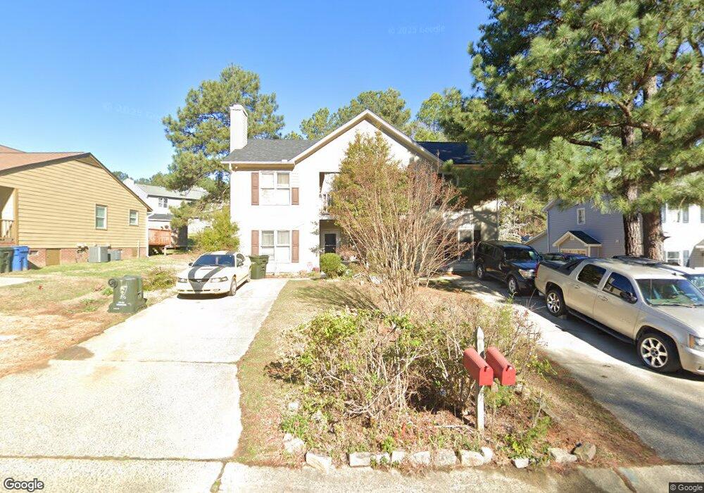
4612 Byrd Rd Durham, NC 27705
West Durham NeighborhoodEstimated Value: $370,000 - $514,000
6
Beds
6
Baths
2,688
Sq Ft
$171/Sq Ft
Est. Value
About This Home
This home is located at 4612 Byrd Rd, Durham, NC 27705 and is currently estimated at $460,657, approximately $171 per square foot. 4612 Byrd Rd is a home located in Durham County with nearby schools including Morehead Montessori, Forest View Elementary, and Brogden Middle.
Ownership History
Date
Name
Owned For
Owner Type
Purchase Details
Closed on
Dec 13, 2024
Sold by
Davis Kathryn C
Bought by
Davis Kathryn C and Davis Aaron B
Current Estimated Value
Purchase Details
Closed on
Jun 4, 2007
Sold by
R & M Investments
Bought by
Davis Kathryn C
Home Financials for this Owner
Home Financials are based on the most recent Mortgage that was taken out on this home.
Original Mortgage
$186,705
Interest Rate
6.1%
Mortgage Type
Unknown
Create a Home Valuation Report for This Property
The Home Valuation Report is an in-depth analysis detailing your home's value as well as a comparison with similar homes in the area
Home Values in the Area
Average Home Value in this Area
Purchase History
| Date | Buyer | Sale Price | Title Company |
|---|---|---|---|
| Davis Kathryn C | -- | None Listed On Document | |
| Davis Kathryn C | -- | None Available |
Source: Public Records
Mortgage History
| Date | Status | Borrower | Loan Amount |
|---|---|---|---|
| Previous Owner | Davis Kathryn C | $186,705 |
Source: Public Records
Tax History
| Year | Tax Paid | Tax Assessment Tax Assessment Total Assessment is a certain percentage of the fair market value that is determined by local assessors to be the total taxable value of land and additions on the property. | Land | Improvement |
|---|---|---|---|---|
| 2025 | $4,320 | $435,778 | $123,000 | $312,778 |
| 2024 | $2,014 | $288,744 | $36,073 | $252,671 |
| 2023 | $1,891 | $288,744 | $36,073 | $252,671 |
| 2022 | $1,848 | $288,744 | $36,073 | $252,671 |
| 2021 | $1,839 | $288,744 | $36,073 | $252,671 |
| 2020 | $1,796 | $288,744 | $36,073 | $252,671 |
| 2019 | $1,796 | $288,744 | $36,073 | $252,671 |
| 2018 | $1,633 | $240,803 | $33,742 | $207,061 |
| 2017 | $1,621 | $240,803 | $33,742 | $207,061 |
| 2016 | $3,133 | $240,803 | $33,742 | $207,061 |
| 2015 | $2,112 | $152,567 | $25,205 | $127,362 |
| 2014 | $2,112 | $152,567 | $25,205 | $127,362 |
Source: Public Records
Map
Nearby Homes
- 2200 Anthony Dr
- 2606 Newquay St
- 96 Sparger Springs Ln
- 2323 Orangewood Dr
- 4627 Stafford Dr
- 4404 Regis Ave
- 2708 Ferrand Dr
- 2801 Sparger Rd
- 4521 Myers Park Dr
- 4408 Cheshire Ct
- 1013 Coldspring Cir
- 6 Webster Ct
- 605 Blackwood Ct
- 2104 Skipping Stone Dr
- 112 Mt Evans Dr
- 112 Salmon River Dr
- 524 Soapstone Dr
- 1221 Opal Ln
- 1229 Opal Ln
- 1217 Opal Ln
- 4614 Byrd Rd
- 4608 Byrd Rd
- 2420 Sparger Rd
- 4606 Byrd Rd
- 2418 Sparger Rd
- 2414 Sparger Rd
- 2414 Sparger Rd Unit A
- 2414 Sparger Rd Unit B
- 2426 Sparger Rd
- 4611 Byrd Rd
- 4615 Byrd Rd Unit B
- 4615 Byrd Rd
- 4615 Byrd Rd Unit A
- 4615 Byrd Rd Unit B
- 4607 Byrd Rd
- 4607 Byrd Rd Unit A
- 4607 Byrd Rd Unit A&B
- 4604 Byrd Rd
- 2410 Sparger Rd
- 2419 Sparger Rd
Your Personal Tour Guide
Ask me questions while you tour the home.