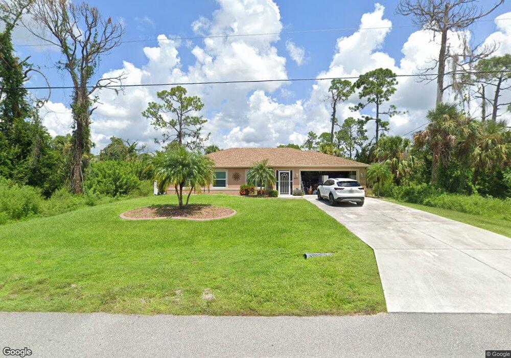
4613 Kenvil Dr North Port, FL 34288
Estimated Value: $325,000 - $358,000
3
Beds
2
Baths
1,592
Sq Ft
$216/Sq Ft
Est. Value
About This Home
This home is located at 4613 Kenvil Dr, North Port, FL 34288 and is currently estimated at $343,653, approximately $215 per square foot. 4613 Kenvil Dr is a home located in Sarasota County with nearby schools including Atwater Elementary School, North Port High School, and Woodland Middle School.
Ownership History
Date
Name
Owned For
Owner Type
Purchase Details
Closed on
Apr 25, 2002
Sold by
Allstate Bldr Sw Fl Inc
Bought by
Durso Crescenzo and Durso Maureen F
Current Estimated Value
Home Financials for this Owner
Home Financials are based on the most recent Mortgage that was taken out on this home.
Original Mortgage
$129,666
Outstanding Balance
$54,545
Interest Rate
7.16%
Mortgage Type
FHA
Estimated Equity
$289,108
Purchase Details
Closed on
Dec 28, 2001
Sold by
T N R Co Inc
Bought by
Allstate Bldr Sw Fl Inc
Create a Home Valuation Report for This Property
The Home Valuation Report is an in-depth analysis detailing your home's value as well as a comparison with similar homes in the area
Home Values in the Area
Average Home Value in this Area
Purchase History
| Date | Buyer | Sale Price | Title Company |
|---|---|---|---|
| Durso Crescenzo | $130,700 | -- | |
| Durso Crescenzo | $130,700 | -- | |
| Allstate Bldr Sw Fl Inc | $9,000 | -- | |
| Allstate Bldr Sw Fl Inc | $9,000 | -- |
Source: Public Records
Mortgage History
| Date | Status | Borrower | Loan Amount |
|---|---|---|---|
| Open | Durso Crescenzo | $129,666 | |
| Closed | Durso Crescenzo | $129,666 |
Source: Public Records
Tax History Compared to Growth
Tax History
| Year | Tax Paid | Tax Assessment Tax Assessment Total Assessment is a certain percentage of the fair market value that is determined by local assessors to be the total taxable value of land and additions on the property. | Land | Improvement |
|---|---|---|---|---|
| 2024 | $2,157 | $154,522 | -- | -- |
| 2023 | $2,157 | $130,848 | $0 | $0 |
| 2022 | $2,045 | $125,041 | $0 | $0 |
| 2021 | $1,884 | $112,855 | $0 | $0 |
| 2020 | $1,859 | $111,297 | $0 | $0 |
| 2019 | $1,799 | $108,795 | $0 | $0 |
| 2018 | $1,656 | $106,766 | $0 | $0 |
| 2017 | $1,610 | $104,570 | $0 | $0 |
| 2016 | $1,606 | $142,300 | $5,500 | $136,800 |
| 2015 | $1,626 | $131,600 | $4,400 | $127,200 |
| 2014 | $1,597 | $99,409 | $0 | $0 |
Source: Public Records
Map
Nearby Homes
- 4683 Oakley Rd
- 0 Oakley Rd Unit MFRC7505026
- 3616 Melissa Terrace
- 0 Malinda Terrace Unit MFRC7505024
- 0 Malinda Terrace Unit MFRC7510576
- Lot 24 -25 Balmor Terrace
- 0 Balmor Terrace Unit MFRC7513411
- 0 Ariton Rd Unit R11120962
- 0 Ariton Rd Unit MFRC7508875
- 3496 Omela Terrace
- 5122 Balmor Terrace
- 5188 Balmor Terrace
- 4819 Ariton Rd
- 0 Omela & Alabelle Ln Terrace Unit MFRD6143996
- 5153 Pinson Dr
- LOT 7 Fernway Dr
- LOT 5 Fernway Dr
- LOT 2 Fernway Dr
- 4875 Ariton Rd
- 1610 Heath Ln