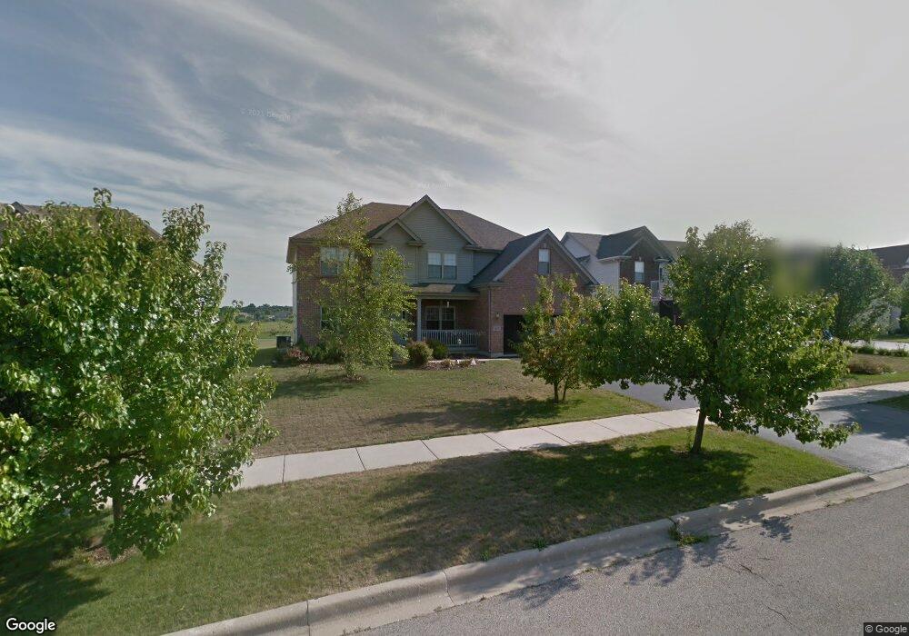
4615 4th St Winthrop Harbor, IL 60096
Estimated Value: $425,896 - $449,000
4
Beds
5
Baths
3,086
Sq Ft
$141/Sq Ft
Est. Value
About This Home
This home is located at 4615 4th St, Winthrop Harbor, IL 60096 and is currently estimated at $434,974, approximately $140 per square foot. 4615 4th St is a home located in Lake County with nearby schools including Kenneth Murphy School, Beach Park Middle School, and Zion-Benton Township High School.
Ownership History
Date
Name
Owned For
Owner Type
Purchase Details
Closed on
Feb 10, 2005
Sold by
Bank Of Waukegan
Bought by
Schnettler Douglas T and Schnettler Janice E
Current Estimated Value
Home Financials for this Owner
Home Financials are based on the most recent Mortgage that was taken out on this home.
Original Mortgage
$238,450
Outstanding Balance
$120,802
Interest Rate
5.7%
Mortgage Type
Purchase Money Mortgage
Estimated Equity
$314,172
Create a Home Valuation Report for This Property
The Home Valuation Report is an in-depth analysis detailing your home's value as well as a comparison with similar homes in the area
Home Values in the Area
Average Home Value in this Area
Purchase History
| Date | Buyer | Sale Price | Title Company |
|---|---|---|---|
| Schnettler Douglas T | $298,500 | -- |
Source: Public Records
Mortgage History
| Date | Status | Borrower | Loan Amount |
|---|---|---|---|
| Open | Schnettler Douglas T | $238,450 | |
| Closed | Schnettler Douglas T | $44,710 |
Source: Public Records
Tax History Compared to Growth
Tax History
| Year | Tax Paid | Tax Assessment Tax Assessment Total Assessment is a certain percentage of the fair market value that is determined by local assessors to be the total taxable value of land and additions on the property. | Land | Improvement |
|---|---|---|---|---|
| 2024 | $12,156 | $129,378 | $8,859 | $120,519 |
| 2023 | $11,125 | $120,275 | $8,552 | $111,723 |
| 2022 | $11,125 | $106,577 | $8,363 | $98,214 |
| 2021 | $11,440 | $103,866 | $8,150 | $95,716 |
| 2020 | $11,176 | $99,118 | $7,777 | $91,341 |
| 2019 | $11,133 | $94,040 | $7,379 | $86,661 |
| 2018 | $10,588 | $87,039 | $8,883 | $78,156 |
| 2017 | $10,502 | $81,881 | $8,357 | $73,524 |
| 2016 | $10,226 | $89,795 | $7,956 | $81,839 |
| 2015 | $9,949 | $82,350 | $7,296 | $75,054 |
| 2014 | $8,788 | $67,754 | $19,994 | $47,760 |
| 2012 | $8,809 | $70,408 | $20,777 | $49,631 |
Source: Public Records
Map
Nearby Homes
- 42908 N Lewis Ave
- 43100 N Lewis Ave
- Lt0 128th St
- 11279 W Russell Rd
- 429 Megan Place
- Lt0 39th Ave
- 140 Old Darby Ln
- 4401 122nd St
- 0 9th St
- 43389 N Oakcrest Ln
- 12122 28th Ave
- 1304 Pelican Ct
- 0 Garnett Ave
- 3616 Creekside Ct
- 3707 Willow Crest Dr
- 12111 28th Ave
- 242 Thompson Ave
- 3717 Willow Crest Dr
- 1405 Lewis Ave
- 908 Countrywood Dr
- 4607 4th St
- 4625 4th St
- 4633 4th St
- 43058 N Fossland Ave
- 415 Prairie Ridge Dr
- 4616 4th St
- 4608 4th St
- 4641 4th St
- 4624 4th St
- 425 Prairie Ridge Dr
- 4632 4th St
- 4632 4th St
- 433 Prairie Ridge Dr
- 4640 4th St
- 332 Fossland Ave
- 43032 N Fossland Ave
- 441 Prairie Ridge Dr
- 43032 N Fossland Ave
- 323 Prairie Ridge Dr
- 324 Fossland Ave