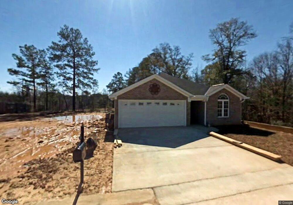
4615 Allums Ave Northport, AL 35473
Estimated Value: $203,603 - $249,000
3
Beds
2
Baths
1,314
Sq Ft
$173/Sq Ft
Est. Value
About This Home
This home is located at 4615 Allums Ave, Northport, AL 35473 and is currently estimated at $226,901, approximately $172 per square foot. 4615 Allums Ave is a home located in Tuscaloosa County with nearby schools including Crestmont Elementary School, Echols Middle School, and Tuscaloosa County High School.
Ownership History
Date
Name
Owned For
Owner Type
Purchase Details
Closed on
Jul 11, 2019
Sold by
Bishop Brenda
Bought by
Fox Kelly Elizabeth Bisho and Fox Michael Phillip
Current Estimated Value
Purchase Details
Closed on
Feb 17, 2016
Sold by
Wells Gary B
Bought by
Bishop Phillip and Bishop Brenda
Purchase Details
Closed on
Nov 15, 2007
Sold by
West Alabama Bank
Bought by
Wells Gary B
Home Financials for this Owner
Home Financials are based on the most recent Mortgage that was taken out on this home.
Original Mortgage
$55,500
Interest Rate
6.32%
Create a Home Valuation Report for This Property
The Home Valuation Report is an in-depth analysis detailing your home's value as well as a comparison with similar homes in the area
Home Values in the Area
Average Home Value in this Area
Purchase History
| Date | Buyer | Sale Price | Title Company |
|---|---|---|---|
| Fox Kelly Elizabeth Bisho | $145,900 | -- | |
| Bishop Phillip | $146,000 | -- | |
| Wells Gary B | $55,500 | -- |
Source: Public Records
Mortgage History
| Date | Status | Borrower | Loan Amount |
|---|---|---|---|
| Previous Owner | Wells Gary B | $55,500 |
Source: Public Records
Tax History Compared to Growth
Tax History
| Year | Tax Paid | Tax Assessment Tax Assessment Total Assessment is a certain percentage of the fair market value that is determined by local assessors to be the total taxable value of land and additions on the property. | Land | Improvement |
|---|---|---|---|---|
| 2024 | $698 | $38,700 | $6,000 | $32,700 |
| 2023 | $698 | $39,100 | $6,000 | $33,100 |
| 2022 | $671 | $37,300 | $6,000 | $31,300 |
| 2021 | $610 | $34,100 | $6,000 | $28,100 |
| 2020 | $547 | $30,840 | $6,000 | $24,840 |
| 2019 | $424 | $27,800 | $6,000 | $21,800 |
| 2018 | $446 | $29,180 | $6,000 | $23,180 |
| 2017 | $438 | $0 | $0 | $0 |
| 2016 | $502 | $0 | $0 | $0 |
| 2015 | $502 | $0 | $0 | $0 |
| 2014 | $483 | $27,520 | $5,000 | $22,520 |
Source: Public Records
Map
Nearby Homes
- 4801 Boh Ave
- 4922 Allums Ave
- 5120 Stewart Parc Dr
- 5118 Azalea Trail
- 5203 Candlewood Dr
- 4531 White Dogwood Ln
- 5206 Azalea Trail
- 5211 Briarcliff Dr
- 5204 Applewood Dr
- 6115 Ashbury Ln
- 4007 Savanah St
- 4115 Malvern Hill Dr
- 4600 Oak Way
- 4810 Oak Way
- 4605 Oak Way
- 5100 Oak Way
- 5213 Oak Way
- 4517 Bluestem Ln
- 0 Tulip Tree Ln
- 3906 Silver Maple Dr
- 4619 Allums Ave
- 5128 Smithfield Cir
- 4703 Allums Ave
- 5122 Smithfield Cir
- 4802 Boh Ave
- 4707 Allums Ave
- 5110 Smithfield Cir
- 4806 Boh Ave
- 4711 Allums Ave
- 5104 Smithfield Cir
- 4910 Boh Ave
- 4805 Boh Ave
- 4715 Allums Ave
- 5038 Smithfield Cir
- 4816 Allums Ave
- 4909 Boh Ave
- 4914 Boh Ave
- 5125 Smithfield Cir
- 5107 Smithfield Cir
- 4820 Allums Ave