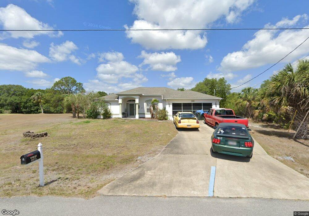
4615 Arley Rd North Port, FL 34288
Estimated Value: $306,428 - $419,000
3
Beds
2
Baths
1,873
Sq Ft
$190/Sq Ft
Est. Value
About This Home
This home is located at 4615 Arley Rd, North Port, FL 34288 and is currently estimated at $355,607, approximately $189 per square foot. 4615 Arley Rd is a home located in Sarasota County with nearby schools including Atwater Elementary School, North Port High School, and Woodland Middle School.
Ownership History
Date
Name
Owned For
Owner Type
Purchase Details
Closed on
Aug 9, 2004
Sold by
Allstate Builders Southwest Florida Inc
Bought by
Romano David A and Romano Susan M
Current Estimated Value
Home Financials for this Owner
Home Financials are based on the most recent Mortgage that was taken out on this home.
Original Mortgage
$147,330
Outstanding Balance
$76,666
Interest Rate
6.75%
Mortgage Type
Purchase Money Mortgage
Estimated Equity
$278,941
Purchase Details
Closed on
Apr 1, 2004
Sold by
Tnr Companies Inc
Bought by
Allstate Builders Of Southwest Florida I
Create a Home Valuation Report for This Property
The Home Valuation Report is an in-depth analysis detailing your home's value as well as a comparison with similar homes in the area
Home Values in the Area
Average Home Value in this Area
Purchase History
| Date | Buyer | Sale Price | Title Company |
|---|---|---|---|
| Romano David A | $163,700 | Aaction Title Agency Inc | |
| Allstate Builders Of Southwest Florida I | $67,400 | Aaction Title Agency |
Source: Public Records
Mortgage History
| Date | Status | Borrower | Loan Amount |
|---|---|---|---|
| Open | Romano David A | $147,330 |
Source: Public Records
Tax History Compared to Growth
Tax History
| Year | Tax Paid | Tax Assessment Tax Assessment Total Assessment is a certain percentage of the fair market value that is determined by local assessors to be the total taxable value of land and additions on the property. | Land | Improvement |
|---|---|---|---|---|
| 2024 | $2,535 | $159,173 | -- | -- |
| 2023 | $2,535 | $154,537 | $0 | $0 |
| 2022 | $2,055 | $122,560 | $0 | $0 |
| 2021 | $2,020 | $118,990 | $0 | $0 |
| 2020 | $1,971 | $117,347 | $0 | $0 |
| 2019 | $1,913 | $114,709 | $0 | $0 |
| 2018 | $1,769 | $112,570 | $0 | $0 |
| 2017 | $1,725 | $110,255 | $0 | $0 |
| 2016 | $1,716 | $156,600 | $6,800 | $149,800 |
| 2015 | $1,740 | $140,400 | $6,000 | $134,400 |
| 2014 | $1,634 | $100,456 | $0 | $0 |
Source: Public Records
Map
Nearby Homes
- 0 Chartwell Ave Unit MFRC7513930
- Lot 27 Arley Rd
- 2470 Talwood Terrace
- 2478 Talwood Terrace
- 0 Delwood Dr Unit MFRC7504264
- 0000 Delwood Dr
- 4661 Fairlane Dr
- 4447 Arley Rd
- 0 Frankfort Ct Unit MFRA4583926
- 0 Northland Ave Unit MFRC7516229
- 0 Northland Ave Unit MFRA4656304
- 2177 Northland Ave
- 2017 Lovoy Ct
- LOT 4 Wheeling Ave
- 0 Wheeling Ave
- 0 Varden Terrace
- 0 Kowal Ave
- 0 Starview Ave Unit MFRO6306505
- Lot 10 Redstone Ave
- 1849 Bobcat Trail
- 14 Chartwell Ave
- 4671 Arley Rd
- 4658 Arley Rd
- 4622 Arley Rd
- 4601 Arley Rd
- 4602 Arley Rd
- 2090 Omega Ct
- 2336 Chartwell Ave
- 0 Chartwell Ave Unit A381992
- 0 Chartwell Ave Unit MFRC7488455
- 0 Chartwell Ave Unit 224016853
- 0 Chartwell Ave Unit C7463724
- 0 Chartwell Ave Unit 221079980
- 0 Chartwell Ave Unit 11 A4435802
- 0 Chartwell Ave Unit C7407524
- 2422 Talwood Terrace
- 2075 Roanoke Rd
- 4800 Hightower Rd
- 0000 Talwood Terrace