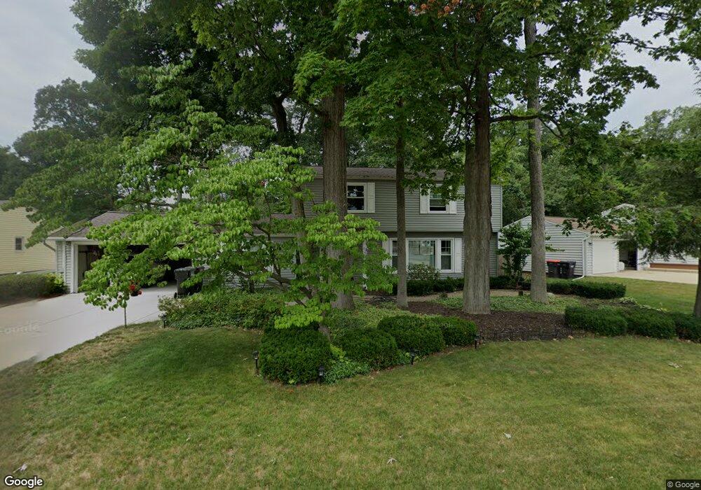
4615 Foxcroft Ave NW Comstock Park, MI 49321
Estimated Value: $307,000 - $344,258
3
Beds
2
Baths
1,724
Sq Ft
$193/Sq Ft
Est. Value
About This Home
This home is located at 4615 Foxcroft Ave NW, Comstock Park, MI 49321 and is currently estimated at $333,065, approximately $193 per square foot. 4615 Foxcroft Ave NW is a home located in Kent County with nearby schools including Stoney Creek Elementary School, Pine Island Elementary School, and Mill Creek Middle School.
Ownership History
Date
Name
Owned For
Owner Type
Purchase Details
Closed on
May 21, 2014
Sold by
Zwarensteyn James J and Zwarensteyn Cathy L
Bought by
The James & Cathy L Zwarensteyn Trust and Zwarensteyn Cathy L
Current Estimated Value
Purchase Details
Closed on
Mar 1, 1987
Bought by
Zwarensteyn J and Zwarensteyn James J
Purchase Details
Closed on
Jun 1, 1977
Purchase Details
Closed on
May 1, 1973
Purchase Details
Closed on
Jan 1, 1970
Create a Home Valuation Report for This Property
The Home Valuation Report is an in-depth analysis detailing your home's value as well as a comparison with similar homes in the area
Home Values in the Area
Average Home Value in this Area
Purchase History
| Date | Buyer | Sale Price | Title Company |
|---|---|---|---|
| The James & Cathy L Zwarensteyn Trust | -- | None Available | |
| Zwarensteyn J | $65,000 | -- | |
| -- | $36,200 | -- | |
| -- | $29,300 | -- | |
| -- | $27,900 | -- |
Source: Public Records
Tax History Compared to Growth
Tax History
| Year | Tax Paid | Tax Assessment Tax Assessment Total Assessment is a certain percentage of the fair market value that is determined by local assessors to be the total taxable value of land and additions on the property. | Land | Improvement |
|---|---|---|---|---|
| 2025 | $2,275 | $170,400 | $0 | $0 |
| 2024 | $2,275 | $148,200 | $0 | $0 |
| 2023 | $2,174 | $136,700 | $0 | $0 |
| 2022 | $2,727 | $118,900 | $0 | $0 |
| 2021 | $2,660 | $110,300 | $0 | $0 |
| 2020 | $1,996 | $103,500 | $0 | $0 |
| 2019 | $2,386 | $79,700 | $0 | $0 |
| 2018 | $2,341 | $79,700 | $0 | $0 |
| 2017 | $2,275 | $74,800 | $0 | $0 |
| 2016 | $2,205 | $71,300 | $0 | $0 |
| 2015 | -- | $71,300 | $0 | $0 |
| 2013 | -- | $63,200 | $0 | $0 |
Source: Public Records
Map
Nearby Homes
- 452 Springfield St NW
- 4678 Westshire Dr NW
- 4581 Westshire Dr NW
- 510 Clark St NW
- 4893 Stony Creek Ave NW
- 4154 Woodrush Ln NW Unit 65
- 4010 Woodrush Ln NW Unit 40
- 4422 Division Ave N
- 5105 Wallingford Dr NW
- 276 Mabel St NW Unit 54
- Wilshire Plan at The Range
- Remington Plan at The Range
- Linden Plan at The Range
- Enclave Plan at The Range
- Croswell Plan at The Range
- Cascade Plan at The Range
- Carson Plan at The Range
- Avery Plan at The Range
- Ashton Plan at The Range
- Andover Plan at The Range
- 4601 Foxcroft Ave NW
- 4631 Foxcroft Ave NW
- 4598 Meryton Ave NW
- 4610 Meryton Ave NW
- 4653 Foxcroft Ave NW
- 4589 Foxcroft Ave NW
- 4614 Foxcroft Ave NW
- 4588 Meryton Ave NW
- 4600 Foxcroft Ave NW
- 4620 Meryton Ave NW
- 4673 Foxcroft Ave NW
- 4638 Foxcroft Ave NW
- 4577 Foxcroft Ave NW
- 4588 Foxcroft Ave NW
- 4576 Meryton Ave NW
- 4650 Foxcroft Ave NW
- 4576 Foxcroft Ave NW
- 4567 Foxcroft Ave NW
- 4660 Foxcroft Ave NW
- 4630 Meryton Ave NW