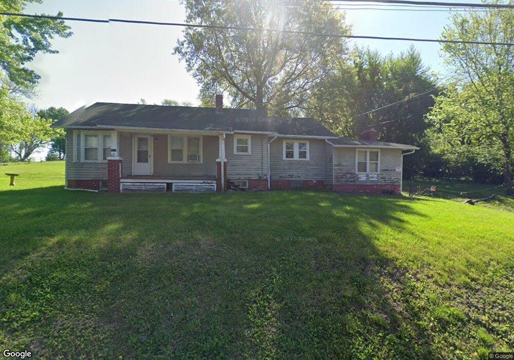
4615 Miller Rd Saint Joseph, MO 64505
Northside NeighborhoodEstimated Value: $149,000 - $255,000
2
Beds
1
Bath
1,436
Sq Ft
$136/Sq Ft
Est. Value
About This Home
This home is located at 4615 Miller Rd, Saint Joseph, MO 64505 and is currently estimated at $194,972, approximately $135 per square foot. 4615 Miller Rd is a home located in Buchanan County with nearby schools including Pershing Elementary School, Robidoux Middle School, and Lafayette High School.
Ownership History
Date
Name
Owned For
Owner Type
Purchase Details
Closed on
Oct 6, 2010
Sold by
Co Federal Home Loan Mortgage Corp and Pr Stewart Lender Services Inc
Bought by
Mccoy Edward
Current Estimated Value
Home Financials for this Owner
Home Financials are based on the most recent Mortgage that was taken out on this home.
Original Mortgage
$39,200
Outstanding Balance
$286
Interest Rate
3.86%
Mortgage Type
Purchase Money Mortgage
Estimated Equity
$194,686
Purchase Details
Closed on
Jun 14, 2010
Sold by
Rainez Dennis W and Rainez Cherilyn
Bought by
Co Federal Home Loan Mortgage Corp
Purchase Details
Closed on
Dec 18, 2007
Sold by
Wilson Ina A and Wilson Wayne E
Bought by
Rainez Ii Dennis W
Home Financials for this Owner
Home Financials are based on the most recent Mortgage that was taken out on this home.
Original Mortgage
$104,000
Interest Rate
6.23%
Mortgage Type
New Conventional
Create a Home Valuation Report for This Property
The Home Valuation Report is an in-depth analysis detailing your home's value as well as a comparison with similar homes in the area
Home Values in the Area
Average Home Value in this Area
Purchase History
| Date | Buyer | Sale Price | Title Company |
|---|---|---|---|
| Mccoy Edward | -- | Advantage Title Llc | |
| Co Federal Home Loan Mortgage Corp | $59,250 | None Available | |
| Rainez Ii Dennis W | -- | Preferred Title Of St Joseph |
Source: Public Records
Mortgage History
| Date | Status | Borrower | Loan Amount |
|---|---|---|---|
| Open | Mccoy Edward | $39,200 | |
| Previous Owner | Rainez Ii Dennis W | $104,000 |
Source: Public Records
Tax History Compared to Growth
Tax History
| Year | Tax Paid | Tax Assessment Tax Assessment Total Assessment is a certain percentage of the fair market value that is determined by local assessors to be the total taxable value of land and additions on the property. | Land | Improvement |
|---|---|---|---|---|
| 2024 | $1,159 | $15,910 | $6,610 | $9,300 |
| 2023 | $1,159 | $15,910 | $6,610 | $9,300 |
| 2022 | $1,072 | $15,910 | $6,610 | $9,300 |
| 2021 | $1,076 | $15,910 | $6,610 | $9,300 |
| 2020 | $1,070 | $15,910 | $6,610 | $9,300 |
| 2019 | $1,034 | $15,910 | $6,610 | $9,300 |
| 2018 | $936 | $15,910 | $6,610 | $9,300 |
| 2017 | $927 | $15,910 | $0 | $0 |
| 2015 | $1 | $15,910 | $0 | $0 |
| 2014 | $1,014 | $15,910 | $0 | $0 |
Source: Public Records
Map
Nearby Homes
- 2715 Cook Rd
- 2906 Cook Rd
- 0 Miller Rd Unit HMS2574937
- 3103 Cook Rd
- 25 N Carriage Dr
- 3004 C Garden Gate N A N
- 2411 Blackwell Rd
- 3815 Miller Rd
- 3036 Floyd Ave
- 5411 Savannah Rd
- 3711 E Colony Square
- 3018 Dover St
- 3326 Chatham Ave
- 3125 Dover St
- 5421 N Pointe Rd
- 3028 Ashland Ave
- 3315 Chatham Ave
- 3612 N Village Dr
- 3015 Miller Rd
- 1714 Blackwell Rd
- 4607 Miller Rd
- 4610 Miller Rd
- 4614 Miller Rd
- 4703 Miller Rd
- 4510 Miller Rd
- 4310 W Haverill Dr
- 4302 W Haverill Dr
- 4601 Miller Rd
- 4314 W Haverill Dr
- 4705 Miller Rd
- 4402 W Haverill Dr
- 4214 W Haverill Dr
- 4708 Miller Rd
- 4406 W Haverill Dr
- 4210 W Haverill Dr
- 4507 Miller Rd
- 4309 W Haverill Dr
- 4305 W Haverill Dr
- 4801 Miller Rd
- 4313 W Haverill Dr