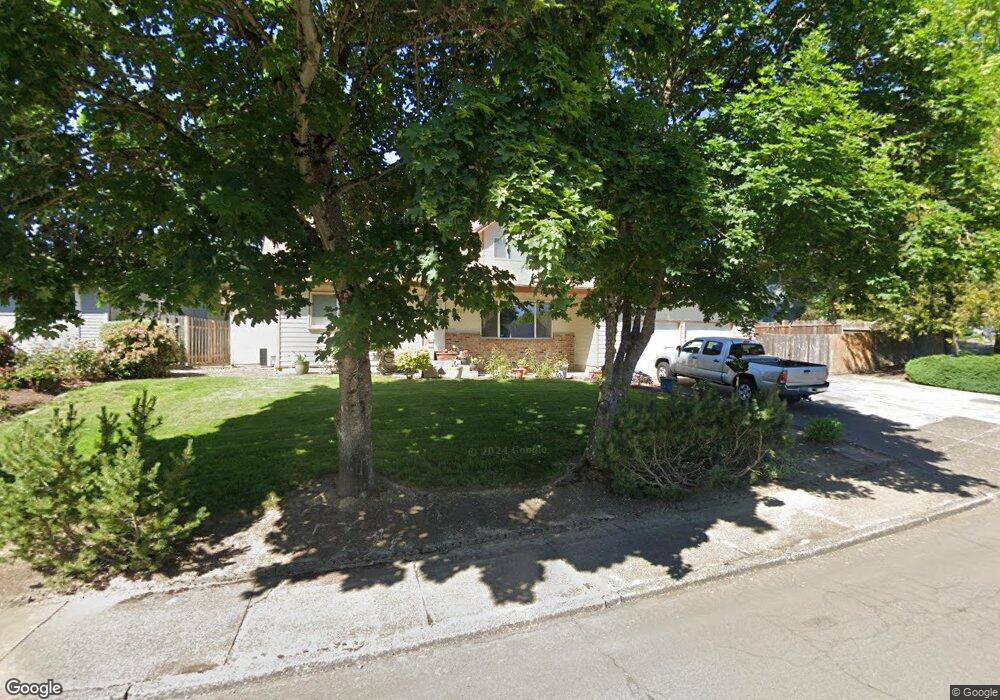
4615 SW Stoddard Dr Beaverton, OR 97007
Estimated Value: $526,000 - $554,000
4
Beds
2
Baths
1,874
Sq Ft
$290/Sq Ft
Est. Value
About This Home
This home is located at 4615 SW Stoddard Dr, Beaverton, OR 97007 and is currently estimated at $543,371, approximately $289 per square foot. 4615 SW Stoddard Dr is a home located in Washington County with nearby schools including Butternut Creek Elementary School, R.A. Brown Middle School, and Century High School.
Ownership History
Date
Name
Owned For
Owner Type
Purchase Details
Closed on
Sep 26, 2008
Sold by
Fisher Theron R and Fisher Suzanne P
Bought by
St Amie Wavel Conworth and St Amie Johanna Casey
Current Estimated Value
Home Financials for this Owner
Home Financials are based on the most recent Mortgage that was taken out on this home.
Original Mortgage
$262,963
Outstanding Balance
$173,940
Interest Rate
6.49%
Mortgage Type
FHA
Estimated Equity
$369,431
Purchase Details
Closed on
Jul 7, 1997
Sold by
Mcelroy Scott A and Mcelroy Gina M
Bought by
Fisher Theron R and Fisher Suzanne P
Home Financials for this Owner
Home Financials are based on the most recent Mortgage that was taken out on this home.
Original Mortgage
$118,320
Interest Rate
7.49%
Mortgage Type
Purchase Money Mortgage
Create a Home Valuation Report for This Property
The Home Valuation Report is an in-depth analysis detailing your home's value as well as a comparison with similar homes in the area
Home Values in the Area
Average Home Value in this Area
Purchase History
| Date | Buyer | Sale Price | Title Company |
|---|---|---|---|
| St Amie Wavel Conworth | $267,750 | Ticor Title | |
| Fisher Theron R | $147,900 | First American Title Ins Co |
Source: Public Records
Mortgage History
| Date | Status | Borrower | Loan Amount |
|---|---|---|---|
| Open | St Amie Wavel Conworth | $262,963 | |
| Previous Owner | Fisher Theron R | $118,320 |
Source: Public Records
Tax History Compared to Growth
Tax History
| Year | Tax Paid | Tax Assessment Tax Assessment Total Assessment is a certain percentage of the fair market value that is determined by local assessors to be the total taxable value of land and additions on the property. | Land | Improvement |
|---|---|---|---|---|
| 2026 | $3,871 | $265,770 | -- | -- |
| 2025 | $3,871 | $258,030 | -- | -- |
| 2024 | $3,761 | $250,520 | -- | -- |
| 2023 | $3,761 | $243,230 | $0 | $0 |
| 2022 | $3,616 | $243,230 | $0 | $0 |
| 2021 | $3,547 | $229,280 | $0 | $0 |
| 2020 | $3,472 | $222,610 | $0 | $0 |
| 2019 | $3,364 | $216,130 | $0 | $0 |
| 2018 | $3,218 | $209,840 | $0 | $0 |
| 2017 | $3,098 | $203,730 | $0 | $0 |
| 2016 | $3,018 | $197,800 | $0 | $0 |
| 2015 | $2,910 | $192,040 | $0 | $0 |
| 2014 | $2,869 | $186,450 | $0 | $0 |
Source: Public Records
Map
Nearby Homes
- 4658 SW Stoddard Dr
- 4895 SW 202nd Ave
- Morgan Plan at Butternut Creek - The Ember Collection
- 19901 SW Meadowbrook Ct
- 4650 SW Southview Terrace
- 20675 SW Rosa Dr
- 20385 SW Shelley Ct
- 19753 SW Celebrity St
- 20020 SW Walquin Ct
- 8473 SE Apricot Ln
- 3980 SW 208th Ct
- 8313 SE Apricot Ln
- 5820 SW 206th Ave
- 8229 SE Kinnaman St
- 3683 SW 209th Ave
- 3627 SW 209th Ave
- 19735 SW Rosa Rd
- 19560 SW Madeline St
- 8543 SE Blanton St Unit 1471
- 20591 SW Ravenswood St
- 4585 SW Stoddard Dr
- 4625 SW Stoddard Dr
- 4585 SW Stoddard Dr Reduced
- 20596 SW Lido Ct
- 20626 SW Lido Ct
- 4565 SW Stoddard Dr
- 4610 SW Stoddard Dr
- 4622 SW Stoddard Dr
- 4645 SW Stoddard Dr
- 4600 SW Stoddard Dr
- 20656 SW Lido Ct
- 20534 SW Venice Ct
- 4640 SW Stoddard Dr
- 20569 SW Lido Ct
- 20599 SW Lido Ct
- 20527 SW Venice Ct
- 20629 SW Lido Ct
- 20686 SW Lido Ct
- 20524 SW Venice Ct
- 4665 SW Stoddard Dr