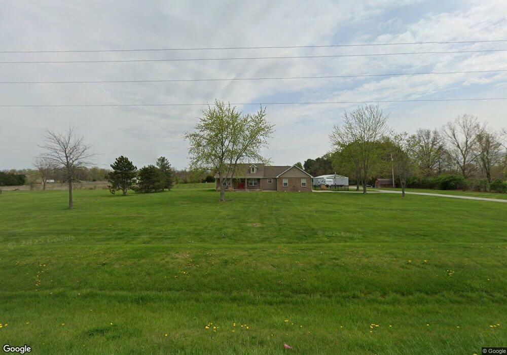
4616 State Route 4 Mascoutah, IL 62258
Estimated Value: $228,000 - $337,000
--
Bed
--
Bath
1,796
Sq Ft
$163/Sq Ft
Est. Value
About This Home
This home is located at 4616 State Route 4, Mascoutah, IL 62258 and is currently estimated at $293,080, approximately $163 per square foot. 4616 State Route 4 is a home located in St. Clair County with nearby schools including Freeburg Elementary School and Freeburg Community High School.
Ownership History
Date
Name
Owned For
Owner Type
Purchase Details
Closed on
Oct 9, 2012
Sold by
Ott Kevin and Ott Aimee
Bought by
Ott Kevin and Ott Aimee
Current Estimated Value
Home Financials for this Owner
Home Financials are based on the most recent Mortgage that was taken out on this home.
Original Mortgage
$190,400
Outstanding Balance
$131,784
Interest Rate
3.5%
Mortgage Type
New Conventional
Estimated Equity
$161,296
Purchase Details
Closed on
Jun 14, 2000
Bought by
Ott Kevin and Ott Aimee
Create a Home Valuation Report for This Property
The Home Valuation Report is an in-depth analysis detailing your home's value as well as a comparison with similar homes in the area
Home Values in the Area
Average Home Value in this Area
Purchase History
| Date | Buyer | Sale Price | Title Company |
|---|---|---|---|
| Ott Kevin | -- | Fatic | |
| Ott Kevin | $35,000 | -- |
Source: Public Records
Mortgage History
| Date | Status | Borrower | Loan Amount |
|---|---|---|---|
| Open | Ott Kevin | $190,400 |
Source: Public Records
Tax History Compared to Growth
Tax History
| Year | Tax Paid | Tax Assessment Tax Assessment Total Assessment is a certain percentage of the fair market value that is determined by local assessors to be the total taxable value of land and additions on the property. | Land | Improvement |
|---|---|---|---|---|
| 2024 | $5,722 | $82,264 | $8,923 | $73,341 |
| 2023 | $4,164 | $59,813 | $5,078 | $54,735 |
| 2022 | $3,810 | $53,886 | $4,575 | $49,311 |
| 2021 | $3,656 | $51,096 | $4,338 | $46,758 |
| 2020 | $3,660 | $52,796 | $4,482 | $48,314 |
| 2019 | $3,649 | $50,867 | $4,212 | $46,655 |
| 2018 | $3,750 | $52,478 | $4,345 | $48,133 |
| 2017 | $3,654 | $51,449 | $4,260 | $47,189 |
| 2016 | $3,626 | $52,237 | $4,325 | $47,912 |
| 2014 | $3,505 | $53,711 | $4,451 | $49,260 |
| 2013 | $3,704 | $56,002 | $4,641 | $51,361 |
Source: Public Records
Map
Nearby Homes
- 4632 State Route 4
- 10121 Chaussee Ln
- 4648 State Route 4
- 4607 State Route 4
- 3221 N 2nd St
- 3206 N 2nd St
- 10168 Chaussee Ln
- 3210 N 2nd St
- 3204 N 2nd St
- 3024 N 2nd St
- 3012 N 2nd St
- 0 Route 4 Unit 16040919
- 3000 N 2nd St
- 2318 N 4th St
- 10100 Hickory Hollow Rd
- 4747 State Route 4
- 2174 Adams Ave
- 2107 Adams Ave
- 2224 N 2nd St
- 2215 N 4th St