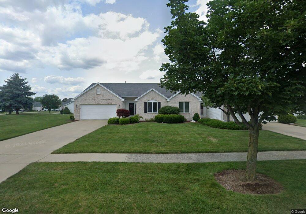
4617 Blackstone Dr W Maumee, OH 43537
Estimated Value: $306,000 - $325,561
3
Beds
2
Baths
1,809
Sq Ft
$173/Sq Ft
Est. Value
About This Home
This home is located at 4617 Blackstone Dr W, Maumee, OH 43537 and is currently estimated at $313,640, approximately $173 per square foot. 4617 Blackstone Dr W is a home located in Lucas County with nearby schools including Anthony Wayne High School, Ohio Digital Learning School, and St Joseph Catholic School.
Ownership History
Date
Name
Owned For
Owner Type
Purchase Details
Closed on
Jun 25, 1999
Sold by
Mccarthy Builders Inc
Bought by
Shepherd George E and Cook Cathy A
Current Estimated Value
Home Financials for this Owner
Home Financials are based on the most recent Mortgage that was taken out on this home.
Original Mortgage
$124,400
Interest Rate
7.15%
Create a Home Valuation Report for This Property
The Home Valuation Report is an in-depth analysis detailing your home's value as well as a comparison with similar homes in the area
Home Values in the Area
Average Home Value in this Area
Purchase History
| Date | Buyer | Sale Price | Title Company |
|---|---|---|---|
| Shepherd George E | $29,800 | Louisville Title Agency For |
Source: Public Records
Mortgage History
| Date | Status | Borrower | Loan Amount |
|---|---|---|---|
| Previous Owner | Shepherd George E | $124,400 |
Source: Public Records
Tax History
| Year | Tax Paid | Tax Assessment Tax Assessment Total Assessment is a certain percentage of the fair market value that is determined by local assessors to be the total taxable value of land and additions on the property. | Land | Improvement |
|---|---|---|---|---|
| 2025 | -- | $91,000 | $28,245 | $62,755 |
| 2024 | $2,022 | $96,355 | $28,245 | $68,110 |
| 2023 | $3,752 | $71,610 | $15,050 | $56,560 |
| 2022 | $3,788 | $71,610 | $15,050 | $56,560 |
| 2021 | $3,715 | $71,610 | $15,050 | $56,560 |
| 2020 | $3,461 | $61,005 | $12,740 | $48,265 |
| 2019 | $3,367 | $61,005 | $12,740 | $48,265 |
| 2018 | $1,845 | $61,005 | $12,740 | $48,265 |
| 2017 | $3,197 | $56,140 | $10,185 | $45,955 |
| 2016 | $3,167 | $160,400 | $29,100 | $131,300 |
| 2015 | $3,038 | $160,400 | $29,100 | $131,300 |
| 2014 | $2,830 | $54,540 | $9,910 | $44,630 |
| 2013 | $3,370 | $54,540 | $9,910 | $44,630 |
Source: Public Records
Map
Nearby Homes
- 4455 Post Office Cir
- 4369 Post Office Cir
- 4346 Post Office Cir
- 4334 Post Office Cir
- 4321 Post Office Cir
- 4644 Terra Ct
- 4351 Sage St
- 4339 Sage St
- 7508 Epaulet Ln
- 7795 Southbranch Terrace
- 0 Black Rd
- 4417 Clearwater Dr E
- 4736 Lakeside Dr
- 4731 Lakeside Dr
- 4745 Lakeside Dr
- 5160 Black Rd
- 5002 Black Rd
- 4226 Back Ridge Way
- 7900 Iron Horse Rd
- 7902 Trestle Bend Rd
- 4618 Blackstone Dr E
- 4612 Blackstone Dr E
- 4537 Blackstone Dr W
- 4540 Blackstone Dr E
- 4531 Blackstone Dr W
- 4614 Blackstone Dr W
- 4534 Blackstone Dr E
- 4613 Blackstone Dr E
- 4525 Blackstone Dr W
- 4528 Blackstone Dr E
- 4607 Blackstone Dr E
- 4556 Blackstone Dr W
- 4550 Blackstone Dr W
- 4519 Blackstone Dr W
- 4600 Blackstone Dr W
- 4538 Blackstone Dr W
- 4544 Blackstone Dr W
- 4522 Blackstone Dr E
- 4601 Blackstone Dr E
- 4532 Blackstone Dr W
Your Personal Tour Guide
Ask me questions while you tour the home.