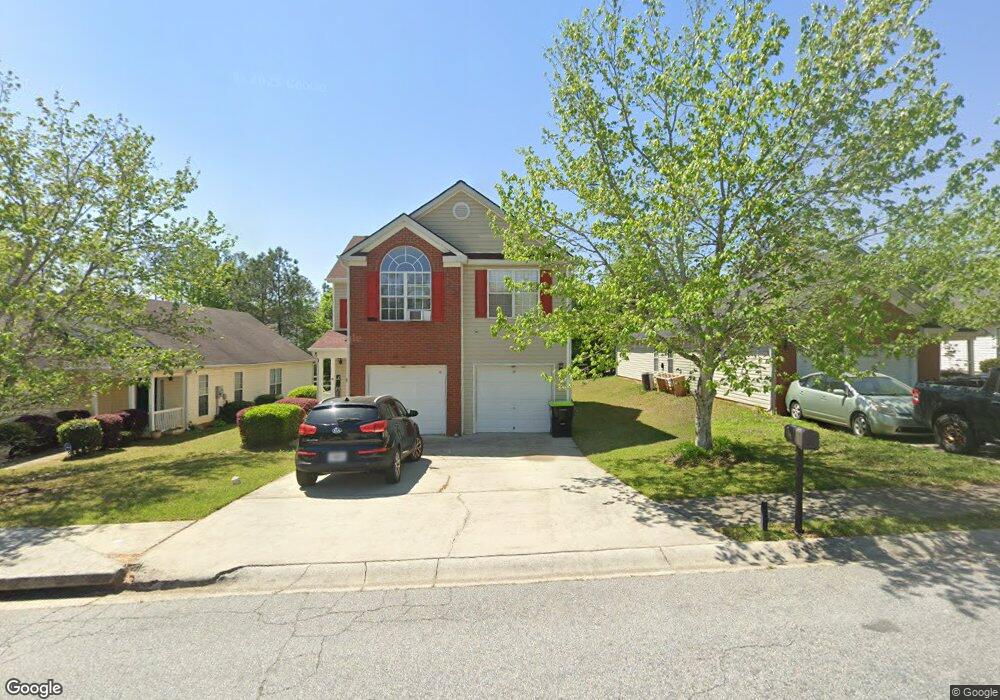
4617 Rolling Brook Ct Union City, GA 30291
Estimated Value: $225,000 - $253,000
3
Beds
2
Baths
1,483
Sq Ft
$161/Sq Ft
Est. Value
About This Home
This home is located at 4617 Rolling Brook Ct, Union City, GA 30291 and is currently estimated at $238,972, approximately $161 per square foot. 4617 Rolling Brook Ct is a home located in Fulton County with nearby schools including C. H. Gullatt Elementary School, Camp Creek Middle School, and Creekside High School.
Ownership History
Date
Name
Owned For
Owner Type
Purchase Details
Closed on
Oct 30, 2002
Sold by
Gt Architecture Contractors Corp
Bought by
Contreras Francisco J
Current Estimated Value
Home Financials for this Owner
Home Financials are based on the most recent Mortgage that was taken out on this home.
Original Mortgage
$111,017
Outstanding Balance
$46,192
Interest Rate
5.93%
Mortgage Type
New Conventional
Estimated Equity
$192,780
Create a Home Valuation Report for This Property
The Home Valuation Report is an in-depth analysis detailing your home's value as well as a comparison with similar homes in the area
Home Values in the Area
Average Home Value in this Area
Purchase History
| Date | Buyer | Sale Price | Title Company |
|---|---|---|---|
| Contreras Francisco J | $112,800 | -- |
Source: Public Records
Mortgage History
| Date | Status | Borrower | Loan Amount |
|---|---|---|---|
| Open | Contreras Francisco J | $111,017 |
Source: Public Records
Tax History Compared to Growth
Tax History
| Year | Tax Paid | Tax Assessment Tax Assessment Total Assessment is a certain percentage of the fair market value that is determined by local assessors to be the total taxable value of land and additions on the property. | Land | Improvement |
|---|---|---|---|---|
| 2025 | $1,117 | $94,200 | $18,920 | $75,280 |
| 2023 | $1,848 | $65,480 | $13,720 | $51,760 |
| 2022 | $935 | $65,480 | $13,720 | $51,760 |
| 2021 | $863 | $54,080 | $6,000 | $48,080 |
| 2020 | $861 | $52,800 | $9,440 | $43,360 |
| 2019 | $1,421 | $45,120 | $5,480 | $39,640 |
| 2018 | $896 | $43,840 | $7,040 | $36,800 |
| 2017 | $675 | $35,080 | $7,040 | $28,040 |
| 2016 | $673 | $35,080 | $7,040 | $28,040 |
| 2015 | $1,226 | $35,080 | $7,040 | $28,040 |
| 2014 | $365 | $21,320 | $4,360 | $16,960 |
Source: Public Records
Map
Nearby Homes
- 289 Switcher Ct
- 288 Switcher Ct
- 280 Switcher Ct
- 291 Switcher Ct
- 282 Switcher Ct
- 286 Switcher Ct
- 285 Switcher Ct
- 292 Switcher Ct
- 284 Switcher Ct
- 290 Switcher Ct
- 203 Switcher Ct
- 183 Stanchion Dr
- 423 Camrose Ave
- 424 Camrose Ave
- 185 Stanchion Dr
- 187 Stanchion Dr
- 179 Stanchion Dr
- 3589 Brookstone Way
- 3599 Brookstone Way
- 5733 Rockaway Dr
- 4619 Rolling Brook Ct
- 4615 Rolling Brook Ct
- 4621 Rolling Brook Ct
- 4613 Rolling Brook Ct
- 4611 Rolling Brook Ct
- 4623 Rolling Brook Ct
- 7900 Four Oaks Ct
- 5701 Rockaway Dr
- 4609 Rolling Brook Ct Unit 110
- 4609 Rolling Brook Ct
- 4625 Rolling Brook Ct
- 7902 Four Oaks Ct
- 5703 Rockaway Dr
- 7901 Four Oaks Ct
- 7901 Four Oaks Ct
- 4607 Rolling Brook Ct
- 7904 Four Oaks Ct
- 4627 Rolling Brook Ct
- 5705 Rockaway Dr
- 7903 Four Oaks Ct