Estimated Value: $111,274 - $188,000
2
Beds
1
Bath
1,366
Sq Ft
$118/Sq Ft
Est. Value
About This Home
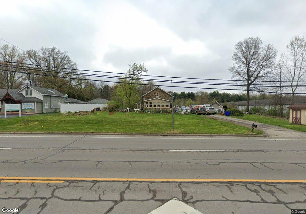
This home is located at 4618 State Route 43, Kent, OH 44240 and is currently estimated at $160,569, approximately $117 per square foot. 4618 State Route 43 is a home located in Portage County with nearby schools including Brimfield Elementary School, Field Middle School, and Field High School.
Ownership History
Date
Name
Owned For
Owner Type
Purchase Details
Closed on
Jun 21, 2019
Sold by
Dean Randy K
Bought by
Violet Lane Llc
Current Estimated Value
Purchase Details
Closed on
Dec 21, 2016
Sold by
Dean Randy K and Dean Fay F
Bought by
Dean Randy K
Purchase Details
Closed on
Jun 8, 2012
Sold by
Hillyer Group Llc
Bought by
Dean Randy K and Dean Fay F
Purchase Details
Closed on
May 4, 2004
Sold by
Johnson Property Management Llc
Bought by
State Of Ohio
Purchase Details
Closed on
Mar 22, 2002
Sold by
Johnson & Associates Inc
Bought by
Johnson Property Management Llc
Purchase Details
Closed on
Aug 6, 1999
Sold by
Shepherd Alice
Bought by
Johnson & Associates
Home Financials for this Owner
Home Financials are based on the most recent Mortgage that was taken out on this home.
Original Mortgage
$108,000
Interest Rate
7.68%
Mortgage Type
Commercial
Purchase Details
Closed on
Jul 28, 1992
Bought by
Shepherd Alice
Create a Home Valuation Report for This Property
The Home Valuation Report is an in-depth analysis detailing your home's value as well as a comparison with similar homes in the area
Home Values in the Area
Average Home Value in this Area
Purchase History
| Date | Buyer | Sale Price | Title Company |
|---|---|---|---|
| Violet Lane Llc | $10,000 | None Available | |
| Dean Randy K | -- | None Available | |
| Dean Randy K | $71,200 | Attorney | |
| State Of Ohio | $12,750 | -- | |
| Johnson Property Management Llc | -- | -- | |
| Johnson & Associates | $100,000 | Meridian Title | |
| Shepherd Alice | $59,000 | -- |
Source: Public Records
Mortgage History
| Date | Status | Borrower | Loan Amount |
|---|---|---|---|
| Previous Owner | Johnson & Associates | $108,000 |
Source: Public Records
Tax History
| Year | Tax Paid | Tax Assessment Tax Assessment Total Assessment is a certain percentage of the fair market value that is determined by local assessors to be the total taxable value of land and additions on the property. | Land | Improvement |
|---|---|---|---|---|
| 2025 | $1,950 | $26,880 | $23,030 | $3,850 |
| 2024 | $1,954 | $28,250 | $24,400 | $3,850 |
| 2023 | $2,270 | $23,460 | $21,040 | $2,420 |
| 2022 | $2,281 | $23,460 | $21,040 | $2,420 |
| 2021 | $2,270 | $23,460 | $21,040 | $2,420 |
| 2020 | $2,221 | $23,460 | $21,040 | $2,420 |
| 2019 | $1,674 | $23,460 | $21,040 | $2,420 |
| 2018 | $1,741 | $25,590 | $23,380 | $2,210 |
| 2017 | $1,583 | $25,590 | $23,380 | $2,210 |
| 2016 | $1,738 | $25,590 | $23,380 | $2,210 |
| 2015 | $1,563 | $25,590 | $23,380 | $2,210 |
| 2014 | $1,518 | $25,590 | $23,380 | $2,210 |
| 2013 | $2,094 | $36,160 | $23,380 | $12,780 |
Source: Public Records
Map
Nearby Homes
- 4545 State Route 43
- 2477 Waterford Pointe Dr
- 4360 Beal Dr
- 5088 Spruce Knoll Run
- 1676 Countryview Dr
- 1680 Countryview Dr
- 0 Meloy Rd Unit 5162435
- 1233 Cedar Ridge Rd
- 5096 Spruce Knoll Run
- 410 Beryl Dr
- 3880 Selnik Rd
- 3929 Lor Ron St
- 3890 Grace Dr
- 4088 Lynwood Dr
- 3834 Morley Dr
- 2092 Sugar Maple Dr
- 1526 Franklin Ave
- 722 Avondale St
- 1997 Sugar Maple Dr
- 1426 Loop Rd Unit 1426
- 4618 St Rt 43
- 4646 State Route 43
- 1319 Brimfield Dr
- 1303 Brimfield Dr
- 4651 State Route 43
- 4666 State Route 43
- 1324 Howe Rd
- 1339 Brimfield Dr
- 1294 Brimfield Dr
- 4674 State Route 43
- 4543 State Route 43
- 4682 Ohio 43
- 1365 Brimfield Dr
- 4554 State Route 43
- 4546 State Route 43
- 1300 Brimfield Dr Unit A6
- 1300 Brimfield Dr Unit A11
- 1300 Brimfield Dr Unit B10
- 1300 Brimfield Dr Unit B9
- 1300 Brimfield Dr Unit B11
Your Personal Tour Guide
Ask me questions while you tour the home.