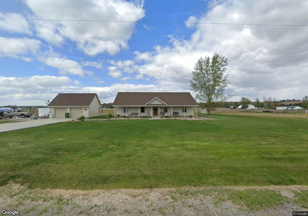
4619 Quail Ln Ontario, OR 97914
Estimated Value: $444,000 - $581,000
3
Beds
2
Baths
1,819
Sq Ft
$283/Sq Ft
Est. Value
About This Home
This home is located at 4619 Quail Ln, Ontario, OR 97914 and is currently estimated at $515,030, approximately $283 per square foot. 4619 Quail Ln is a home located in Malheur County with nearby schools including Ontario High School, River of Life Christian School, and Treasure Valley Seventh-Day Adventist School.
Ownership History
Date
Name
Owned For
Owner Type
Purchase Details
Closed on
Mar 30, 2009
Sold by
Duncan Christopher H
Bought by
Moore James A
Current Estimated Value
Home Financials for this Owner
Home Financials are based on the most recent Mortgage that was taken out on this home.
Original Mortgage
$147,000
Outstanding Balance
$93,971
Interest Rate
5.15%
Mortgage Type
Future Advance Clause Open End Mortgage
Estimated Equity
$421,060
Create a Home Valuation Report for This Property
The Home Valuation Report is an in-depth analysis detailing your home's value as well as a comparison with similar homes in the area
Home Values in the Area
Average Home Value in this Area
Purchase History
| Date | Buyer | Sale Price | Title Company |
|---|---|---|---|
| Moore James A | $247,000 | -- |
Source: Public Records
Mortgage History
| Date | Status | Borrower | Loan Amount |
|---|---|---|---|
| Open | Moore James A | $147,000 |
Source: Public Records
Tax History Compared to Growth
Tax History
| Year | Tax Paid | Tax Assessment Tax Assessment Total Assessment is a certain percentage of the fair market value that is determined by local assessors to be the total taxable value of land and additions on the property. | Land | Improvement |
|---|---|---|---|---|
| 2024 | $3,305 | $262,789 | $63,810 | $198,979 |
| 2023 | $3,259 | $255,135 | $56,904 | $198,231 |
| 2022 | $3,190 | $247,704 | $58,816 | $188,888 |
| 2021 | $3,134 | $240,490 | $55,661 | $184,829 |
| 2020 | $3,087 | $233,486 | $57,531 | $175,955 |
| 2019 | $3,026 | $226,686 | $58,479 | $168,207 |
| 2018 | $2,840 | $220,084 | $61,907 | $158,177 |
| 2017 | $2,737 | $213,674 | $59,288 | $154,386 |
| 2016 | $2,732 | $207,451 | $62,938 | $144,513 |
| 2015 | $2,666 | $201,409 | $63,202 | $138,207 |
| 2014 | $2,591 | $195,543 | $58,979 | $136,564 |
Source: Public Records
Map
Nearby Homes
- TBD Quail Ln
- 4620 Quail Ln
- 4615 Quail Ln
- 4630 Quail Ln
- 4606 Quail Ln
- 1950 Boat Landing Rd
- 228 Boat Landing Rd
- 222 Boat Landing Rd
- 4621 Rolland Rd
- 265 Cedar Rd
- 216 Boat Landing Rd
- 257 Boat Landing Rd
- 4647 Highway 52
- 245 Cedar Rd
- 4615 Rolland Rd
- 242 Cedar
- 242 Cedar Rd
- 232 Cedar Rd
- 252 Cedar Rd
- 4631 Rolland Rd