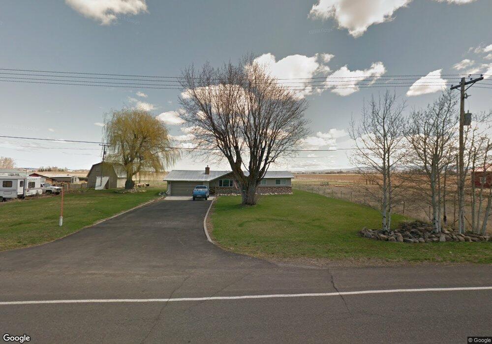
462 N 2400 E Saint Anthony, ID 83445
Estimated Value: $349,265 - $412,000
3
Beds
2
Baths
1,502
Sq Ft
$248/Sq Ft
Est. Value
About This Home
This home is located at 462 N 2400 E, Saint Anthony, ID 83445 and is currently estimated at $372,816, approximately $248 per square foot. 462 N 2400 E is a home located in Fremont County with nearby schools including Henrys Fork Elementary School, South Fremont Junior High School, and South Fremont High School.
Create a Home Valuation Report for This Property
The Home Valuation Report is an in-depth analysis detailing your home's value as well as a comparison with similar homes in the area
Home Values in the Area
Average Home Value in this Area
Tax History
| Year | Tax Paid | Tax Assessment Tax Assessment Total Assessment is a certain percentage of the fair market value that is determined by local assessors to be the total taxable value of land and additions on the property. | Land | Improvement |
|---|---|---|---|---|
| 2025 | $1,330 | $287,696 | $51,000 | $236,696 |
| 2024 | $1,372 | $282,136 | $51,000 | $231,136 |
| 2023 | $1,412 | $282,136 | $51,000 | $231,136 |
| 2022 | $1,582 | $227,661 | $41,000 | $186,661 |
| 2021 | $1,379 | $146,394 | $24,500 | $121,894 |
| 2020 | $1,368 | $135,702 | $24,500 | $111,202 |
| 2019 | $1,353 | $135,702 | $24,500 | $111,202 |
| 2018 | $1,333 | $126,077 | $24,500 | $101,577 |
| 2017 | $14 | $122,134 | $23,765 | $98,369 |
| 2016 | $863 | $62,666 | $23,765 | $38,901 |
| 2015 | $836 | $118,739 | $0 | $0 |
| 2014 | $651 | $60,969 | $0 | $0 |
| 2013 | $651 | $60,969 | $0 | $0 |
Source: Public Records
Map
Nearby Homes
- 130 Industrial Park Rd
- 120 Industrial Park Rd
- 2420 E 434 N
- 505 N 2420 E
- 506 N 2420 E
- 1149 S Yellowstone Hwy Unit 22
- 430 W 6th S
- 149 E Main St
- 308 E 3rd N Unit 1-4
- 206 E 3rd N
- 247 N 3rd E
- 518 W 1st N
- 745 W Main St
- 645 W 1st N
- TBD 8th St
- 608 W 4th N
- 415 Juniper View Ave
- 595 Bechler St
- Lot 22 N Wilford Rd
- Lot 16 N Wilford Rd
- 465 N 2400 E
- 456 N 2400 E
- 463 N 2400 E
- 467 N 2400 E
- 469 Teton Hwy Unit 9-20
- 450 N 2400 E
- 2395 E 465 N
- 474 N 2400 E
- 473 N 2400 E
- 449 N 2400 E
- 2385 E 465 N
- 478 N 2400 E
- LOT 6 Industrial Park Rd
- LOT 5 Industrial Park Rd
- LOT 4 Industrial Park Rd
- LOT 14 Industrial Park Rd
- LOT 13 Industrial Park Rd
- LOT 12 Industrial Park Rd
- LOT 11 Industrial Park Rd
- LOT 10 Industrial Park Rd
Your Personal Tour Guide
Ask me questions while you tour the home.