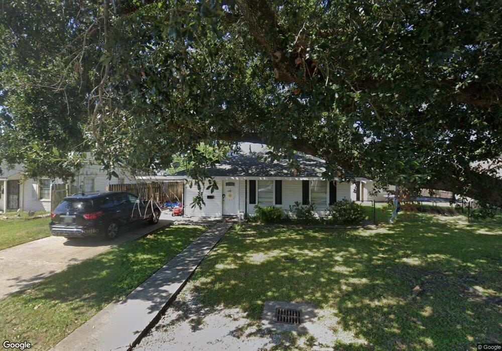
462 Roseland Pkwy Harahan, LA 70123
Estimated Value: $176,862 - $209,000
3
Beds
1
Bath
1,095
Sq Ft
$181/Sq Ft
Est. Value
About This Home
This home is located at 462 Roseland Pkwy, Harahan, LA 70123 and is currently estimated at $198,216, approximately $181 per square foot. 462 Roseland Pkwy is a home located in Jefferson Parish with nearby schools including Harahan Elementary School, Airline Park Academy For Advanced Studies, and Greenfield Middle School.
Ownership History
Date
Name
Owned For
Owner Type
Purchase Details
Closed on
Oct 22, 2009
Sold by
Residential Funding Co Llc
Bought by
Bryant Joshua
Current Estimated Value
Purchase Details
Closed on
Jul 17, 2009
Sold by
Residential Funding Co Ll
Bought by
Gmac Mtg Llc
Purchase Details
Closed on
Jan 31, 2006
Sold by
Clesi Alan J
Bought by
Fortenberry Jamie L
Home Financials for this Owner
Home Financials are based on the most recent Mortgage that was taken out on this home.
Original Mortgage
$131,200
Interest Rate
6.18%
Mortgage Type
Purchase Money Mortgage
Create a Home Valuation Report for This Property
The Home Valuation Report is an in-depth analysis detailing your home's value as well as a comparison with similar homes in the area
Home Values in the Area
Average Home Value in this Area
Purchase History
| Date | Buyer | Sale Price | Title Company |
|---|---|---|---|
| Bryant Joshua | $85,000 | -- | |
| Gmac Mtg Llc | $129,000 | -- | |
| Fortenberry Jamie L | $164,000 | -- |
Source: Public Records
Mortgage History
| Date | Status | Borrower | Loan Amount |
|---|---|---|---|
| Previous Owner | Fortenberry Jamie L | $131,200 |
Source: Public Records
Tax History Compared to Growth
Tax History
| Year | Tax Paid | Tax Assessment Tax Assessment Total Assessment is a certain percentage of the fair market value that is determined by local assessors to be the total taxable value of land and additions on the property. | Land | Improvement |
|---|---|---|---|---|
| 2024 | $1,709 | $10,210 | $7,180 | $3,030 |
| 2023 | $981 | $8,670 | $5,750 | $2,920 |
| 2022 | $965 | $8,670 | $5,750 | $2,920 |
| 2021 | $904 | $8,670 | $5,750 | $2,920 |
| 2020 | $896 | $8,670 | $5,750 | $2,920 |
| 2019 | $913 | $8,670 | $4,600 | $4,070 |
| 2018 | $575 | $8,670 | $4,600 | $4,070 |
| 2017 | $773 | $8,670 | $4,600 | $4,070 |
| 2016 | $770 | $8,670 | $4,600 | $4,070 |
| 2015 | $569 | $8,500 | $3,680 | $4,820 |
| 2014 | $569 | $8,500 | $3,680 | $4,820 |
Source: Public Records
Map
Nearby Homes
- 471 Roseland Pkwy
- 447 Roseland Pkwy
- 509 Kenmore Dr
- 7501 Wilson St
- 420 Roseland Pkwy
- 551 Grove Ave
- 439 West Ave
- 334-336 Oak Ave
- 367 Carolyn Dr
- 333 Roseland Pkwy
- 560 Oak Ave
- 350 Carolyn Dr
- 362 West Ave
- 412 Stratford Dr
- 0 Colonial Club Dr
- 98 Colonial Club Dr
- 631 Stratford Dr
- 342 Oak Ave
- 258 East Ave
- 240 Penfold Place
- 454 Roseland Pkwy
- 7212 Wilson St
- 472 Roseland Pkwy
- 446 Roseland Pkwy
- 7220 Wilson St
- 440 Roseland Pkwy
- 457 Roseland Pkwy
- 447 Soniat Ave
- 600 Roseland Pkwy
- 463 Roseland Pkwy
- 7211 Wilson St
- 453 Soniat Ave
- 477 Roseland Pkwy
- 447 Soniat St
- 436 Roseland Pkwy
- 443 Soniat Ave
- 483 Roseland Pkwy
- 437 Soniat Ave
- 437 Soniat St
- 504 Roseland Pkwy