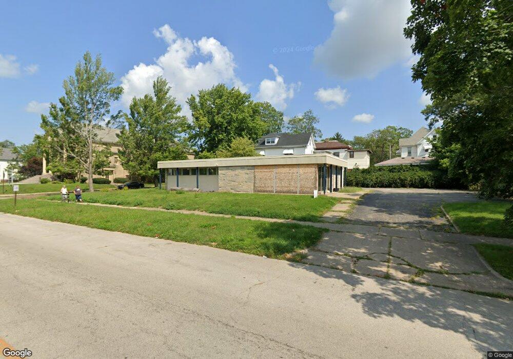
462 W William St Decatur, IL 62522
Millikin Home NeighborhoodEstimated Value: $109,797
--
Bed
--
Bath
--
Sq Ft
0.31
Acres
About This Home
This home is located at 462 W William St, Decatur, IL 62522 and is currently estimated at $109,797. 462 W William St is a home located in Macon County with nearby schools including Dennis Lab School.
Ownership History
Date
Name
Owned For
Owner Type
Purchase Details
Closed on
May 19, 2023
Sold by
462 Partners Llc
Bought by
Angels On Wheels Llc
Current Estimated Value
Purchase Details
Closed on
Dec 27, 2013
Sold by
Macon County Land Trust No 462
Bought by
462 Prtners Llc
Purchase Details
Closed on
Aug 16, 2012
Sold by
Girl Scouts Of Central Illionois
Bought by
Macon County Land Trust No 462
Home Financials for this Owner
Home Financials are based on the most recent Mortgage that was taken out on this home.
Original Mortgage
$63,000
Interest Rate
3.54%
Mortgage Type
Future Advance Clause Open End Mortgage
Create a Home Valuation Report for This Property
The Home Valuation Report is an in-depth analysis detailing your home's value as well as a comparison with similar homes in the area
Home Values in the Area
Average Home Value in this Area
Purchase History
| Date | Buyer | Sale Price | Title Company |
|---|---|---|---|
| Angels On Wheels Llc | -- | None Listed On Document | |
| 462 Prtners Llc | -- | None Available | |
| Macon County Land Trust No 462 | -- | None Available |
Source: Public Records
Mortgage History
| Date | Status | Borrower | Loan Amount |
|---|---|---|---|
| Previous Owner | Macon County Land Trust No 462 | $63,000 |
Source: Public Records
Tax History Compared to Growth
Tax History
| Year | Tax Paid | Tax Assessment Tax Assessment Total Assessment is a certain percentage of the fair market value that is determined by local assessors to be the total taxable value of land and additions on the property. | Land | Improvement |
|---|---|---|---|---|
| 2024 | $3,053 | $31,537 | $4,298 | $27,239 |
| 2023 | $3,028 | $30,421 | $4,146 | $26,275 |
| 2022 | $2,879 | $28,150 | $3,836 | $24,314 |
| 2021 | $2,705 | $26,289 | $3,583 | $22,706 |
| 2020 | $2,666 | $25,068 | $3,417 | $21,651 |
| 2019 | $2,666 | $25,068 | $3,417 | $21,651 |
| 2018 | $2,643 | $25,151 | $3,428 | $21,723 |
| 2017 | $2,705 | $25,823 | $3,520 | $22,303 |
| 2016 | $2,756 | $26,087 | $3,556 | $22,531 |
| 2015 | $2,619 | $25,626 | $3,493 | $22,133 |
| 2014 | -- | $0 | $0 | $0 |
| 2013 | -- | $0 | $0 | $0 |
Source: Public Records
Map
Nearby Homes
- 422 W William St
- 452 W Prairie Ave
- 442 W Prairie Ave
- 233 N Edward St
- 366 W Prairie Ave
- 330 W William St
- 609 W William St
- 281 W Prairie Ave
- 320 W Main St
- 254 N Pine St
- 717 W Prairie Ave Unit 2
- 875 N Monroe St
- 450 W Macon St
- 440 W Macon St
- 657 W Wood St
- 415 W Green St
- 612 W Macon St
- 135 E Prairie Ave Unit 1-4
- 844 N Edward St
- 899 W Main St
- 320 N College St
- 436 W William St
- 447 W North St
- 328 N College St
- 510 W William St
- 467 W William St
- 467 W William St Unit 467 W.William
- 340 N College St
- 437 W William St
- 445 W William St
- 250 N College St
- 250 N College St Unit 1
- 259 N College St
- 521 W William St
- 240 N College St
- 361 N College St
- 309 N Edward St
- 405 W William St
- 437 W North St
- 245 N College St