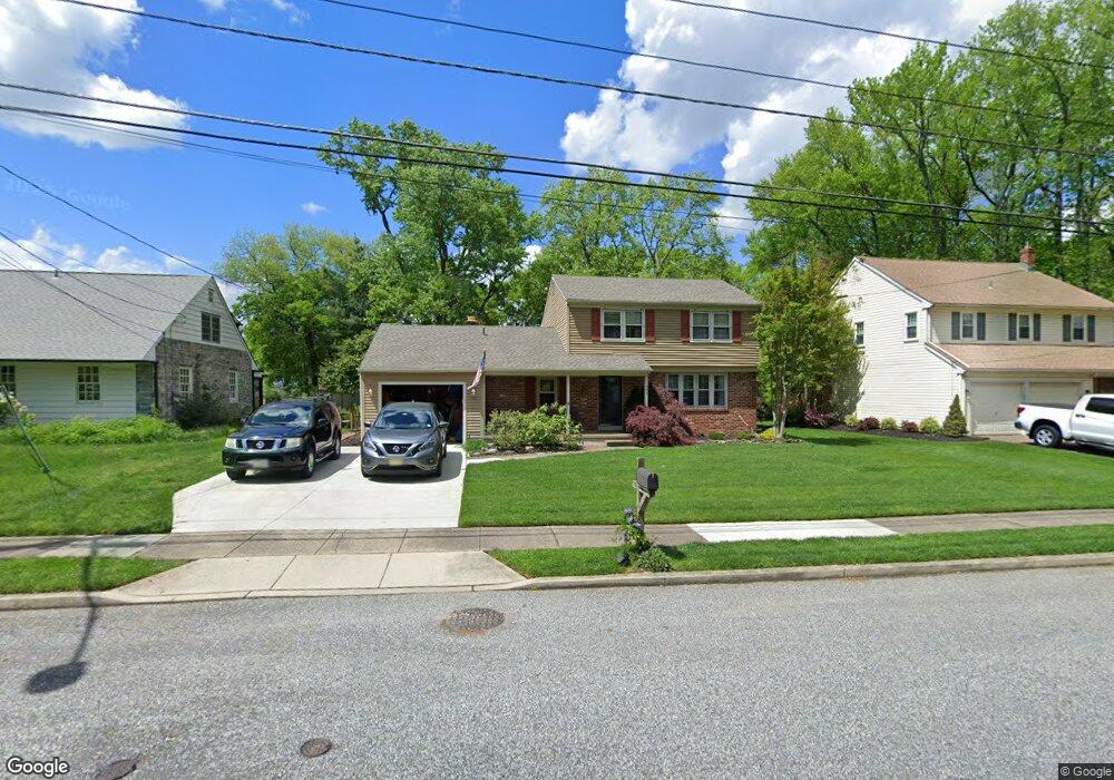
462 Westwood Dr West Deptford, NJ 08096
West Deptford Township NeighborhoodEstimated Value: $414,455 - $515,000
--
Bed
--
Bath
2,148
Sq Ft
$222/Sq Ft
Est. Value
About This Home
This home is located at 462 Westwood Dr, West Deptford, NJ 08096 and is currently estimated at $476,114, approximately $221 per square foot. 462 Westwood Dr is a home located in Gloucester County with nearby schools including Green-Fields Elementary School, Oakview Elementary School, and Red Bank Elementary School.
Ownership History
Date
Name
Owned For
Owner Type
Purchase Details
Closed on
Nov 12, 1999
Sold by
Rogers Stephen O and Rogers Linda H
Bought by
Holmstrom Edward J and Holmstrom Jill N
Current Estimated Value
Home Financials for this Owner
Home Financials are based on the most recent Mortgage that was taken out on this home.
Original Mortgage
$166,250
Outstanding Balance
$50,987
Interest Rate
7.81%
Estimated Equity
$425,127
Create a Home Valuation Report for This Property
The Home Valuation Report is an in-depth analysis detailing your home's value as well as a comparison with similar homes in the area
Home Values in the Area
Average Home Value in this Area
Purchase History
| Date | Buyer | Sale Price | Title Company |
|---|---|---|---|
| Holmstrom Edward J | $175,000 | Surety Title Corporation |
Source: Public Records
Mortgage History
| Date | Status | Borrower | Loan Amount |
|---|---|---|---|
| Open | Holmstrom Edward J | $166,250 |
Source: Public Records
Tax History Compared to Growth
Tax History
| Year | Tax Paid | Tax Assessment Tax Assessment Total Assessment is a certain percentage of the fair market value that is determined by local assessors to be the total taxable value of land and additions on the property. | Land | Improvement |
|---|---|---|---|---|
| 2025 | $8,803 | $252,100 | $70,100 | $182,000 |
| 2024 | $8,690 | $252,100 | $70,100 | $182,000 |
| 2023 | $8,690 | $252,100 | $70,100 | $182,000 |
| 2022 | $8,650 | $252,100 | $70,100 | $182,000 |
| 2021 | $8,619 | $252,100 | $70,100 | $182,000 |
| 2020 | $8,599 | $252,100 | $70,100 | $182,000 |
| 2019 | $8,360 | $252,100 | $70,100 | $182,000 |
| 2018 | $8,133 | $252,100 | $70,100 | $182,000 |
| 2017 | $7,944 | $252,100 | $70,100 | $182,000 |
| 2016 | $7,722 | $252,100 | $70,100 | $182,000 |
| 2015 | $7,356 | $252,100 | $70,100 | $182,000 |
| 2014 | $6,991 | $252,100 | $70,100 | $182,000 |
Source: Public Records
Map
Nearby Homes
- 4 Saint Emilion Ct
- 1102 Barnesdale Rd
- 1810 Fernwood Dr
- 1220 Royal Ln
- 1211 Plantation Dr
- 720 Maegus Dr
- 558 Prince St
- 80 Cedarwood Ct Unit 80
- 1204 Doncaster Ct
- 863 Doncaster Dr
- 344 S Girard St
- 438 S Columbia St
- 640 Worcester Dr
- 609 Salem Ave
- 318 S Columbia St
- 12 Highbridge Ln Unit I2
- 125 Lionheart Ln Unit C125
- 64 Tilden Rd
- 1012 Moore Rd Unit 6
- 71 Pleasant Valley Dr
- 458 Westwood Dr
- 466 Westwood Dr
- 470 Westwood Dr
- 457 Westwood Dr
- 469 Westwood Dr
- 474 Westwood Dr
- 473 Westwood Dr
- 478 Westwood Dr
- 105 Cromwell Ct
- 446 Westwood Dr
- 477 Westwood Dr
- 104 Cromwell Ct
- 1312 Barnesdale Rd
- 1314 Barnesdale Rd
- 1310 Barnesdale Rd
- 9 Saint Emilion Ct
- 1316 Barnesdale Rd
- 1308 Barnesdale Rd
- 442 Westwood Dr
- 481 Westwood Dr