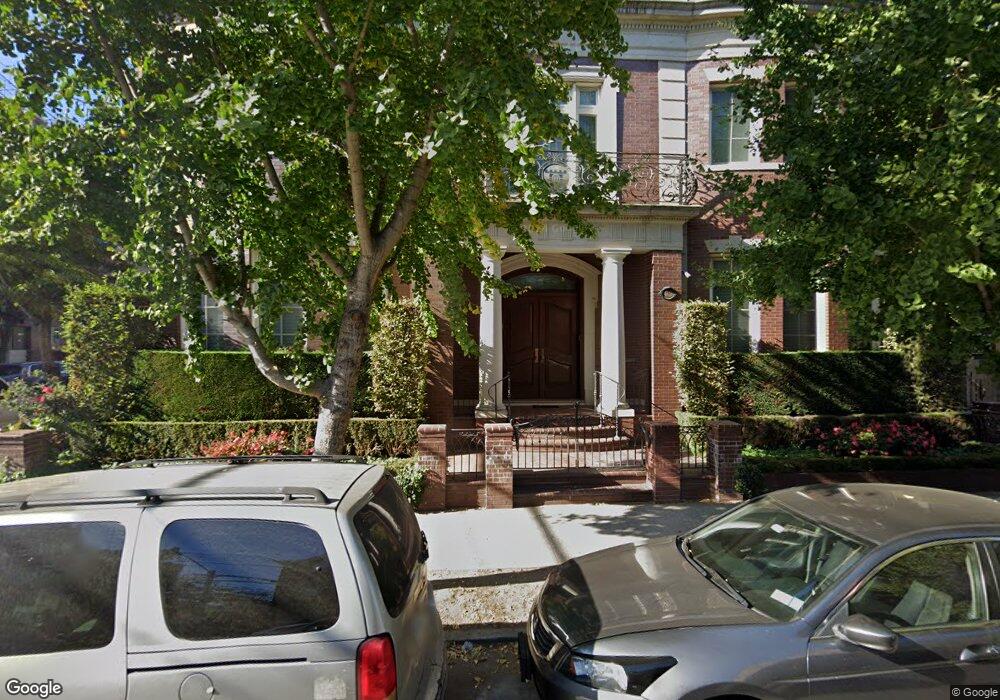
4620 12th Ave Brooklyn, NY 11219
Borough Park NeighborhoodEstimated Value: $909,000 - $1,092,000
--
Bed
--
Bath
18,792
Sq Ft
$53/Sq Ft
Est. Value
About This Home
This home is located at 4620 12th Ave, Brooklyn, NY 11219 and is currently estimated at $1,000,500, approximately $53 per square foot. 4620 12th Ave is a home located in Kings County with nearby schools including P.S. 131 Brooklyn, I.S. 223 The Montauk, and Franklin Delano Roosevelt High School.
Ownership History
Date
Name
Owned For
Owner Type
Purchase Details
Closed on
Oct 3, 2011
Sold by
Rensow Development Llc
Bought by
Rensow No 1 Condominium Association Llc
Current Estimated Value
Purchase Details
Closed on
Nov 19, 2008
Sold by
Freund Pincus
Bought by
Rensow Development Llc
Purchase Details
Closed on
Jun 3, 2001
Sold by
Freund Eva
Bought by
Freund Pincus and Stern Avrohom
Purchase Details
Closed on
Mar 8, 2001
Sold by
Freund Pincus and Freund Joseph Moshe
Bought by
Freund Pincus
Purchase Details
Closed on
Oct 5, 2000
Sold by
Freud Eva
Bought by
Freud Pincus and Freud Morris
Purchase Details
Closed on
Dec 5, 1996
Sold by
Freund Eva
Bought by
Freund Pincus and Freund Morris
Create a Home Valuation Report for This Property
The Home Valuation Report is an in-depth analysis detailing your home's value as well as a comparison with similar homes in the area
Home Values in the Area
Average Home Value in this Area
Purchase History
| Date | Buyer | Sale Price | Title Company |
|---|---|---|---|
| Rensow No 1 Condominium Association Llc | -- | -- | |
| Rensow No 1 Condominium Association Llc | -- | -- | |
| Rensow Development Llc | $3,100,000 | -- | |
| Rensow Development Llc | $3,100,000 | -- | |
| Freund Pincus | -- | -- | |
| Freund Pincus | -- | -- | |
| Freund Pincus | -- | -- | |
| Freund Pincus | -- | -- | |
| Freud Pincus | -- | -- | |
| Freud Pincus | -- | -- | |
| Freund Pincus | -- | -- | |
| Freund Pincus | -- | -- |
Source: Public Records
Tax History Compared to Growth
Tax History
| Year | Tax Paid | Tax Assessment Tax Assessment Total Assessment is a certain percentage of the fair market value that is determined by local assessors to be the total taxable value of land and additions on the property. | Land | Improvement |
|---|---|---|---|---|
| 2025 | $0 | -- | -- | -- |
| 2024 | $0 | $0 | $0 | $0 |
| 2023 | $0 | $0 | $0 | $0 |
| 2022 | $0 | $0 | $0 | $0 |
| 2021 | $0 | $0 | $0 | $0 |
| 2020 | $0 | $0 | $0 | $0 |
| 2019 | $0 | $0 | $0 | $0 |
| 2018 | $0 | $0 | $0 | $0 |
| 2017 | -- | $0 | $0 | $0 |
| 2016 | -- | $0 | $0 | $0 |
| 2015 | -- | $0 | $0 | $0 |
| 2014 | -- | $0 | $0 | $0 |
Source: Public Records
Map
Nearby Homes
- 4709 New Utrecht Ave
- 4726 New Utrecht Ave
- 4518 11th Ave
- 4409 New Utrecht Ave
- 1025 45th St Unit 4D
- 1025 45th St Unit 3F
- 1117 51st St
- 4924 13th Ave
- 4906 Fort Hamilton Pkwy
- 1115 40th St
- 1227 40th St
- 4107 New Utrecht Ave
- 4105 New Utrecht Ave
- 4103 10th Ave
- 3902 Fort Hamilton Pkwy
- 4019 10th Ave
- 982 50th St Unit 5A
- 933 45th St
- 3809 12th Ave
- 921 45th St
- 4620 12th Ave Unit B
- 4620 12th Ave Unit A
- 4612 12th Ave
- 1171 47th St
- 4610 12th Ave
- 1169 47th St
- 4608 12th Ave Unit 4610
- 4608-4610 12th Ave
- 1167 47th St
- 1180 47th St
- 4702 12th Ave
- 1178 47th St
- 1163 47th St
- 4706 12th Ave
- 1168 46th St
- 1161 47th St Unit 3
- 1161 47th St Unit 2
- 1161 47th St Unit 1
- 1161 47th St
- 1164 47th St