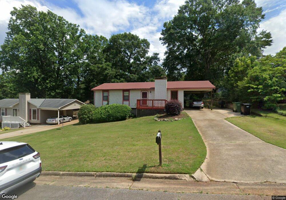
4620 Redding Ct Columbus, GA 31909
North Columbus NeighborhoodEstimated Value: $190,145 - $212,000
3
Beds
3
Baths
1,170
Sq Ft
$170/Sq Ft
Est. Value
About This Home
This home is located at 4620 Redding Ct, Columbus, GA 31909 and is currently estimated at $199,286, approximately $170 per square foot. 4620 Redding Ct is a home located in Muscogee County with nearby schools including Blanchard Elementary School, Blackmon Road Middle School, and Shaw High School.
Ownership History
Date
Name
Owned For
Owner Type
Purchase Details
Closed on
Apr 5, 2019
Sold by
Oropeza Andrew A
Bought by
Johnson Robert L and Johnson Connie L
Current Estimated Value
Purchase Details
Closed on
Aug 28, 2013
Sold by
Dew Romeo Regina
Bought by
Oporeza Andrew J
Home Financials for this Owner
Home Financials are based on the most recent Mortgage that was taken out on this home.
Original Mortgage
$95,136
Interest Rate
3.75%
Mortgage Type
FHA
Purchase Details
Closed on
Dec 14, 2007
Sold by
Holmes Catherine J
Bought by
Dew Regina
Home Financials for this Owner
Home Financials are based on the most recent Mortgage that was taken out on this home.
Original Mortgage
$103,377
Interest Rate
6.22%
Mortgage Type
FHA
Create a Home Valuation Report for This Property
The Home Valuation Report is an in-depth analysis detailing your home's value as well as a comparison with similar homes in the area
Home Values in the Area
Average Home Value in this Area
Purchase History
| Date | Buyer | Sale Price | Title Company |
|---|---|---|---|
| Johnson Robert L | $115,000 | -- | |
| Oporeza Andrew J | $101,000 | -- | |
| Dew Regina | $105,000 | None Available |
Source: Public Records
Mortgage History
| Date | Status | Borrower | Loan Amount |
|---|---|---|---|
| Previous Owner | Oporeza Andrew J | $95,136 | |
| Previous Owner | Oporeza Andrew J | $7,500 | |
| Previous Owner | Dew Regina | $103,377 |
Source: Public Records
Tax History
| Year | Tax Paid | Tax Assessment Tax Assessment Total Assessment is a certain percentage of the fair market value that is determined by local assessors to be the total taxable value of land and additions on the property. | Land | Improvement |
|---|---|---|---|---|
| 2025 | $2,697 | $68,892 | $10,024 | $58,868 |
| 2024 | $208 | $53,016 | $10,024 | $42,992 |
| 2023 | $2,088 | $53,016 | $10,024 | $42,992 |
| 2022 | $1,907 | $46,696 | $10,024 | $36,672 |
| 2021 | $1,742 | $42,668 | $10,024 | $32,644 |
| 2020 | $1,743 | $42,668 | $10,024 | $32,644 |
| 2019 | $1,108 | $42,668 | $10,024 | $32,644 |
| 2018 | $1,108 | $42,668 | $10,024 | $32,644 |
| 2017 | $1,114 | $42,668 | $10,024 | $32,644 |
| 2016 | $1,119 | $40,400 | $6,472 | $33,928 |
| 2015 | $1,121 | $40,400 | $6,472 | $33,928 |
| 2014 | $1,123 | $40,400 | $6,472 | $33,928 |
| 2013 | -- | $41,857 | $6,472 | $35,385 |
Source: Public Records
Map
Nearby Homes
- 4449 Miller
- 6629 Benson Dr
- 4627 Wimbish Ct
- 4802 Basswood Dr
- 4507 N Oaks Dr
- 6421 Lemans Ln
- 4826 Teak Dr
- 4543 Papaya Dr
- 4618 Thoroughbred Ln
- 5041 Montego Dr
- 5042 Foxfire Dr
- 5045 Old Post Rd
- 4465 Weems Rd
- 1 N Whisper Ct
- 4202 Cheshire Bridge Rd
- 6411 Michael Ave
- 4174 Will Rhoades Dr
- 6003 Morningside Dr
- 3670 Weems Rd
- 4603 Mayo Dr
- 4614 Redding Ct
- 4626 Redding Ct
- 4605 Randall Dr
- 4613 Randall Dr
- 4601 Randall Dr
- 4632 Redding Ct
- 4608 Redding Ct
- 4627 Redding Ct
- 4621 Redding Ct
- 4619 Randall Dr
- 4535 Randall Dr
- 4633 Redding Ct
- 4615 Redding Ct
- 4638 Redding Ct
- 4625 Randall Dr
- 4529 Randall Dr
- 4639 Redding Ct
- 4609 Redding Ct
- 4631 Randall Dr
- 4606 Randall Dr
Your Personal Tour Guide
Ask me questions while you tour the home.