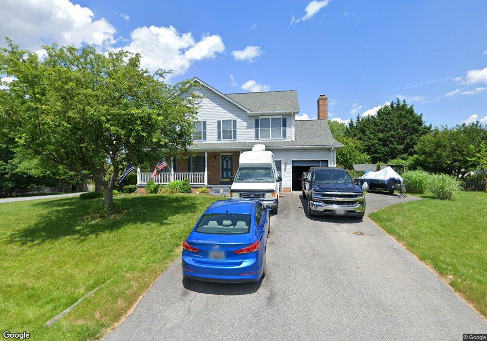
4621 Aaron Ct Jefferson, MD 21755
Estimated Value: $542,616 - $576,000
--
Bed
3
Baths
1,904
Sq Ft
$293/Sq Ft
Est. Value
About This Home
This home is located at 4621 Aaron Ct, Jefferson, MD 21755 and is currently estimated at $558,654, approximately $293 per square foot. 4621 Aaron Ct is a home located in Frederick County with nearby schools including Valley Elementary School, Brunswick Middle School, and Brunswick High School.
Ownership History
Date
Name
Owned For
Owner Type
Purchase Details
Closed on
Jun 25, 2003
Sold by
Orlik Peter J and Orlik Bianca M
Bought by
Hale Anthony and Hale Amy
Current Estimated Value
Purchase Details
Closed on
Mar 2, 2001
Sold by
Fineran Daniel Jo Ann
Bought by
Orlik Peter J and Orlik Bianca M
Purchase Details
Closed on
Mar 4, 1994
Sold by
Copperfield Lp
Bought by
Fineran Daniel
Home Financials for this Owner
Home Financials are based on the most recent Mortgage that was taken out on this home.
Original Mortgage
$184,000
Interest Rate
7.01%
Create a Home Valuation Report for This Property
The Home Valuation Report is an in-depth analysis detailing your home's value as well as a comparison with similar homes in the area
Home Values in the Area
Average Home Value in this Area
Purchase History
| Date | Buyer | Sale Price | Title Company |
|---|---|---|---|
| Hale Anthony | $294,900 | -- | |
| Orlik Peter J | -- | -- | |
| Fineran Daniel | $192,805 | -- |
Source: Public Records
Mortgage History
| Date | Status | Borrower | Loan Amount |
|---|---|---|---|
| Previous Owner | Fineran Daniel | $184,000 | |
| Closed | Hale Anthony | -- |
Source: Public Records
Tax History Compared to Growth
Tax History
| Year | Tax Paid | Tax Assessment Tax Assessment Total Assessment is a certain percentage of the fair market value that is determined by local assessors to be the total taxable value of land and additions on the property. | Land | Improvement |
|---|---|---|---|---|
| 2025 | $4,456 | $394,033 | -- | -- |
| 2024 | $4,456 | $360,700 | $102,200 | $258,500 |
| 2023 | $4,134 | $348,333 | $0 | $0 |
| 2022 | $3,990 | $335,967 | $0 | $0 |
| 2021 | $3,705 | $323,600 | $95,400 | $228,200 |
| 2020 | $3,705 | $311,400 | $0 | $0 |
| 2019 | $3,563 | $299,200 | $0 | $0 |
| 2018 | $3,452 | $287,000 | $77,800 | $209,200 |
| 2017 | $3,292 | $287,000 | $0 | $0 |
| 2016 | $3,154 | $264,667 | $0 | $0 |
| 2015 | $3,154 | $253,500 | $0 | $0 |
| 2014 | $3,154 | $253,500 | $0 | $0 |
Source: Public Records
Map
Nearby Homes
- 3390 Westport Dr
- 3343 Brockton Dr
- 3620 Carswell Place
- 3801 Brook Dr
- 4211 Spring View Ct
- 4144 Lander Road Lander Rd
- 4144A Lander Rd
- 3805 Brook Dr
- 3805 Bedford Dr
- 2640 Jefferson Pike
- 4810 Camden Place S
- 3901 Shadywood Ct
- 4147 Lander Rd
- 4804 Bennington Place E
- 4414 Mountville Rd
- Lot 2 Sumantown Rd
- Lot 1 Sumantown Rd
- 5400 Woodlyn Ct
- 2834 E Boss Arnold Rd
- 3105 Sumantown Rd
- 3315 Westport Dr
- 2106 Ports Cir
- 4615 Aaron Ct
- 3310 Brockton Dr
- 4618 Aaron Ct
- 3325 Westport Dr
- 4614 Aaron Ct
- 4622 Aaron Ct
- 3314 Brockton Dr
- 3302 Brockton Dr
- 4697 Newington Rd
- 4633 Aaron Ct
- 3335 Westport Dr
- 4626 Aaron Ct
- 3318 Brockton Dr
- 4693 Newington Rd
- 3309 Brockton Dr
- 4615 Newington Rd
- 4611 Newington Rd
- 3313 Brockton Dr