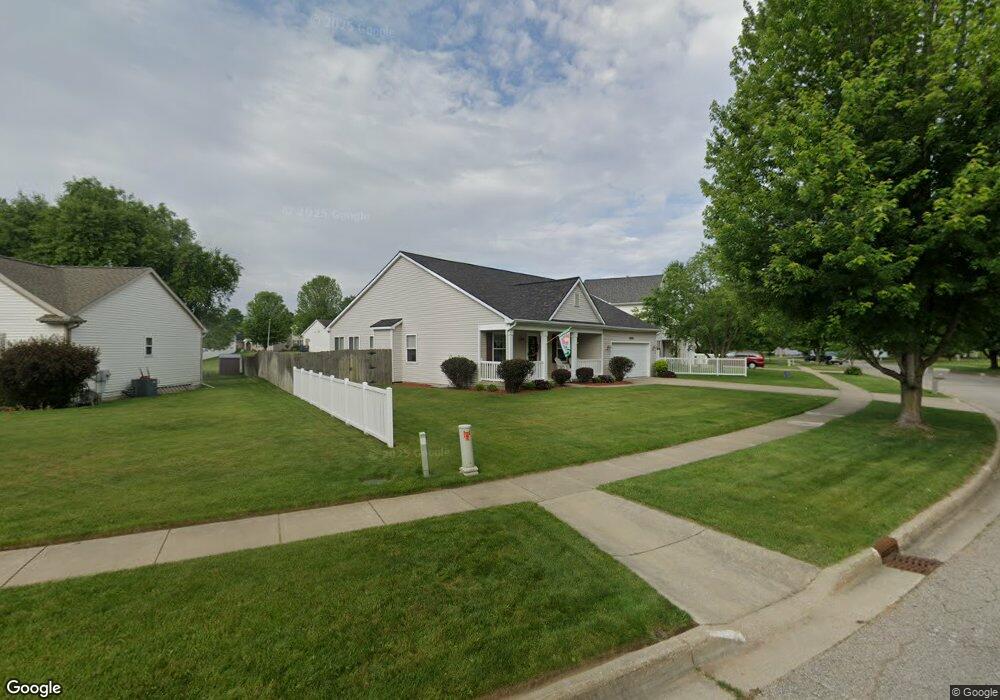
4621 Geneva Ave Portage, MI 49024
Estimated Value: $336,000 - $384,234
--
Bed
1
Bath
1,664
Sq Ft
$218/Sq Ft
Est. Value
About This Home
This home is located at 4621 Geneva Ave, Portage, MI 49024 and is currently estimated at $362,559, approximately $217 per square foot. 4621 Geneva Ave is a home located in Kalamazoo County with nearby schools including 12th Street Elementary School, Portage West Middle School, and Portage Central High School.
Ownership History
Date
Name
Owned For
Owner Type
Purchase Details
Closed on
Jan 10, 2019
Sold by
Warner Marcia A and Warner Robert L
Bought by
Warner Marcia A and Marcia A Warner Trust No 1
Current Estimated Value
Purchase Details
Closed on
Aug 13, 2004
Sold by
Aeg Development Llc
Bought by
Warner Robert L and Warner Marcia A
Home Financials for this Owner
Home Financials are based on the most recent Mortgage that was taken out on this home.
Original Mortgage
$32,900
Outstanding Balance
$16,423
Interest Rate
6.1%
Mortgage Type
Stand Alone First
Estimated Equity
$346,136
Create a Home Valuation Report for This Property
The Home Valuation Report is an in-depth analysis detailing your home's value as well as a comparison with similar homes in the area
Home Values in the Area
Average Home Value in this Area
Purchase History
| Date | Buyer | Sale Price | Title Company |
|---|---|---|---|
| Warner Marcia A | -- | None Available | |
| Warner Robert L | $34,900 | Metro |
Source: Public Records
Mortgage History
| Date | Status | Borrower | Loan Amount |
|---|---|---|---|
| Open | Warner Robert L | $32,900 | |
| Closed | Warner Robert L | $157,970 |
Source: Public Records
Tax History Compared to Growth
Tax History
| Year | Tax Paid | Tax Assessment Tax Assessment Total Assessment is a certain percentage of the fair market value that is determined by local assessors to be the total taxable value of land and additions on the property. | Land | Improvement |
|---|---|---|---|---|
| 2025 | $5,274 | $207,400 | $0 | $0 |
| 2024 | $4,643 | $196,000 | $0 | $0 |
| 2023 | $4,425 | $160,400 | $0 | $0 |
| 2022 | $4,782 | $154,200 | $0 | $0 |
| 2021 | $4,621 | $148,800 | $0 | $0 |
| 2020 | $4,521 | $136,700 | $0 | $0 |
| 2019 | $407 | $133,200 | $0 | $0 |
| 2018 | $0 | $124,400 | $0 | $0 |
| 2017 | $0 | $119,500 | $0 | $0 |
| 2016 | -- | $111,100 | $0 | $0 |
| 2015 | -- | $103,700 | $0 | $0 |
| 2014 | -- | $95,100 | $0 | $0 |
Source: Public Records
Map
Nearby Homes
- 4788 Norfolk Cir
- 6794 Brickleton Ct
- 3737 Bellflower Dr
- 5464 Cypress Bay Dr
- 5189 Queen Victoria Ln
- 3653 Tartan Cir
- 7873 Shepherds Glen Ct
- 6787 Tiger Lily Dr Unit 55
- 3638 Bellflower Dr
- 7296 Annandale Dr
- 7236 Hampstead Ln Unit 18
- 6971 Annandale Dr
- 7175 Hopkinton Dr
- 7951 S 12th St
- 6782 Southwind St Unit 68
- 7566 Cobblewood Dr
- 5103 Brinson Ln
- 5207 Brinson Ln
- 5122 Brinson Ln
- 5102 Brinson Ln
- 4651 Geneva Ave
- 7294 Milan Dr
- 7320 Milan Dr
- 4687 Geneva Ave
- 7311 Salerno Cir
- 7325 Salerno Cir
- 4634 Geneva Ave
- 4610 Geneva Ave
- 4660 Geneva Ave
- 7336 Milan Dr
- 4715 Geneva Ave
- 7310 Salerno Cir
- 7295 Milan Dr
- 7281 Provence Dr
- 7341 Salerno Cir
- 7348 Milan Dr
- 7311 Milan Dr
- 4741 Geneva Ave
- 4633 Connolly Ln
- 4659 Connolly Ln