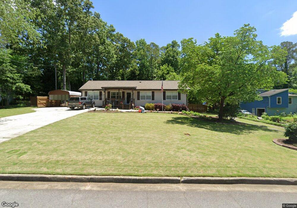
4622 Patrick Dr NE Unit 1 Kennesaw, GA 30144
Sandy Plains NeighborhoodEstimated Value: $330,809 - $383,000
2
Beds
2
Baths
1,719
Sq Ft
$205/Sq Ft
Est. Value
About This Home
This home is located at 4622 Patrick Dr NE Unit 1, Kennesaw, GA 30144 and is currently estimated at $352,202, approximately $204 per square foot. 4622 Patrick Dr NE Unit 1 is a home located in Cobb County with nearby schools including Nicholson Elementary School, McCleskey Middle School, and Kell High School.
Ownership History
Date
Name
Owned For
Owner Type
Purchase Details
Closed on
Feb 22, 2021
Sold by
Spicer Sharon Kay
Bought by
Spicer Sharon Kay and Nichols Patricia Ann
Current Estimated Value
Home Financials for this Owner
Home Financials are based on the most recent Mortgage that was taken out on this home.
Original Mortgage
$119,394
Interest Rate
2.9%
Mortgage Type
VA
Purchase Details
Closed on
Nov 20, 2017
Sold by
Nichols Patricia
Bought by
Spicer Sharon Kay
Home Financials for this Owner
Home Financials are based on the most recent Mortgage that was taken out on this home.
Original Mortgage
$127,687
Interest Rate
3.88%
Mortgage Type
VA
Purchase Details
Closed on
Jan 27, 1997
Sold by
Austic Victor Cindy Lou
Bought by
Nichols Pat
Create a Home Valuation Report for This Property
The Home Valuation Report is an in-depth analysis detailing your home's value as well as a comparison with similar homes in the area
Home Values in the Area
Average Home Value in this Area
Purchase History
| Date | Buyer | Sale Price | Title Company |
|---|---|---|---|
| Spicer Sharon Kay | -- | Amrock Inc | |
| Spicer Sharon Kay | -- | None Listed On Document | |
| Spicer Sharon Kay | -- | -- | |
| Nichols Pat | $69,900 | -- |
Source: Public Records
Mortgage History
| Date | Status | Borrower | Loan Amount |
|---|---|---|---|
| Previous Owner | Spicer Sharon Kay | $119,394 | |
| Previous Owner | Spicer Sharon Kay | $127,687 | |
| Closed | Nichols Pat | $0 |
Source: Public Records
Tax History Compared to Growth
Tax History
| Year | Tax Paid | Tax Assessment Tax Assessment Total Assessment is a certain percentage of the fair market value that is determined by local assessors to be the total taxable value of land and additions on the property. | Land | Improvement |
|---|---|---|---|---|
| 2024 | $567 | $127,084 | $26,000 | $101,084 |
| 2023 | $264 | $94,424 | $22,000 | $72,424 |
| 2022 | $453 | $88,900 | $18,000 | $70,900 |
| 2021 | $423 | $78,924 | $14,000 | $64,924 |
| 2020 | $357 | $56,672 | $8,000 | $48,672 |
| 2019 | $357 | $56,672 | $8,000 | $48,672 |
| 2018 | $319 | $44,000 | $8,000 | $36,000 |
| 2017 | $286 | $44,000 | $8,000 | $36,000 |
| 2016 | $296 | $46,572 | $6,000 | $40,572 |
| 2015 | $751 | $35,024 | $6,000 | $29,024 |
| 2014 | $757 | $35,024 | $0 | $0 |
Source: Public Records
Map
Nearby Homes
- 4704 Lincoln Dr NE
- The Gavin E Plan at The Village at Shallowford - Signature Series
- The Marion A Plan at The Village at Shallowford - Classic Series
- The Cary A Plan at The Village at Shallowford - Classic Series
- 4669 Blue Topaz Trail
- 707 Smokey Quartz Way
- 710 Smokey Quartz Way
- 694 Smokey Quartz Way
- 4785 Moonstone NE
- 703 Smokey Quartz Way
- 706 Smokey Quartz Way
- 702 Smokey Quartz Way
- 4778 Moonstone NE
- 639 Tigers Eye Terrace
- 4785 Moonstone Trace
- 4632 Patrick Dr NE
- 4554 Patrick Dr NE
- 4590 Battle Ct NE
- 4627 Patrick Dr NE
- 4617 Patrick Dr NE
- 4642 Patrick Dr NE
- 4604 Battle Ct NE
- 4544 Patrick Dr NE
- 4637 Patrick Dr NE
- 4553 Patrick Dr NE
- 641 Glenmar Ct NE
- 4652 Patrick Dr NE
- 0 Patrick Dr Unit 7014623
- 0 Patrick Dr Unit 7194226
- 0 Patrick Dr Unit 7131876
- 0 Patrick Dr Unit 7123618
- 0 Patrick Dr Unit 7014591
- 0 Patrick Dr
- 0 Battle Ct NE Unit 8364797
- 0 Battle Ct NE