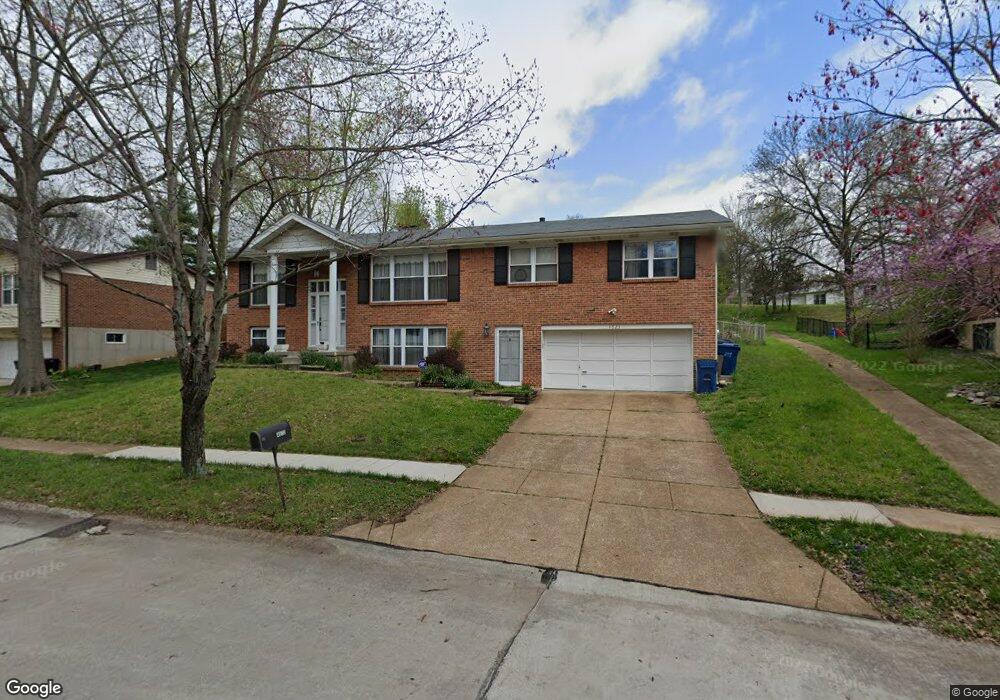
4623 Longspur Dr Saint Louis, MO 63128
Estimated Value: $392,000 - $462,000
3
Beds
3
Baths
2,770
Sq Ft
$152/Sq Ft
Est. Value
About This Home
This home is located at 4623 Longspur Dr, Saint Louis, MO 63128 and is currently estimated at $421,860, approximately $152 per square foot. 4623 Longspur Dr is a home located in St. Louis County with nearby schools including Kennerly Elementary School, Sperreng Middle School, and Lindbergh High School.
Ownership History
Date
Name
Owned For
Owner Type
Purchase Details
Closed on
May 4, 2018
Sold by
Calltagirone April P and Mathews April P
Bought by
Caltagirone Michael P
Current Estimated Value
Home Financials for this Owner
Home Financials are based on the most recent Mortgage that was taken out on this home.
Original Mortgage
$198,136
Outstanding Balance
$170,483
Interest Rate
4.37%
Mortgage Type
FHA
Estimated Equity
$251,377
Purchase Details
Closed on
Oct 31, 2003
Sold by
Kaestner Ronald H and Kaestner Lucille M
Bought by
Caltagirone Michael P and Caltagirone April M
Home Financials for this Owner
Home Financials are based on the most recent Mortgage that was taken out on this home.
Original Mortgage
$176,500
Interest Rate
5.96%
Mortgage Type
Purchase Money Mortgage
Create a Home Valuation Report for This Property
The Home Valuation Report is an in-depth analysis detailing your home's value as well as a comparison with similar homes in the area
Home Values in the Area
Average Home Value in this Area
Purchase History
| Date | Buyer | Sale Price | Title Company |
|---|---|---|---|
| Caltagirone Michael P | -- | Orntic | |
| Caltagirone Michael P | $186,000 | Capital Title |
Source: Public Records
Mortgage History
| Date | Status | Borrower | Loan Amount |
|---|---|---|---|
| Open | Caltagirone Michael P | $198,136 | |
| Closed | Caltagirone Michael P | $176,500 |
Source: Public Records
Tax History Compared to Growth
Tax History
| Year | Tax Paid | Tax Assessment Tax Assessment Total Assessment is a certain percentage of the fair market value that is determined by local assessors to be the total taxable value of land and additions on the property. | Land | Improvement |
|---|---|---|---|---|
| 2025 | $3,929 | $64,520 | $15,390 | $49,130 |
| 2024 | $3,929 | $60,400 | $17,080 | $43,320 |
| 2023 | $3,929 | $60,400 | $17,080 | $43,320 |
| 2022 | $3,305 | $48,810 | $17,080 | $31,730 |
| 2021 | $3,188 | $48,810 | $17,080 | $31,730 |
| 2020 | $2,883 | $42,560 | $15,390 | $27,170 |
| 2019 | $2,876 | $42,560 | $15,390 | $27,170 |
| 2018 | $3,715 | $50,130 | $9,410 | $40,720 |
| 2017 | $3,675 | $50,130 | $9,410 | $40,720 |
| 2016 | $3,267 | $42,280 | $8,550 | $33,730 |
| 2015 | $3,218 | $42,280 | $8,550 | $33,730 |
| 2014 | $2,854 | $37,090 | $4,960 | $32,130 |
Source: Public Records
Map
Nearby Homes
- 4525 Eli Dr Unit D
- 4501 Eli Dr Unit I
- 4642 Theiss Rd
- 4700 Theiss Rd
- 4829 Vermilion Dr
- 4334 Arrow Tree Dr Unit L
- 4334 Arrow Tree Dr Unit J
- 4724 Tarlton Dr
- 4740 Hedgemont Dr
- 4449 Pinyon Jay Ct
- 4818 Chapel Hill Dr
- 4849 Gatesbury Dr
- 4643 Littlebury Dr
- 37 Kassebaum Ln Unit 207
- 4931 Theiss Rd
- 33 Kassebaum Ln Unit 305
- 4838 Dorsie Dr
- 4921 Kerth Rd
- 27 Kassebaum Ln Unit 202
- 27 Kassebaum Ln Unit 101
- 4629 Longspur Dr
- 4615 Longspur Dr
- 4635 Longspur Dr
- 4624 Longspur Dr
- 4616 Longspur Dr
- 4609 Longspur Dr
- 4630 Longspur Dr
- 4618 Colima Ct
- 4643 Longspur Dr
- 4444 Theiss Rd
- 4612 Theiss Rd
- 4636 Longspur Dr
- 4617 Colima Ct
- 4603 Longspur Dr
- 4620 Colima Ct
- 4651 Longspur Dr
- 4642 Longspur Dr
- 4620 Theiss Rd
- 4650 Longspur Dr
- 4621 Colima Ct