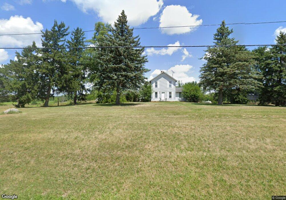
4624 Ohio 162 New London, OH 44851
Estimated Value: $272,000
4
Beds
2
Baths
1,984
Sq Ft
$137/Sq Ft
Est. Value
About This Home
This home is located at 4624 Ohio 162, New London, OH 44851 and is currently estimated at $272,000, approximately $137 per square foot. 4624 Ohio 162 is a home located in Huron County with nearby schools including New London Elementary School, New London Middle School, and New London High School.
Ownership History
Date
Name
Owned For
Owner Type
Purchase Details
Closed on
Apr 3, 2025
Sold by
Sheriff Of Huron County
Bought by
Village Capital & Investment Llc
Current Estimated Value
Purchase Details
Closed on
Oct 13, 2022
Sold by
New London Alliance Church
Bought by
Conley David Lee
Home Financials for this Owner
Home Financials are based on the most recent Mortgage that was taken out on this home.
Original Mortgage
$191,919
Interest Rate
6.02%
Purchase Details
Closed on
Dec 22, 2016
Sold by
Seifert Shirley A
Bought by
New London Alliance Church
Purchase Details
Closed on
Dec 5, 2003
Bought by
Seifert Thomas G and Seifert Shirley A
Purchase Details
Closed on
Jul 14, 1989
Bought by
Seifert Thomas G
Create a Home Valuation Report for This Property
The Home Valuation Report is an in-depth analysis detailing your home's value as well as a comparison with similar homes in the area
Home Values in the Area
Average Home Value in this Area
Purchase History
| Date | Buyer | Sale Price | Title Company |
|---|---|---|---|
| Village Capital & Investment Llc | $113,334 | None Listed On Document | |
| Conley David Lee | $190,000 | Tucker Escrow & Title Services | |
| New London Alliance Church | $130,000 | Attorney | |
| Seifert Thomas G | -- | -- | |
| Seifert Thomas G | $79,900 | -- |
Source: Public Records
Mortgage History
| Date | Status | Borrower | Loan Amount |
|---|---|---|---|
| Previous Owner | Conley David Lee | $191,919 |
Source: Public Records
Tax History Compared to Growth
Tax History
| Year | Tax Paid | Tax Assessment Tax Assessment Total Assessment is a certain percentage of the fair market value that is determined by local assessors to be the total taxable value of land and additions on the property. | Land | Improvement |
|---|---|---|---|---|
| 2024 | $2,516 | $73,390 | $34,340 | $39,050 |
| 2023 | $2,516 | $59,050 | $27,360 | $31,690 |
| 2022 | $1,465 | $59,770 | $28,080 | $31,690 |
| 2021 | $1,496 | $59,770 | $28,080 | $31,690 |
| 2020 | $1,648 | $59,600 | $28,080 | $31,520 |
| 2019 | $1,640 | $59,600 | $28,080 | $31,520 |
| 2018 | $1,603 | $59,600 | $28,080 | $31,520 |
| 2017 | $1,473 | $54,440 | $25,090 | $29,350 |
| 2016 | $1,595 | $58,700 | $25,090 | $33,610 |
| 2015 | $1,268 | $53,520 | $19,910 | $33,610 |
| 2014 | $973 | $43,140 | $15,310 | $27,830 |
| 2013 | $965 | $43,140 | $15,310 | $27,830 |
Source: Public Records
Map
Nearby Homes
- 179 W Main St
- 115 W Main St
- 152 N Main St Unit 2
- 0 Section Line Rd Unit 20253852
- 21 Cedar St
- 109 Clifton St
- 128 1st St
- 41 N Railroad St
- 34 Park Ave
- 99 S Main St
- 41 Walnut St
- 155 E Main St
- 159 E Main St
- 201 E Main St
- 3969 Town Line Road 187
- 1345 County Road 16
- 37 State Route 60
- 141 State Route 60
- 141 Ohio 60
- 2841 Ohio 162
- 4624 State Route 162 E
- 3693 Towline 187 Rd
- 4698 State Route 162 E
- 4698 Ohio 162
- 4546 State Route 162 E
- 4527 State Route 162 E
- 1971 Euclid Rd
- 4484 State Route 162 E
- 4479 State Route 162 E
- 4786 State Route 162 E
- 4785 State Route 162 E
- 4441 State Route 162 E
- 4813 State Route 162 E
- 4422 State Route 162 E
- 4851 State Route 162 E
- 2045 Euclid Rd
- 4360 State Route 162 E
- 211 W Main St
- 3327 Ohio 162
- 4626 Ohio 162