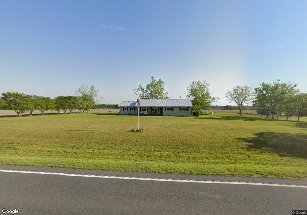
4626 Ga Highway 135 N Willacoochee, GA 31650
Estimated Value: $148,000 - $160,422
--
Bed
1
Bath
1,680
Sq Ft
$93/Sq Ft
Est. Value
About This Home
This home is located at 4626 Ga Highway 135 N, Willacoochee, GA 31650 and is currently estimated at $155,474, approximately $92 per square foot. 4626 Ga Highway 135 N is a home with nearby schools including Willacoochee Elementary School, Pearson Elementary School, and Atkinson County High School.
Ownership History
Date
Name
Owned For
Owner Type
Purchase Details
Closed on
Mar 9, 2015
Sold by
Dillingham Glenn F
Bought by
Dillingham Selena
Current Estimated Value
Purchase Details
Closed on
May 8, 2007
Sold by
Dillingham Davis Selena
Bought by
Dillingham Glenn F
Purchase Details
Closed on
Mar 16, 2007
Sold by
Davis Kirt
Bought by
Davis Selena Dillingham
Purchase Details
Closed on
Aug 5, 1999
Sold by
Dillingham Glenn F
Bought by
Davis Selena Dillingham
Purchase Details
Closed on
Jan 21, 1970
Bought by
Dillingham Glenn F
Create a Home Valuation Report for This Property
The Home Valuation Report is an in-depth analysis detailing your home's value as well as a comparison with similar homes in the area
Home Values in the Area
Average Home Value in this Area
Purchase History
| Date | Buyer | Sale Price | Title Company |
|---|---|---|---|
| Dillingham Selena | -- | -- | |
| Dillingham Glenn F | -- | -- | |
| Davis Selena Dillingham | -- | -- | |
| Davis Selena Dillingham | $56,000 | -- | |
| Dillingham Glenn F | -- | -- |
Source: Public Records
Tax History Compared to Growth
Tax History
| Year | Tax Paid | Tax Assessment Tax Assessment Total Assessment is a certain percentage of the fair market value that is determined by local assessors to be the total taxable value of land and additions on the property. | Land | Improvement |
|---|---|---|---|---|
| 2024 | $975 | $33,894 | $6,257 | $27,637 |
| 2023 | $425 | $33,894 | $6,257 | $27,637 |
| 2022 | $971 | $33,894 | $6,257 | $27,637 |
| 2021 | $1,089 | $33,894 | $6,257 | $27,637 |
| 2020 | $1,090 | $33,894 | $6,257 | $27,637 |
| 2019 | $1,090 | $33,894 | $6,257 | $27,637 |
| 2018 | $1,096 | $33,894 | $6,257 | $27,637 |
| 2017 | $1,090 | $33,894 | $6,257 | $27,637 |
| 2016 | $1,090 | $33,894 | $6,257 | $27,637 |
| 2015 | -- | $33,894 | $6,257 | $27,637 |
| 2014 | -- | $33,894 | $6,257 | $27,637 |
Source: Public Records
Map
Nearby Homes
- 132 Final Lap Ln
- 609 Main St E
- 139 Moore St N
- 684 Columbus Rd
- 2450 Paradise Ln
- 820 Main St W
- N/A Fernwood Dr
- 53 Apple Blossom Rd
- 70 Angie Dr
- 00 W Bay Meadows Dr
- 2828 Baymeadows Dr W
- 674 Forest Hills Dr
- 2987 Baymeadows Dr W
- 211 Tinsley St
- 38 Arbor Dr
- 380 Brookewood Dr
- 358 Lakeside Cir
- 40 Pinedale Dr
- 1325 Baymeadows Dr W
- 6923 Willacoochee Hwy