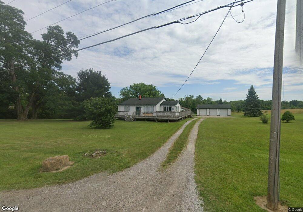
4626 Laurel Rd Brunswick, OH 44212
Estimated Value: $284,000 - $780,474
2
Beds
5
Baths
1,284
Sq Ft
$403/Sq Ft
Est. Value
About This Home
This home is located at 4626 Laurel Rd, Brunswick, OH 44212 and is currently estimated at $517,491, approximately $403 per square foot. 4626 Laurel Rd is a home located in Medina County with nearby schools including Huntington Elementary School, Willets Middle School, and Brunswick High School.
Ownership History
Date
Name
Owned For
Owner Type
Purchase Details
Closed on
Feb 22, 2008
Sold by
Ann John Barbara
Bought by
Ann John Barbara
Current Estimated Value
Home Financials for this Owner
Home Financials are based on the most recent Mortgage that was taken out on this home.
Original Mortgage
$225,000
Outstanding Balance
$139,606
Interest Rate
5.75%
Mortgage Type
Future Advance Clause Open End Mortgage
Estimated Equity
$377,885
Create a Home Valuation Report for This Property
The Home Valuation Report is an in-depth analysis detailing your home's value as well as a comparison with similar homes in the area
Home Values in the Area
Average Home Value in this Area
Purchase History
| Date | Buyer | Sale Price | Title Company |
|---|---|---|---|
| Ann John Barbara | -- | -- |
Source: Public Records
Mortgage History
| Date | Status | Borrower | Loan Amount |
|---|---|---|---|
| Open | Ann John Barbara | $225,000 |
Source: Public Records
Tax History Compared to Growth
Tax History
| Year | Tax Paid | Tax Assessment Tax Assessment Total Assessment is a certain percentage of the fair market value that is determined by local assessors to be the total taxable value of land and additions on the property. | Land | Improvement |
|---|---|---|---|---|
| 2024 | $11,390 | $198,580 | $167,660 | $30,920 |
| 2023 | $11,390 | $198,580 | $167,660 | $30,920 |
| 2022 | $10,829 | $198,580 | $167,660 | $30,920 |
| 2021 | $9,839 | $158,860 | $134,130 | $24,730 |
| 2020 | $8,954 | $158,860 | $134,130 | $24,730 |
| 2019 | $8,956 | $158,860 | $134,130 | $24,730 |
| 2018 | $8,170 | $139,400 | $115,890 | $23,510 |
| 2017 | $8,181 | $139,400 | $115,890 | $23,510 |
| 2016 | $8,239 | $139,400 | $115,890 | $23,510 |
| 2015 | $7,424 | $129,070 | $107,300 | $21,770 |
| 2014 | $7,406 | $129,070 | $107,300 | $21,770 |
| 2013 | $7,604 | $129,070 | $107,300 | $21,770 |
Source: Public Records
Map
Nearby Homes
- 4464 Newcastle Cove
- VL Laurel & Substation Rd
- 1536 Jefferson Ave
- 1591 Pearl Rd
- 1431 Roosevelt Ave
- 4200 Raymond Dr
- 1389 Mussel Shoals Dr
- 4186 Saint James Dr
- 2088 Glenmont
- 2090 Glenmont
- 2091 Glenmont
- 4408 Center Rd
- 2097 Glenmont
- ABBY TH Plan at Market Highlands
- LIBBY TH Plan at Market Highlands
- LUCAS TH Plan at Market Highlands
- 2105 Glenmont
- 2075 Glenmont
- 4104 Arlington Dr
- 4227 Sleepy Hollow Rd
- 4648 4604 Laurel Rd
- 4604 Laurel Rd
- 4604 Laurel Rd
- 4604 Laurel Rd Unit REAR
- 4604 Laurel Rd Unit REAR
- 4593 Laurel Rd
- 4575 Laurel Rd
- 4694 Laurel Rd
- 4712 Laurel Rd
- 4541 Newkirk Dr
- 4537 Newkirk Dr
- 1850 Manningford Oval
- 1848 Manningford Oval
- 1856 Manningford Oval
- 4538 Newkirk Dr
- 4535 Newkirk Dr
- 1849 Manningford Oval
- 4675 Laurel Rd
- 1860 Manningford Oval
- 4536 Newkirk Dr
