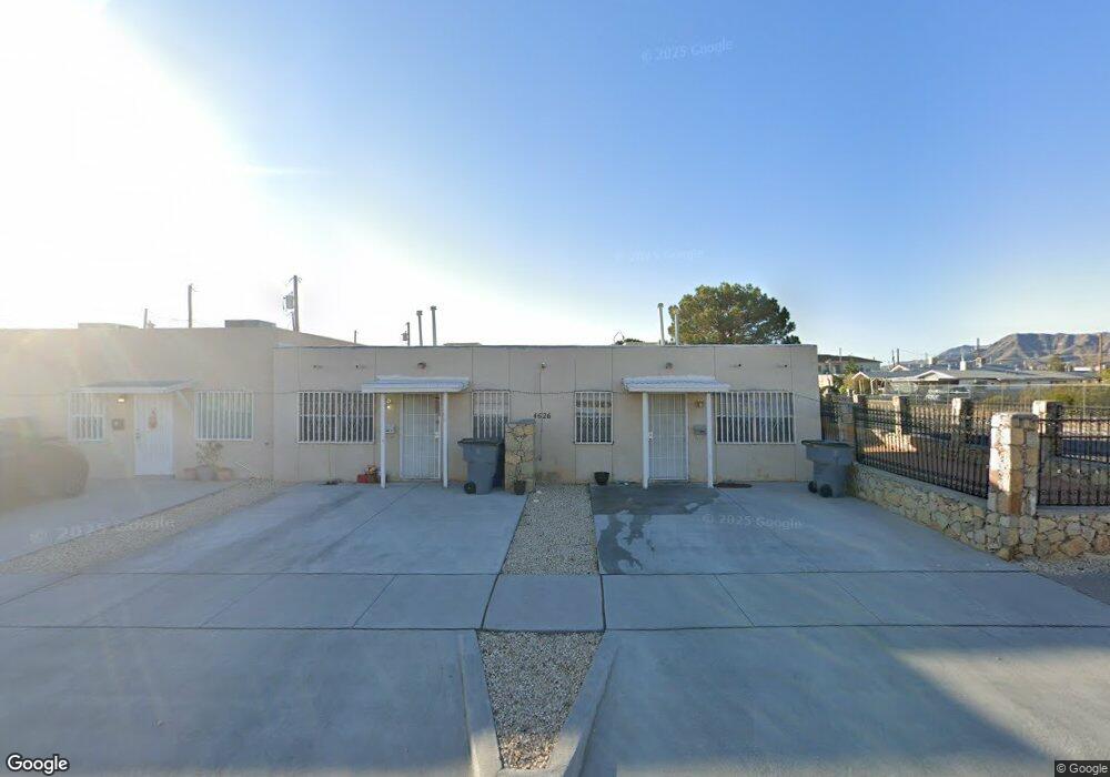
4626 Maxwell Ave Unit AB El Paso, TX 79904
Mountain View NeighborhoodEstimated Value: $260,000 - $311,000
6
Beds
4
Baths
2,678
Sq Ft
$107/Sq Ft
Est. Value
About This Home
This home is located at 4626 Maxwell Ave Unit AB, El Paso, TX 79904 and is currently estimated at $285,333, approximately $106 per square foot. 4626 Maxwell Ave Unit AB is a home located in El Paso County with nearby schools including Moye Elementary School, Canyon Hills Middle School, and Irvin High School.
Ownership History
Date
Name
Owned For
Owner Type
Purchase Details
Closed on
Jan 15, 2008
Sold by
Cg Poperties Llc
Bought by
Tuttle John Patrick
Current Estimated Value
Purchase Details
Closed on
May 16, 2005
Sold by
Jimenez Victor
Bought by
Cg Properties Llc
Home Financials for this Owner
Home Financials are based on the most recent Mortgage that was taken out on this home.
Original Mortgage
$59,000
Interest Rate
5.87%
Mortgage Type
Purchase Money Mortgage
Create a Home Valuation Report for This Property
The Home Valuation Report is an in-depth analysis detailing your home's value as well as a comparison with similar homes in the area
Home Values in the Area
Average Home Value in this Area
Purchase History
| Date | Buyer | Sale Price | Title Company |
|---|---|---|---|
| Tuttle John Patrick | -- | None Available | |
| Cg Properties Llc | -- | -- |
Source: Public Records
Mortgage History
| Date | Status | Borrower | Loan Amount |
|---|---|---|---|
| Previous Owner | Cg Properties Llc | $59,000 |
Source: Public Records
Tax History
| Year | Tax Paid | Tax Assessment Tax Assessment Total Assessment is a certain percentage of the fair market value that is determined by local assessors to be the total taxable value of land and additions on the property. | Land | Improvement |
|---|---|---|---|---|
| 2025 | $6,670 | $342,127 | $28,332 | $313,795 |
| 2024 | $6,670 | $256,964 | $28,319 | $228,645 |
| 2023 | $4,042 | $146,121 | $12,873 | $133,248 |
| 2022 | $3,614 | $122,089 | $12,873 | $109,216 |
| 2021 | $3,230 | $103,463 | $12,873 | $90,590 |
| 2020 | $2,592 | $84,345 | $12,873 | $71,472 |
| 2018 | $2,496 | $84,345 | $12,873 | $71,472 |
| 2017 | $2,336 | $82,941 | $12,873 | $70,068 |
| 2016 | $2,336 | $82,941 | $12,873 | $70,068 |
| 2015 | $2,270 | $82,941 | $12,873 | $70,068 |
| 2014 | $2,270 | $82,941 | $12,873 | $70,068 |
Source: Public Records
Map
Nearby Homes
- 9020 Norton St
- 8920 Kenneth St
- 4605 Arlen Ave
- 8715 Lawson St
- 4930 Mcgregor Dr
- 4713 Gt Powers Dr
- 4801 Chisos Ln
- 8811 Neptune St
- 4543 Croton Cir
- 4943 Aiken Ln
- 4728 Sierra Madre Dr
- 4733 Tetons Dr
- 8809 Mercury St Unit A&B
- 8440 Dyer St
- 9400 Stonewall Rd
- 4505 Sky Hawk Ave
- 4951 Rutherford Dr
- 8730 Leo St
- 4520 R T Cassidy Dr
- 5025 Mount Vernon Ct
- 4626 Maxwell Ave Unit D
- 4626 Maxwell Ave Unit C
- 4626 Maxwell Ave Unit B
- 4626 Maxwell Ave Unit A
- 8968 Robert Dr
- 8968 Roberts
- 8969 Robert Dr
- 8961 Herbert St
- 8961 Herbert St Unit 1-32
- 8952 Robert Dr Unit 8954
- 8961 Robert Dr
- 8957 Herbert St
- 8957 Robert Dr
- 8953 Herbert St Unit 4
- 8953 Herbert St Unit 1
- 8953 Herbert St Unit 3
- 8953 Herbert St
- 8948 Robert Dr Unit 8950
- 8949 Robert Dr
- 8949 Herbert St Unit 2
Your Personal Tour Guide
Ask me questions while you tour the home.