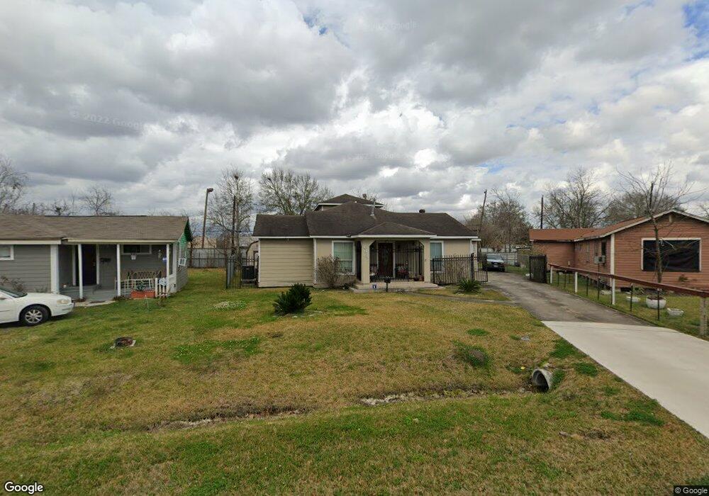
4627 Kingsbury St Houston, TX 77021
OST-South Union NeighborhoodEstimated Value: $282,000 - $339,000
4
Beds
2
Baths
2,120
Sq Ft
$142/Sq Ft
Est. Value
About This Home
This home is located at 4627 Kingsbury St, Houston, TX 77021 and is currently estimated at $301,805, approximately $142 per square foot. 4627 Kingsbury St is a home located in Harris County with nearby schools including Peck Elementary School, Cullen Middle School, and Yates High School.
Ownership History
Date
Name
Owned For
Owner Type
Purchase Details
Closed on
Jun 28, 2005
Sold by
Dunham Jeffrey Edward
Bought by
Hill Holton and Brannon Sherrell
Current Estimated Value
Purchase Details
Closed on
Jun 20, 1997
Sold by
Nelson David Charles
Bought by
Hill Holton and Brannon Sherrell
Home Financials for this Owner
Home Financials are based on the most recent Mortgage that was taken out on this home.
Original Mortgage
$23,000
Interest Rate
7.85%
Mortgage Type
Seller Take Back
Create a Home Valuation Report for This Property
The Home Valuation Report is an in-depth analysis detailing your home's value as well as a comparison with similar homes in the area
Home Values in the Area
Average Home Value in this Area
Purchase History
| Date | Buyer | Sale Price | Title Company |
|---|---|---|---|
| Hill Holton | -- | -- | |
| Hill Holton | -- | -- |
Source: Public Records
Mortgage History
| Date | Status | Borrower | Loan Amount |
|---|---|---|---|
| Previous Owner | Hill Holton | $23,000 |
Source: Public Records
Tax History Compared to Growth
Tax History
| Year | Tax Paid | Tax Assessment Tax Assessment Total Assessment is a certain percentage of the fair market value that is determined by local assessors to be the total taxable value of land and additions on the property. | Land | Improvement |
|---|---|---|---|---|
| 2025 | $3,261 | $273,644 | $139,094 | $134,550 |
| 2024 | $3,261 | $273,644 | $139,094 | $134,550 |
| 2023 | $3,261 | $277,945 | $126,821 | $151,124 |
| 2022 | $4,481 | $256,157 | $114,548 | $141,609 |
| 2021 | $4,957 | $212,665 | $69,547 | $143,118 |
| 2020 | $4,331 | $178,835 | $45,001 | $133,834 |
| 2019 | $4,461 | $176,297 | $45,001 | $131,296 |
| 2018 | $2,239 | $88,471 | $36,819 | $51,652 |
| 2017 | $2,237 | $88,471 | $36,819 | $51,652 |
| 2016 | $2,237 | $88,471 | $36,819 | $51,652 |
| 2015 | $1,139 | $88,471 | $36,819 | $51,652 |
| 2014 | $1,139 | $50,000 | $20,455 | $29,545 |
Source: Public Records
Map
Nearby Homes
- 6014 Grace Ln Unit A/B
- 6109 Grace Ln
- 4624 Kingsbury St
- 5902 Grace Ln
- 5831 Grace Ln
- 5822 Grace Ln
- 4613 Dewberry St
- 4603 Keystone St
- 4604 Keystone St
- 0 Perry St
- 4523 Keystone St
- 4522 Dixie Dr
- 4910 Eppes St
- 5023 Cosby St
- 6919 Calhoun Rd
- 4611 Dewberry St
- 6302 Calhoun Rd
- 6309 Calhoun Rd
- 4522 Dewberry St
- 3917, 3919 Griggs Rd
- 4625 Kingsbury St
- 6105 Wayland St
- 6109 Wayland St
- 4626 Kingsbury St
- 6020 Grace Ln
- 6024 Grace Ln
- 4621 Kingsbury St
- 6014 Grace Ln
- 6030 Grace Ln
- 6113 Wayland St
- 4622 Kingsbury St
- 6012 Grace Ln
- 4619 Kingsbury St
- 6032 Grace Ln
- 4627 Keystone St
- 4620 Kingsbury St
- 6004 Grace Ln
- 4625 Keystone St
- 4617 Kingsbury St
- 6121 Wayland St