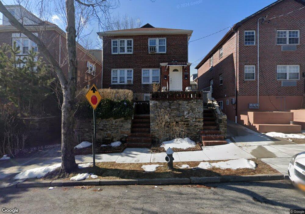
4627 Murdock Ave Bronx, NY 10466
Wakefield NeighborhoodEstimated Value: $866,000 - $996,000
--
Bed
--
Bath
3,120
Sq Ft
$303/Sq Ft
Est. Value
About This Home
This home is located at 4627 Murdock Ave, Bronx, NY 10466 and is currently estimated at $944,333, approximately $302 per square foot. 4627 Murdock Ave is a home located in Bronx County with nearby schools including P.S. 68 - Bronx, One World Middle School At Edenwald, and Baychester Middle School.
Ownership History
Date
Name
Owned For
Owner Type
Purchase Details
Closed on
Sep 23, 1994
Sold by
Robinson Carol
Bought by
Robinson Lambert G
Current Estimated Value
Home Financials for this Owner
Home Financials are based on the most recent Mortgage that was taken out on this home.
Original Mortgage
$153,375
Interest Rate
8.81%
Mortgage Type
FHA
Create a Home Valuation Report for This Property
The Home Valuation Report is an in-depth analysis detailing your home's value as well as a comparison with similar homes in the area
Home Values in the Area
Average Home Value in this Area
Purchase History
| Date | Buyer | Sale Price | Title Company |
|---|---|---|---|
| Robinson Lambert G | -- | Commonwealth Land Title Ins | |
| Robinson Lambert G | -- | Commonwealth Land Title Ins |
Source: Public Records
Mortgage History
| Date | Status | Borrower | Loan Amount |
|---|---|---|---|
| Closed | Robinson Lambert G | $153,375 |
Source: Public Records
Tax History Compared to Growth
Tax History
| Year | Tax Paid | Tax Assessment Tax Assessment Total Assessment is a certain percentage of the fair market value that is determined by local assessors to be the total taxable value of land and additions on the property. | Land | Improvement |
|---|---|---|---|---|
| 2025 | $7,406 | $38,275 | $7,098 | $31,177 |
| 2024 | $7,406 | $38,275 | $6,617 | $31,658 |
| 2023 | $7,430 | $37,986 | $6,837 | $31,149 |
| 2022 | $6,867 | $45,480 | $9,180 | $36,300 |
| 2021 | $6,812 | $39,360 | $9,180 | $30,180 |
| 2020 | $6,455 | $42,540 | $9,180 | $33,360 |
| 2019 | $6,379 | $42,600 | $9,180 | $33,420 |
| 2018 | $6,155 | $31,655 | $7,875 | $23,780 |
| 2017 | $5,788 | $29,864 | $7,073 | $22,791 |
| 2016 | $5,322 | $28,174 | $8,133 | $20,041 |
| 2015 | $3,566 | $26,580 | $10,200 | $16,380 |
| 2014 | $3,566 | $26,580 | $10,200 | $16,380 |
Source: Public Records
Map
Nearby Homes
- 4528 Wilder Ave
- 820 Penfield St
- 4525 Monticello Ave
- 807 E 242nd St
- 148 S 13th Ave
- 137 S 14th Ave
- 999 E 241st St
- 4519 Seton Ave
- 4450 Hill Ave
- 719 E 242nd St
- 4740 White Plains Rd
- 109 Vista Place
- 4425 Wilder Ave
- 225 S 11th Ave
- 109 S 12th Ave
- 258 S 10th Ave
- 4406 Murdock Ave
- 4749 Richardson Ave
- 4439 Mundy Ln
- 679 E 241st St
- 4631 Murdock Ave
- 4611 Murdock Ave
- 4611 Murdock Ave Unit 1F
- 4633 Murdock Ave
- 4618 Wilder Ave
- 4614 Wilder Ave
- 4610 Wilder Ave
- 861 Cranford Ave
- 4620 Wilder Ave
- 4601 Murdock Ave
- 859 Cranford Ave
- 4635 Murdock Ave
- 4622 Wilder Ave
- 857 Cranford Ave
- 855 Cranford Ave
- 4624 Wilder Ave
- 4614 Murdock Ave
- 4612 Murdock Ave
- 873 Cranford Ave
- 853 Cranford Ave