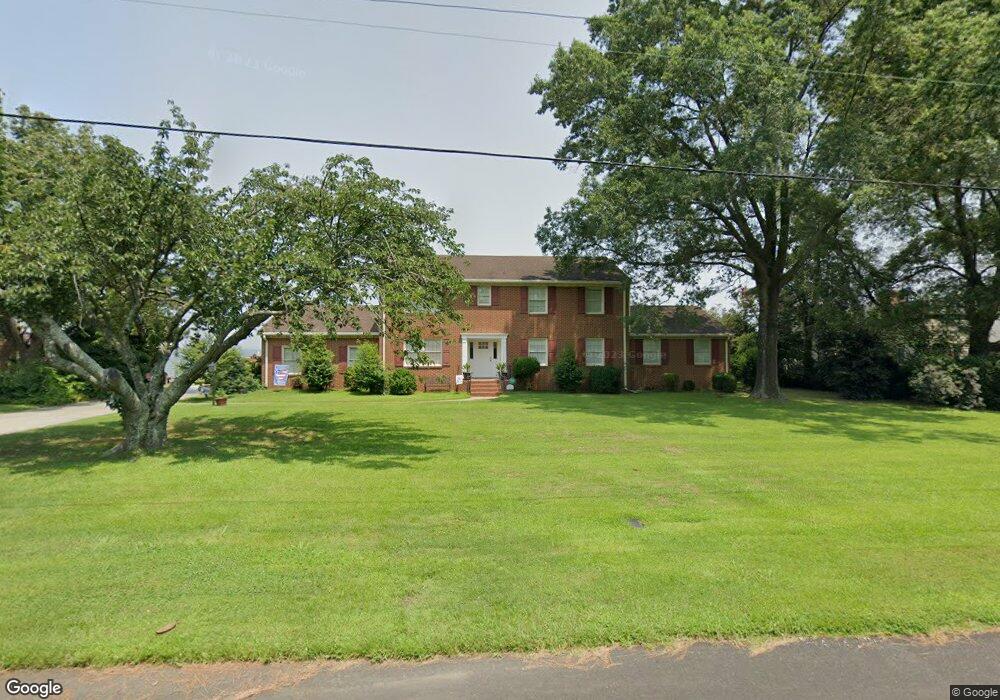
4627 River Shore Rd Portsmouth, VA 23703
Churchland NeighborhoodEstimated Value: $653,000 - $765,000
--
Bed
1
Bath
3,712
Sq Ft
$189/Sq Ft
Est. Value
About This Home
This home is located at 4627 River Shore Rd, Portsmouth, VA 23703 and is currently estimated at $701,826, approximately $189 per square foot. 4627 River Shore Rd is a home located in Portsmouth City with nearby schools including Churchland Primary/Intermediate School, Churchland Middle School, and Churchland High School.
Ownership History
Date
Name
Owned For
Owner Type
Purchase Details
Closed on
Sep 27, 2010
Sold by
Comer Tr John C and Sara G Comer Descendants Trust
Bought by
Bartell Lawrence L
Current Estimated Value
Home Financials for this Owner
Home Financials are based on the most recent Mortgage that was taken out on this home.
Original Mortgage
$373,600
Outstanding Balance
$245,733
Interest Rate
4.44%
Mortgage Type
New Conventional
Estimated Equity
$456,093
Create a Home Valuation Report for This Property
The Home Valuation Report is an in-depth analysis detailing your home's value as well as a comparison with similar homes in the area
Home Values in the Area
Average Home Value in this Area
Purchase History
| Date | Buyer | Sale Price | Title Company |
|---|---|---|---|
| Bartell Lawrence L | $467,000 | -- |
Source: Public Records
Mortgage History
| Date | Status | Borrower | Loan Amount |
|---|---|---|---|
| Open | Bartell Lawrence L | $373,600 |
Source: Public Records
Tax History Compared to Growth
Tax History
| Year | Tax Paid | Tax Assessment Tax Assessment Total Assessment is a certain percentage of the fair market value that is determined by local assessors to be the total taxable value of land and additions on the property. | Land | Improvement |
|---|---|---|---|---|
| 2025 | $8,091 | $647,340 | $246,890 | $400,450 |
| 2024 | $8,091 | $643,880 | $246,890 | $396,990 |
| 2023 | $7,703 | $616,210 | $246,890 | $369,320 |
| 2022 | $8,294 | $638,010 | $244,480 | $393,530 |
| 2021 | $7,885 | $606,510 | $233,740 | $372,770 |
| 2020 | $7,740 | $595,380 | $222,610 | $372,770 |
| 2019 | $7,650 | $588,470 | $222,610 | $365,860 |
| 2018 | $7,470 | $574,630 | $222,610 | $352,020 |
| 2017 | $7,442 | $572,480 | $222,610 | $349,870 |
| 2016 | $7,442 | $572,480 | $222,610 | $349,870 |
| 2015 | $7,442 | $572,480 | $222,610 | $349,870 |
| 2014 | $7,270 | $572,480 | $222,610 | $349,870 |
Source: Public Records
Map
Nearby Homes
- 4619 River Shore Rd
- 4444 Southampton Arch
- 4726 River Shore Rd
- 21 Windy Pines Crescent
- 5833 Hawthorne Ln
- 5728 Hawthorne Ln
- 5693 Rivermill Cir
- 4224 Burnham Dr
- 4232 Summerset Dr
- 5606 Gregory Ct
- 6750 Burbage Landing Cir
- 8 Compass Ct
- 4200 Quince Rd
- 6602 James Point Ct
- 5028 Bay Cir
- 4071 Long Point Blvd
- 17 Shoal Ct
- 4028 Swannanoa Dr
- 4100 Mayfair Way
- 6832 Ivanhoe Ct
- 4623 River Shore Rd
- 4631 River Shore Rd
- 4624 River Shore Rd
- 4622 River Shore Rd
- 4630 River Shore Rd
- 4635 River Shore Rd
- 4618 River Shore Rd
- 4615 River Shore Rd
- 4634 River Shore Rd
- 4619 Southampton Arch
- 4617 Southampton Arch
- 4621 Southampton Arch
- 4615 Southampton Arch
- 4614 River Shore Rd
- 4639 River Shore Rd
- 4623 Southampton Arch
- 4613 Southampton Arch
- 4638 River Shore Rd
- 4611 River Shore Rd
- 4625 Southampton Arch