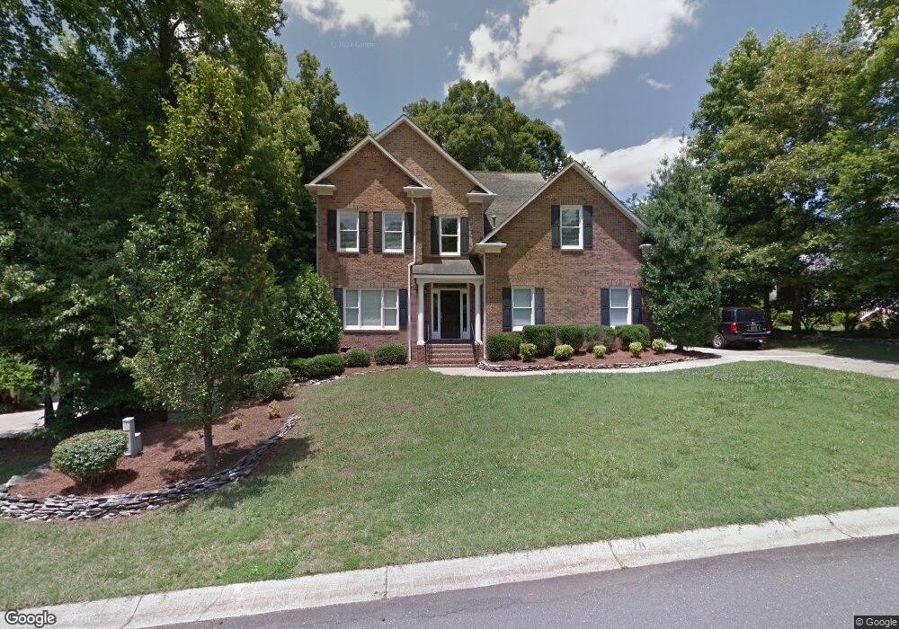
4628 Channing Park Way Rock Hill, SC 29732
Estimated Value: $487,141 - $517,000
4
Beds
3
Baths
2,360
Sq Ft
$212/Sq Ft
Est. Value
About This Home
This home is located at 4628 Channing Park Way, Rock Hill, SC 29732 and is currently estimated at $501,285, approximately $212 per square foot. 4628 Channing Park Way is a home located in York County with nearby schools including Mount Gallant Elementary School, Dutchman Creek Middle School, and Northwestern High School.
Ownership History
Date
Name
Owned For
Owner Type
Purchase Details
Closed on
May 7, 2012
Sold by
Langston Robert C and Langston Cheryl W
Bought by
Faile Mark T and Faile Rebecca
Current Estimated Value
Home Financials for this Owner
Home Financials are based on the most recent Mortgage that was taken out on this home.
Original Mortgage
$212,203
Outstanding Balance
$147,094
Interest Rate
3.91%
Mortgage Type
FHA
Estimated Equity
$354,191
Purchase Details
Closed on
Jun 18, 2003
Sold by
Miller Mark A
Bought by
Langston Robert C and Langston Cheryl W
Create a Home Valuation Report for This Property
The Home Valuation Report is an in-depth analysis detailing your home's value as well as a comparison with similar homes in the area
Home Values in the Area
Average Home Value in this Area
Purchase History
| Date | Buyer | Sale Price | Title Company |
|---|---|---|---|
| Faile Mark T | $219,900 | -- | |
| Langston Robert C | $212,500 | -- |
Source: Public Records
Mortgage History
| Date | Status | Borrower | Loan Amount |
|---|---|---|---|
| Open | Faile Mark T | $212,203 |
Source: Public Records
Tax History Compared to Growth
Tax History
| Year | Tax Paid | Tax Assessment Tax Assessment Total Assessment is a certain percentage of the fair market value that is determined by local assessors to be the total taxable value of land and additions on the property. | Land | Improvement |
|---|---|---|---|---|
| 2024 | $1,302 | $9,292 | $1,366 | $7,926 |
| 2023 | $1,335 | $9,292 | $1,366 | $7,926 |
| 2022 | $1,340 | $9,292 | $1,366 | $7,926 |
| 2021 | -- | $9,292 | $1,366 | $7,926 |
| 2020 | $1,337 | $9,292 | $0 | $0 |
| 2019 | $1,218 | $8,080 | $0 | $0 |
| 2018 | $1,210 | $8,080 | $0 | $0 |
| 2017 | $1,141 | $8,080 | $0 | $0 |
| 2016 | $1,119 | $8,080 | $0 | $0 |
| 2014 | $3,989 | $8,080 | $1,600 | $6,480 |
| 2013 | $3,989 | $8,540 | $1,600 | $6,940 |
Source: Public Records
Map
Nearby Homes
- 4640 Channing Park Way
- 931 Museum Rd
- 1947 Fairhill Cir
- 1620 Enon Ct Unit 9
- 4445 Homestead Rd
- 3060 Rocket Rd
- 3056 Rocket Rd
- 1210 Aragon Beach Rd
- 4169 Thomas Sam Dr
- 217 Otman Ct
- 4222 Mount Gallant Rd
- 1367 Aragon Beach Rd
- 4026 Palmetto Dr
- 1388 Aragon Beach Rd
- 1538 Aragon Beach Rd
- 3445 Homestead Rd
- 1623 E Lakewood Dr
- 716 Millstream Dr
- 704 Millstream Dr
- 4531 Deer Run
- 4622 Channing Park Way
- 4622 Channing Park Way
- 1019 S Bank Dr
- 1019 Southbank Dr
- 4627 Channing Park Way
- 4631 Channing Park Way
- 4623 Channing Park Way
- 4635 Channing Park Way
- 4632 Channing Park Way
- 1023 S Bank Dr
- 1023 Southbank Dr
- 4613 Channing Park Way
- 4618 Channing Park Way
- 4639 Channing Park Way
- 1006 S Bank Dr
- 4704 Amberside Dr Unit 24
- 4708 Amberside Dr
- 4636 Channing Park Way
- 1027 S Bank Dr
- 4700 Amberside Dr