Estimated Value: $276,000 - $285,000
3
Beds
2
Baths
1,716
Sq Ft
$164/Sq Ft
Est. Value
About This Home
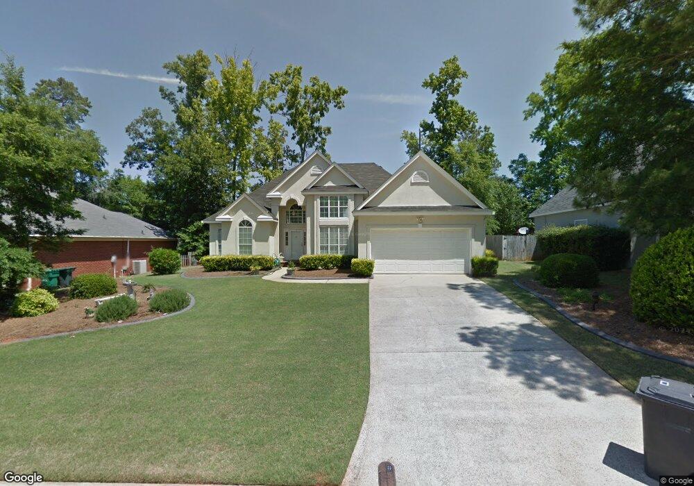
This home is located at 4629 Brittany Dr, Evans, GA 30809 and is currently estimated at $281,042, approximately $163 per square foot. 4629 Brittany Dr is a home located in Columbia County with nearby schools including Evans Elementary School, Evans Middle School, and Evans High School.
Ownership History
Date
Name
Owned For
Owner Type
Purchase Details
Closed on
May 17, 2021
Sold by
Marsh William F
Bought by
Schwark Sharon D
Current Estimated Value
Home Financials for this Owner
Home Financials are based on the most recent Mortgage that was taken out on this home.
Original Mortgage
$215,000
Outstanding Balance
$194,539
Interest Rate
3%
Mortgage Type
VA
Estimated Equity
$86,503
Create a Home Valuation Report for This Property
The Home Valuation Report is an in-depth analysis detailing your home's value as well as a comparison with similar homes in the area
Home Values in the Area
Average Home Value in this Area
Purchase History
| Date | Buyer | Sale Price | Title Company |
|---|---|---|---|
| Schwark Sharon D | $235,000 | -- | |
| Marsh William F | -- | -- |
Source: Public Records
Mortgage History
| Date | Status | Borrower | Loan Amount |
|---|---|---|---|
| Open | Schwark Sharon D | $215,000 |
Source: Public Records
Tax History
| Year | Tax Paid | Tax Assessment Tax Assessment Total Assessment is a certain percentage of the fair market value that is determined by local assessors to be the total taxable value of land and additions on the property. | Land | Improvement |
|---|---|---|---|---|
| 2025 | $2,530 | $103,645 | $20,804 | $82,841 |
| 2024 | $2,690 | $105,311 | $21,104 | $84,207 |
| 2023 | $2,690 | $94,536 | $17,604 | $76,932 |
| 2022 | $2,194 | $82,187 | $17,004 | $65,183 |
| 2021 | $652 | $67,080 | $16,204 | $50,876 |
| 2020 | $668 | $66,213 | $15,704 | $50,509 |
| 2019 | $671 | $66,477 | $13,704 | $52,773 |
| 2018 | $664 | $65,098 | $14,104 | $50,994 |
| 2017 | $647 | $62,656 | $13,504 | $49,152 |
| 2016 | $560 | $59,880 | $13,380 | $46,500 |
| 2015 | $547 | $58,407 | $12,880 | $45,527 |
| 2014 | $526 | $53,938 | $13,380 | $40,558 |
Source: Public Records
Map
Nearby Homes
- 4622 Brittany Dr
- 4712 Walnut Hill Dr
- 599 Windward Ct
- 5068 Hereford Farm Rd
- 4560 Mulberry Creek Dr
- 604 Kimberley Place
- 4593 Gray Ln
- 385 Canterbury Dr
- 642 Kimberley Place
- 736 Low Meadow Dr
- 665 Steeplechase Way
- 703 Low Meadow Dr
- 648 River Oaks Ln
- 305 Sumac Trail
- 3441 Hilltop Trail
- 3542 Hilltop Trail
- 3527 Hilltop Trail
- 3538 Hilltop Trail
- 4614 Stoneridge Ct
- 625 Dunloe Cir
- 4627 Brittany Dr
- 4631 Brittany Dr
- 4711 Park Ridge Ct
- 4713 Park Ridge Ct
- 4709 Park Ridge Ct
- 4625 Brittany Dr
- 4635 Brittany Dr
- 4715 Park Ridge Ct
- 4626 Brittany Dr
- 4628 Brittany Dr
- 4630 Brittany Dr
- 4707 Park Ridge Ct
- 4624 Brittany Dr
- 4623 Brittany Dr
- 4717 Park Ridge Ct
- 4632 Brittany Ct
- 4719 Park Ridge Ct
- 4705 Park Ridge Ct
- 4644 Brittany Dr
- 4641 Brittany Dr
Your Personal Tour Guide
Ask me questions while you tour the home.