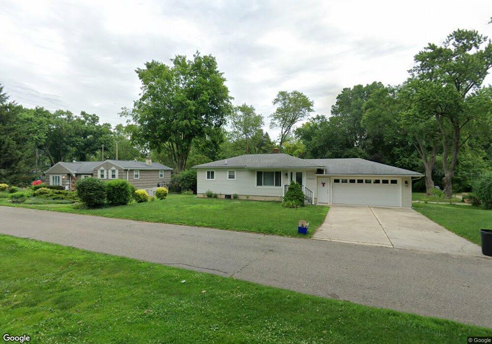
4629 Welland Dr West Bloomfield, MI 48323
Estimated Value: $245,339 - $313,000
2
Beds
1
Bath
1,000
Sq Ft
$265/Sq Ft
Est. Value
About This Home
This home is located at 4629 Welland Dr, West Bloomfield, MI 48323 and is currently estimated at $265,335, approximately $265 per square foot. 4629 Welland Dr is a home located in Oakland County with nearby schools including Walled Lake Central High School, Brookfield Academy - West Bloomfield, and The Susan And Rabbi Harold Loss Ecc.
Ownership History
Date
Name
Owned For
Owner Type
Purchase Details
Closed on
Nov 28, 2006
Sold by
Horton Melissa
Bought by
Us Bank Na and Credit Suisse First Boston Heat 2005-4
Current Estimated Value
Purchase Details
Closed on
Apr 28, 2005
Sold by
Swiden Albert J and Swiden Tamara M
Bought by
Horton Melissa
Home Financials for this Owner
Home Financials are based on the most recent Mortgage that was taken out on this home.
Original Mortgage
$155,480
Interest Rate
6.95%
Mortgage Type
Fannie Mae Freddie Mac
Purchase Details
Closed on
Aug 22, 2003
Sold by
Werden Suzanne E
Bought by
Swiden Albert J
Create a Home Valuation Report for This Property
The Home Valuation Report is an in-depth analysis detailing your home's value as well as a comparison with similar homes in the area
Home Values in the Area
Average Home Value in this Area
Purchase History
| Date | Buyer | Sale Price | Title Company |
|---|---|---|---|
| Us Bank Na | $162,606 | None Available | |
| Horton Melissa | $194,350 | Lawyers Title Insurance Co | |
| Swiden Albert J | $126,000 | -- |
Source: Public Records
Mortgage History
| Date | Status | Borrower | Loan Amount |
|---|---|---|---|
| Previous Owner | Horton Melissa | $155,480 | |
| Closed | Horton Melissa | $19,435 |
Source: Public Records
Tax History Compared to Growth
Tax History
| Year | Tax Paid | Tax Assessment Tax Assessment Total Assessment is a certain percentage of the fair market value that is determined by local assessors to be the total taxable value of land and additions on the property. | Land | Improvement |
|---|---|---|---|---|
| 2024 | $1,548 | $91,430 | $0 | $0 |
| 2022 | $1,460 | $86,790 | $42,040 | $44,750 |
| 2021 | $3,483 | $84,510 | $0 | $0 |
| 2020 | $2,516 | $82,220 | $42,040 | $40,180 |
| 2018 | $3,165 | $72,230 | $42,040 | $30,190 |
| 2015 | -- | $65,110 | $0 | $0 |
| 2014 | -- | $61,260 | $0 | $0 |
| 2011 | -- | $57,590 | $0 | $0 |
Source: Public Records
Map
Nearby Homes
- 6980 Hambro St
- 4442 Borland St
- 4540 Rolling Pine Ct
- 4335 Crestdale Ave
- 4066 Green Lake Rd
- 4245 Bunker Ave
- 6675 Langtoft St
- 0000 Langtoft
- 6978 Colony Dr
- 4212 Greendale Ave
- 7065 Deerwood Trail Unit 27
- 7337 Richardson Rd
- 3991 Fieldview Ave
- 7359 Woodlore Dr
- 7381 Crestmore St
- 3965 Carrick Ave
- 3950 Bradmore Ave
- 6903 Dandison Blvd
- 5994 Glen Eagles Dr
- 7545/7585 Pontiac Trail
- 6850 Abalone St
- 4605 Welland Dr
- 4651 Welland Dr
- 4630 Welland Dr
- 6851 Abalone St
- 6843 Dix Terrace
- 4664 Welland Dr
- 4679 Welland Dr
- 4578 Welland Dr
- 6835 Abalone St
- 4545 Welland Dr
- 4542 Bethune Ct
- 6833 Dix Terrace
- 000 000 Kress Dr
- 6900 Pontiac Trail
- 4570 Borland St
- 4566 Welland Dr
- No Number Pontiac Trail
- 6920 Pontiac Trail
- 4525 Welland Dr