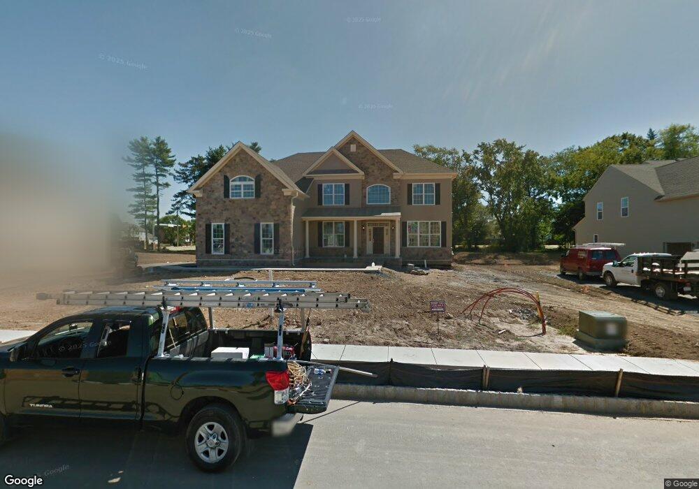
463 Barrington St Horsham, PA 19044
Estimated Value: $1,172,000 - $1,318,000
4
Beds
5
Baths
4,612
Sq Ft
$271/Sq Ft
Est. Value
About This Home
This home is located at 463 Barrington St, Horsham, PA 19044 and is currently estimated at $1,247,703, approximately $270 per square foot. 463 Barrington St is a home with nearby schools including Simmons Elementary School, Keith Valley Middle School, and Hatboro-Horsham Senior High School.
Ownership History
Date
Name
Owned For
Owner Type
Purchase Details
Closed on
Oct 16, 2013
Sold by
Toll Ap Xiv Lp
Bought by
Ward Jeffrey D and Ward Pamela M
Current Estimated Value
Home Financials for this Owner
Home Financials are based on the most recent Mortgage that was taken out on this home.
Original Mortgage
$651,888
Outstanding Balance
$465,060
Interest Rate
3.25%
Mortgage Type
Adjustable Rate Mortgage/ARM
Estimated Equity
$782,643
Create a Home Valuation Report for This Property
The Home Valuation Report is an in-depth analysis detailing your home's value as well as a comparison with similar homes in the area
Home Values in the Area
Average Home Value in this Area
Purchase History
| Date | Buyer | Sale Price | Title Company |
|---|---|---|---|
| Ward Jeffrey D | $817,549 | None Available |
Source: Public Records
Mortgage History
| Date | Status | Borrower | Loan Amount |
|---|---|---|---|
| Open | Ward Jeffrey D | $651,888 |
Source: Public Records
Tax History Compared to Growth
Tax History
| Year | Tax Paid | Tax Assessment Tax Assessment Total Assessment is a certain percentage of the fair market value that is determined by local assessors to be the total taxable value of land and additions on the property. | Land | Improvement |
|---|---|---|---|---|
| 2025 | $16,591 | $422,050 | -- | -- |
| 2024 | $16,591 | $422,050 | -- | -- |
| 2023 | $15,792 | $422,050 | $0 | $0 |
| 2022 | $15,280 | $422,050 | $0 | $0 |
| 2021 | $14,918 | $422,050 | $0 | $0 |
| 2020 | $14,566 | $422,050 | $0 | $0 |
| 2019 | $14,287 | $422,050 | $0 | $0 |
| 2018 | $12,156 | $422,050 | $0 | $0 |
| 2017 | $13,647 | $422,050 | $0 | $0 |
| 2016 | $13,483 | $418,340 | $0 | $0 |
| 2015 | $12,092 | $396,340 | $0 | $0 |
| 2014 | $12,092 | $388,980 | $0 | $0 |
Source: Public Records
Map
Nearby Homes
- 132 Hunt Dr
- 968 Tennis Ave
- 159 Hunt Dr
- 962 Tennis Ave Unit RESIDENCE 1
- 18 Hunt Dr
- 1049 Mckean Rd
- 832 Paradise Dr
- 711 E Butler Pike
- 499 Grouse Cir
- 703 Daventry Way
- 600 Stoneham Ct
- 244 Park Rd
- 221 Winchester Dr
- 603 Norristown Rd
- 236 Park Rd
- Lot 46 Bryce Dr
- Lot 49 Bryce Dr
- 1844 Hood Ln
- 553 Exeter Ct
- 738 LOT 2 Emory Ct
- 465 Barrington St
- 461 Barrington St
- 462 Barrington St
- 460 Barrington St
- 467 Barrington St
- 464 Barrington St
- 461 Barbin St
- 469 Barrington St
- 463 Barbin St
- 466 Barrington St
- 733 Gregory Dr
- 450 Barbin St
- 735 Gregory Dr
- 436 Babylon Rd
- 452 Barbin St
- 465 Barbin St
- 468 Barrington St
- 467 Barbin St
- 438 Babylon Rd
- 454 Barbin St